Map of Fargo
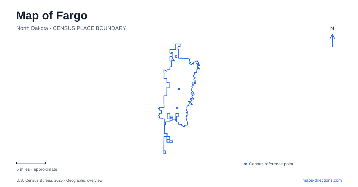
Street tiles load from OpenStreetMap when opened. The blue line shows the 2025 Census boundary.
- State
- North Dakota
- Population · July 2025
- 136,275
- Land area
- 51.9 sq mi
- Water area
- 0.0 sq mi
Fargo sits beside a river that connects recreational places while separating city destinations. A downtown street map, a park trail map and an airport approach map therefore answer different questions. Main Avenue and Broadway help organize the central area; the Red River explains cross-river relationships; the northern university and airport destinations require their own close views. Keeping those frames separate makes the city easier to navigate than relying on one pin labeled with its name.
Broadway and Main Avenue establish downtown references
The city's Main Avenue project map traces the corridor from Broadway toward the Red River and labels nearby streets and parks. This provides a useful starting arrangement: Broadway is a downtown reference, while Main Avenue leads toward the river crossing. At the individual-address scale, retain the north or south designation attached to a numbered street. The map shows both northern and southern street labels around the corridor, so the suffix is part of locating the right block.
For a Fargo downtown meeting, use a business or public facility as the endpoint rather than treating Broadway as a complete address. A long street is an orientation line, not a single arrival location. Likewise, a reconstruction or planning map is useful for understanding the street pattern but should not be read as a live statement about lane access. Its geographic labels can remain informative after the specific project conditions have changed.
A river crossing joins two city street systems
The Main Avenue Bridge crosses the Red River between the city and Moorhead. Minnesota's transportation agency describes it as the Highway 10 connection, making it an important reference when a journey extends across the water. A regional destination list may combine places on both banks, but the bridge remains a specific part of the trip. Confirm which city contains each address before assuming that two nearby pins use the same street approach.
A river-centered map can be misleading if it is read only for straight-line distance. The useful measure is the connection through a suitable crossing, followed by the local streets on the other side. That principle is particularly visible here because the river is also lined with recreation land. A pathway connection and a highway bridge serve different kinds of movement even when both lead toward the neighboring city.
Island Park is a downtown green space
Island Park gives central Fargo a substantial recreational reference. The park district lists its address at 302 7th Street South and describes it as the city's oldest park, originating within the railroad-platted townsite. Its name should not be taken as an instruction to look for an isolated island in the river. The street address and downtown setting are the useful clues for a visitor arriving from nearby blocks.
The park includes paths, recreation facilities and a gazebo, so the destination within the grounds may matter as much as the park itself. Someone attending a gathering should retain the named facility from the invitation. A person simply finding the park can use the general address, but an arranged meeting benefits from a more precise reference. This is a place where a familiar historic name gives context while the internal park map solves the final location question.
Lindenwood connects with a park across the river
Lindenwood Park lies at 1905 Roger Maris Drive. The park district identifies a pedestrian bridge linking it with Moorhead's Gooseberry Park, as well as a campground, trails and a kayak launch. This is a different setting from downtown Island Park. A search for “river park” is too broad to distinguish the intended activity, especially when an overnight camping arrival and a short walk use the same larger grounds.
For a Fargo river outing, decide whether the destination is the campground, a shelter, the launch or the cross-river path. The pedestrian bridge is relevant to a walk, not a substitute for a vehicle crossing. The riverbank itself also does not identify an appropriate boat launch; the named launch facility does. These category distinctions make a park map practical without claiming that all amenities operate in every season.
Northern destinations need facility-level directions
North Dakota State University's visitor directions use 19th Avenue North and University Drive as approach references and then direct guests toward their specific check-in and parking locations. A campus contains many buildings, so its central label is not enough for an appointment. Follow the building and lot information associated with the visit rather than assuming that any university entrance leads to the same reception point.
Hector International Airport is another separate northern destination, with its published address at 2801 32nd Avenue North. For a Fargo flight, choose the passenger terminal and its relevant parking or drop-off information. The airport's land area is much larger than that arrival point. Combining the correct terminal address with a separate downtown or university destination produces a clear trip plan while leaving changing traffic, weather and flight conditions to current operational information.
Map and statistics: U.S. Census Bureau, 2025 Gazetteer, January 2025 generalized place boundaries and Vintage 2025 population estimates. Local references: City of Fargo; Minnesota Department of Transportation; Fargo Park District; North Dakota State University; Hector International Airport. Article prepared by Maps & Directions.