Map of Fairfield
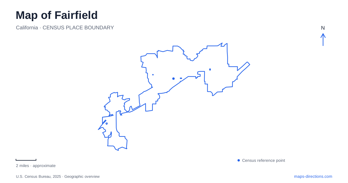
Street tiles load from OpenStreetMap when opened. The blue line shows the 2025 Census boundary.
- State
- California
- Population · July 2025
- 122,489
- Land area
- 41.6 sq mi
- Water area
- 0.3 sq mi
Fairfield sits between several very different kinds of landscape: a downtown street corridor, developed neighborhoods, wooded hills, and the marsh country beyond Suisun City. A map that shows only the interstate misses much of this variety. Texas Street provides a useful line into the urban center, while Rockville Road and Grizzly Island Road lead toward quite different outdoor settings. Reading those roads as separate approaches helps distinguish a civic errand, a community park visit, and a regional nature outing before choosing individual destinations.
Texas Street explains the downtown approach
West Texas Street connects Interstate 80 with downtown and a collection of civic, commercial, and recreation destinations. Its history explains its prominence on a Fairfield map: it carried Highway 12 before the highway was rerouted and the former alignment transferred to the city in the 1990s. It now serves as a local corridor rather than simply a continuation of the regional highway.
The downtown zoning description places the core along Texas Street and its cross streets, with the broader downtown districts between Empire and Missouri streets east of Pennsylvania Avenue. These references provide a more precise picture than a large downtown marker. For a business or appointment, the relationship to Pennsylvania Avenue and the particular cross street helps establish which portion of the corridor is relevant.
The city's West Texas improvement program is changing the street for walking, cycling, and local access. The project's existence matters when comparing an older street image with a newer map, but proposed features should not be read as proof of a completed route. The lasting geographic point is the corridor's connection between the interstate approach and downtown activity.
A second useful landmark is the Fairfield Transportation Center at 2000 Cadenasso Drive. Regional transit information identifies it as a bus hub used by several agencies. The city's corridor description separately names the Suisun-Fairfield train station. Similar place names can obscure that distinction: the Cadenasso facility and the rail station are different transportation destinations. A journey involving both requires a transfer between places, not merely a change of platform within one building.
Community recreation and the Rockville hills
Cordelia Community Park uses a Gold Hill Road address, next to the Tri-Valley Little League fields and Green Valley Middle School. Its grounds include playing areas, walking paths, picnic facilities, and dog park space. This is a developed community recreation setting. On the city map, the school and ball fields help explain the park's surroundings and make the Gold Hill Road location recognizable.
Rockville Hills Regional Park is a different type of destination. Its main entrance is at 2149 Rockville Road, and the city describes grassland, oak woodland, and mixed broadleaf forest across its terrain. The official approach follows Rockville Road through the Suisun Valley Road intersection. Those road names are useful because the park's broad hillside outline alone does not explain its relationship to the surrounding road network.
The city also identifies an Emerald Bay Drive entrance, which reinforces the distinction between a park boundary and a chosen access point. For a hillside outing, begin with the intended entrance and then study the trail map within the park. For a gathering at Cordelia's recreation facilities, use the Gold Hill Road setting instead. The two parks offer different experiences and sit within different local street contexts, even though both may appear in the same recreation search.
Marsh geography south of Highway 12
Rush Ranch belongs to the regional landscape around Fairfield, but its address is in Suisun City. The Solano Land Trust property lies on Grizzly Island Road, approximately two miles south of Highway 12. Including the neighboring place name in a search helps keep this destination distinct from the city's hill parks and urban recreation grounds.
Here, the significant map feature is the meeting of rolling grassland and tidal marsh. Rush Ranch occupies the northeastern edge of Suisun Marsh and preserves an important example of brackish tidal habitat. Its historic ranch buildings add a cultural reference to the landscape. The property is therefore more than a generic green polygon: upland ground, marsh channels, and the ranch complex describe different parts of a visit.
The land trust identifies both marsh and pasture trails, but also documents restoration work and restricted access toward Goat Island. A regional map should not be used to infer a continuous walk across every levee. The useful comparison is between this low marsh edge and Rockville's wooded hills. Choosing between them determines the character of the outing as well as the road approach, while Texas Street remains the separate reference for the urban center.
Map and statistics: U.S. Census Bureau, 2025 Gazetteer, January 2025 generalized place boundaries and Vintage 2025 population estimates. Local references: City of Fairfield; Metropolitan Transportation Commission 511; Solano Land Trust. Article prepared by Maps & Directions.