Map of Everett
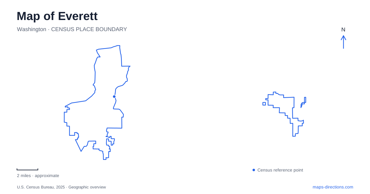
Street tiles load from OpenStreetMap when opened. The blue line shows the 2025 Census boundary.
- State
- Washington
- Population · July 2025
- 113,567
- Land area
- 33.6 sq mi
- Water area
- 15.7 sq mi
Everett has several waterfronts, and each gives the city a different geographical character. Port Gardner Bay faces the marina and the western skyline, while the Snohomish River provides access to trails, rowing facilities, and estuary habitats. Between them, streets rise above parts of the shoreline, with rail corridors adding another layer to the terrain. A useful map separates the bayfront, riverfront, and downtown connections instead of treating every waterside destination as part of one promenade.
A bridge from the bluff to the marina
Grand Avenue Park Bridge makes the change in elevation especially clear. It leaves the park bluff near 16th Street, crosses the BNSF railroad right-of-way and State Route 529, and lands on port property. The bridge is therefore both a waterfront connection and a response to the transport corridors below the bluff. Its position explains why an apparently short distance on the map can involve a substantial vertical change.
The crossing accommodates pedestrians, bicycles, and wheelchair users, with places to pause for views. From this part of Everett, the marina and Port Gardner Bay form the foreground, with the Olympic Mountains across the water. Tracing the bridge before planning a walk gives a clear sequence: upper neighborhood park, crossing above road and rail, then the lower waterfront. That sequence is a defining feature of this approach to the bay.
A historic mill office with several addresses over time
The Weyerhaeuser Office Building at Boxcar Park tells a particularly geographical story. Built in 1923 at the company's Mill A plant, it was designed by Carl Gould to display local wood products, including fir, cedar, and hemlock. Its Gothic appearance makes it a distinctive landmark within the surrounding waterfront development.
The building moved to Mill B on the Snohomish River in 1938. In 1983, after donation to the port, it traveled back by barge to the marina area. A third move in 2016 placed it at Boxcar Park, west of Waterfront Center. The sequence links the bay and river sides of Everett through one surviving structure. An old photograph or historical address may therefore locate the same building in a completely different industrial setting.
Its current position makes the building a useful starting point for considering the waterfront's changes. The surrounding recreational landscape belongs to a later chapter than the mills that first gave the office its purpose. The structure's survival, rather than an unchanged location, preserves that connection to the lumber industry.
Jetty Island begins with a water crossing
Jetty Island lies offshore from the marina and offers a sandy shoreline reached by water. The seasonal passenger ferry uses Jetty Landing near 10th Street and West Marine View Drive. The landing is the mainland destination to identify when planning that trip; the island itself is the second stage.
The ferry operates seasonally, so the island's presence on a year-round map should not be read as a promise of daily scheduled access. Boats and other suitable watercraft provide another way to reach it. Looking at the landing, the crossing, and the island together explains why this beach outing differs from a walk along the mainland marina. In Everett, the closest-looking shoreline is not always part of the street network at all.
River access at Lowell and Langus
Lowell Riverfront Park uses Lowell-Snohomish River Road, with its trailhead just off Lenora Street. The city describes a 1.75-mile paved, multi-use trail with a ten-foot-wide path. The river, wildlife habitats, and mountain views shape this outing, rather than marina slips and bayfront businesses. Lowell supplies a useful eastern waterside reference for walkers and cyclists exploring the city.
Langus Riverfront Park, at 400 Smith Island Road, offers another river setting. Its boat launch, fishing pier, shell house, and rowing dock emphasize direct access to the Snohomish River. A three-mile paved trail supports walking, jogging, cycling, and bird observation. The park's address also places it in the Smith Island landscape, distinct from the streets around the western marina.
Spencer Island extends the estuary story. The state wildlife area is a flat intertidal landscape with grassy areas and surrounding forest, accessible on foot from Langus. Waterfowl and shorebird habitat become important features of the map here, alongside the river channels and trails.
The rail arrival point
The passenger station at 3201 Smith Avenue supplies a separate arrival anchor for Everett. Its rail connection and downtown relationship belong to the urban transport map, while Smith Island Road leads to the river park. Keeping those similarly named addresses distinct helps organize an itinerary that combines a rail arrival, the bluff-to-marina bridge, and one of the river landscapes without blending their separate settings.
Map and statistics: U.S. Census Bureau, 2025 Gazetteer, January 2025 generalized place boundaries and Vintage 2025 population estimates. Local references: City of Everett; City tourism office; Port historical interpretive program; Washington Department of Fish and Wildlife; Amtrak. Article prepared by Maps & Directions.