Map of Evansville
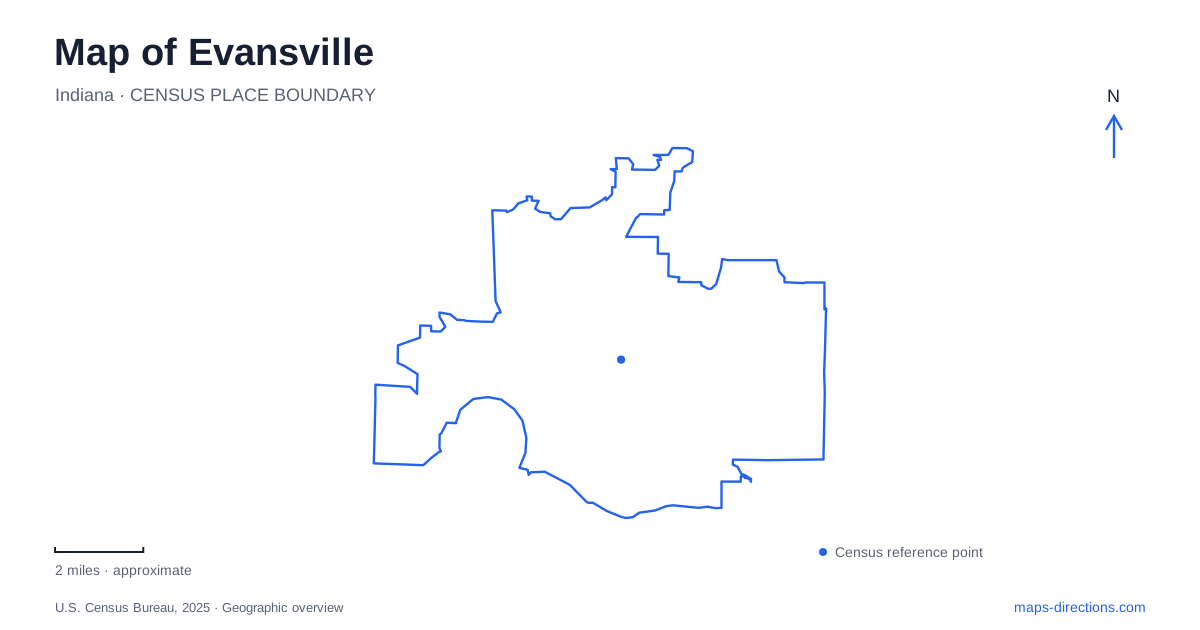
Street tiles load from OpenStreetMap when opened. The blue line shows the 2025 Census boundary.
- State
- Indiana
- Population · July 2025
- 116,176
- Land area
- 47.4 sq mi
- Water area
- 0.5 sq mi
Evansville's map makes the most sense when the Ohio River is treated as its historical front door. The settlement began in 1812 as McGary's Landing, near what are now Main Street and Riverside Drive, on a horseshoe bend in the river. Later steamboat commerce, rail connections, and industrial development changed the waterfront repeatedly. Today, museums and trails help interpret that movement, while Angel Mounds places the region's settlement history on a much longer timeline than the nineteenth-century city alone.
Begin where Main Street meets the river
The riverfront's changing uses explain why a historic illustration may look so different from the contemporary shoreline. The local museum's historical account traces a progression from a small landing to a busy steamboat port and then to the construction of Dress Plaza in 1936. Main Street and Riverside Drive provide the geographical link between those periods even when individual buildings have disappeared.
The Wabash and Erie Canal also figures in that history. Its terminus was here, and the prospect of a connection between the Ohio River and the Great Lakes encouraged growth, although the canal's working life was short. This makes the waterfront more than a scenic edge: it was a meeting place for transportation systems with different ambitions and different levels of success.
For an Evansville visit centered on history, the riverfront is a useful starting landscape because the route itself supplies context. A walk beside the Ohio can introduce the city's commercial setting before an indoor exhibition adds dates, objects, and explanations. The broad river and the street approaching it remain more enduring landmarks than the former warehouses or businesses visible in old photographs.
Transportation history continues inside the museum
The Museum of Arts, History and Science stands along the downtown riverfront. Its collections combine several subjects, and the associated transportation center, known as EMTRAC, examines river, rail, street, and aviation history. Historic railway equipment includes a 1908 steam locomotive, a 1926 club car, and a caboose dating from around 1900. These objects make the transition from river commerce to other forms of travel tangible.
The museum also offers art and science galleries and an immersive theater and planetarium. That mix makes it suitable for a visit with more than one interest, rather than only for railway enthusiasts. The historic train has access limitations that differ from the museum's main facilities, so visitors who need step-free access should discuss that part of the visit with museum staff. The transportation equipment is an exhibit, not a passenger departure point on the city map.
Pigeon Creek turns the waterfront route inland
The Pigeon Creek Greenway Passage follows both the Ohio and its tributary, creating a route that changes direction with the waterways. The riverfront portion connects with an industrial corridor and a middle-levee corridor. The city's published route description follows Pigeon Creek north, crosses Fulton Avenue near Cedar Hall Community School, and continues toward Garvin Park and the Heidelbach Canoe Launch.
At the creek's mouth, the Marchand Bridge is an overlook rather than a through crossing of the Ohio River. The 1891 truss structure was adapted as a greenway amenity. Farther inland, the Shirley James Gateway Plaza at 1501 West John Street commemorates a greenway advocate and interprets transportation history. These are useful landmarks because they explain both the path's direction and the industrial landscape through which it passes.
Evansville's Jacobsville neighborhood adds another connection. Garvin Park lies on its north side, and the North Main street project introduced a protected bicycle path, improved sidewalks, and landscaping in 2018. This gives the neighborhood a street-based link with downtown as well as access to the creek corridor. Comparing North Main with the greenway reveals two different ways of organizing the same outing: one through neighborhood streets, the other along water and former industrial land.
Angel Mounds broadens the regional story
Angel Mounds State Historic Site is east of the city center at 8215 Pollack Avenue. The preserved settlement was occupied by people archaeologists describe as Mississippian, approximately between AD 1000 and 1450. Earthen mounds, an interpretive center, and walking trails present a community involved in agriculture, trade, and regional political and religious life centuries before McGary's Landing.
On an Evansville map, give this site its own eastern destination rather than trying to fold it into a downtown walking circuit. Its significance lies in the larger Ohio Valley landscape and the relationships between settlements, farmland, and exchange. Pairing it with the riverfront museum offers a meaningful contrast between two very different periods of life along the same river. Evansville then becomes a starting point for understanding a region, as well as a city whose streets can be explored individually.
Map and statistics: U.S. Census Bureau, 2025 Gazetteer, January 2025 generalized place boundaries and Vintage 2025 population estimates. Local references: Evansville Museum; City of Evansville; Evansville-Area Trails Coalition; Indiana State Museum and Historic Sites. Article prepared by Maps & Directions.