Map of Evanston
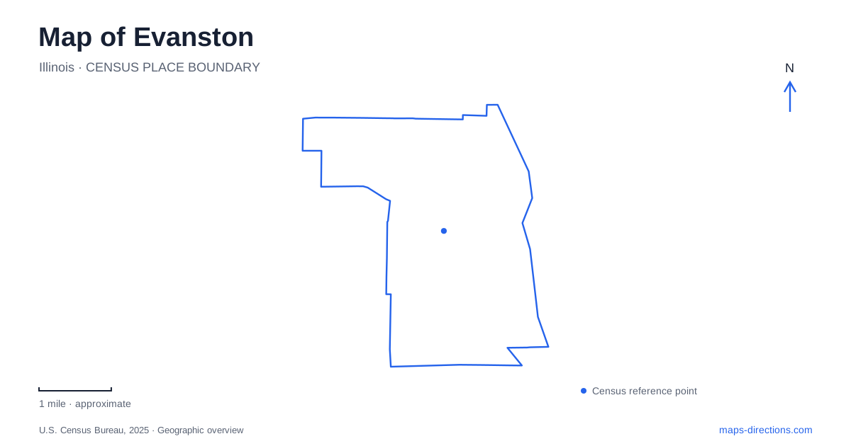
Street tiles load from OpenStreetMap when opened. The blue line shows the 2025 Census boundary.
- State
- Illinois
- Population · July 2025
- 76,380
- Land area
- 7.8 sq mi
- Water area
- 0.0 sq mi
Evanston's relationship with Lake Michigan is visible in its university campus, beaches, historic houses, and lighthouse. Yet the city's daily movement also follows inland rail corridors and east-west streets that connect those waterfront destinations with neighborhoods. Davis Street provides a downtown transit reference, Sheridan Road helps orient the university and northern shore, and Main Street reaches community facilities beyond the lakefront. Reading these elements together gives a fuller picture than a map centered only on the campus.
Davis Street and the rail choices
CTA's Davis station is at 1612 Benson Avenue and serves the Purple Line. Its official connection information includes Metra's Union Pacific North Line as well as local bus routes. The names Davis and Main appear in both the rapid-transit and commuter-rail geography, so identifying the operator is part of understanding a rail journey here.
The Purple Line's local service links the city with Howard and Linden, while express service to Chicago's Loop operates during weekday rush periods. At other times, CTA directs travelers heading toward the Loop to transfer at Howard. The map's continuous colored line can therefore represent different service patterns depending on the trip. That is a practical distinction for using Evanston as a starting point for a journey south, rather than simply traveling between its local stations.
Northwestern identifies Davis, Foster, and Noyes as useful Purple Line stops for reaching campus. Foster and Noyes lie west of Sheridan Road, making the final approach an eastward walk toward the university. The station choice can change with the part of campus being visited, because the institution extends along the lake rather than occupying one compact block.
A campus that expanded into the lake
Northwestern's eastern grounds include land created through the lakefill project of the 1960s. The university considered expansion west across Sheridan Road and denser building on existing green spaces before choosing to extend toward Lake Michigan. A limestone perimeter and sand fill created new ground, dedicated in 1964.
This history explains an unusual feature of the campus map: some of the apparent shoreline land is the result of a major engineering project. Later buildings and open spaces occupy ground that was once water. The relationship between the older campus and the lakefill is therefore more informative than treating the entire university as a single undifferentiated area. Walking eastward can involve crossing not only an institutional landscape but also a former shoreline.
For a map of Evanston, the lakefill is an important local distinction. It shows how the university's need for space changed the physical outline of the city while preserving a relationship with the lake that remains central to campus identity.
Lighthouse and house museum on the shore
Grosse Point Lighthouse stands at 2601 Sheridan Road. Historic American Buildings Survey documentation dates its initial construction to 1872–1873. Near Lighthouse Beach, the tower records a maritime purpose along a shoreline now widely used for recreation. Its presence reminds visitors that the lake was a transportation environment requiring navigation aids, not merely a scenic edge to residential streets.
Farther south, the Dawes House at 225 Greenwood Street has a different relationship with the water. Built in 1894 on grounds overlooking Lake Michigan, it became the home of Charles Gates Dawes and his family in 1909. The residence now houses the local history center. Its rooms and collections interpret domestic life and community history within a surviving lakefront setting.
The lighthouse and house museum provide two different historical perspectives on the same broad shore. One concerns navigation and maritime infrastructure; the other concerns a prominent household and the history preserved within its home. Their separate addresses help place those stories along the waterfront rather than collapsing them into a single historic district destination.
Beaches and a community center inland
The city maintains six public swimming beaches, including Lighthouse and South Boulevard beaches. Swimming access and access to the sandy beach itself can be managed separately when conditions require it. The distinction reflects the lake's changing physical conditions and the different ways people use the shore, from entering the water to spending time beside it.
Away from that shoreline sequence, Robert Crown Community Center stands at 1801 Main Street. Completed in 2020, the complex brings together two ice rinks, a two-hundred-meter running track, gymnasiums, art and dance spaces, outdoor fields, and a public library branch. It gives Evanston a substantial recreation and learning destination whose focus is everyday community activity rather than the lake or university.
The branch library at Robert Crown is separate from the main library at 1703 Orrington Avenue downtown. That contrast captures the city's wider pattern: services and gathering places are distributed among several local centers. Evanston becomes easier to understand when downtown transit, the extended university shoreline, historic waterfront landmarks, beaches, and inland community facilities all remain visible on the same map.
Map and statistics: U.S. Census Bureau, 2025 Gazetteer, January 2025 generalized place boundaries and Vintage 2025 population estimates. Local references: Chicago Transit Authority; Metra; Northwestern University; Library of Congress; City of Evanston; Evanston History Center; Evanston Public Library. Article prepared by Maps & Directions.