Map of Euless
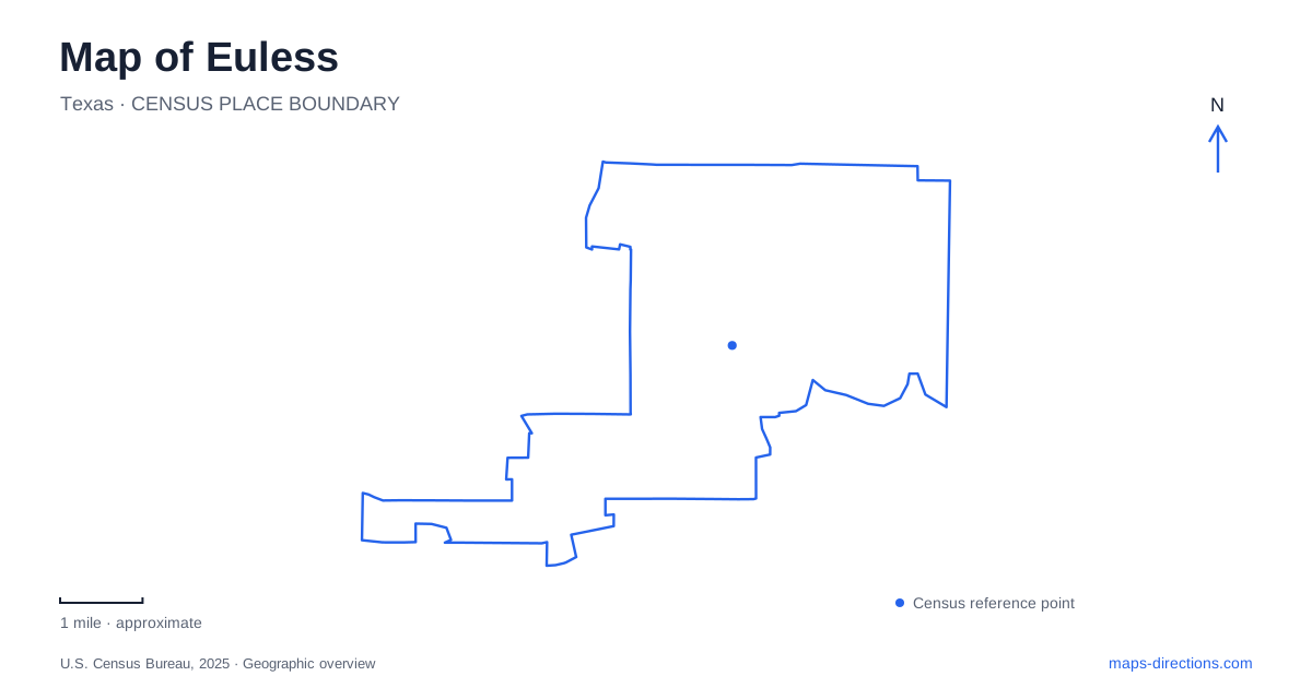
Street tiles load from OpenStreetMap when opened. The blue line shows the 2025 Census boundary.
- State
- Texas
- Population · July 2025
- 60,008
- Land area
- 16.1 sq mi
- Water area
- 0.1 sq mi
The most revealing feature on a map of Euless is its chain of green spaces. Bob Eden Park, McCormick Park, the Preserve at McCormick Park and Villages of Bear Creek form a connected recreational landscape with several different street addresses. Elsewhere, historic buildings gather on Cullum Drive, while the Texas Star name identifies a collection of sports destinations. These clusters provide a more useful introduction than treating every park symbol as an isolated attraction.
Following the Bear Creek park sequence
Bob Eden Park occupies the western end of this sequence at 901 Mid-Cities Boulevard. Its courts, playing fields and picnic facilities give it the character of an active community park. Moving east through the connected park landscape brings you to McCormick Park, whose street address is 2190 Joyce Court. The smaller park includes a gazebo, playground and picnic area, and its trail provides a connection between neighboring recreation spaces. On a map, the change of park name marks a change of property and facilities within a larger route.
The Preserve at McCormick Park continues the sequence eastward at 2005 Fuller-Wiser Road. Its environmental learning features include a tree identification trail, birdwatching area, ponds and a boardwalk beside wetlands. This is the quieter interpretive part of the chain, where a walk can involve stopping to examine trees and water habitats rather than simply covering distance. The connection continues toward Villages of Bear Creek Park at 1951 Bear Creek Parkway.
For an outing in Euless, this west-to-east arrangement suggests several different starting points. Mid-Cities Boulevard suits a visit centered on Bob Eden's recreational facilities; Fuller-Wiser Road identifies the preserve; Bear Creek Parkway identifies the eastern park. The sequence also explains why a trail outing can pass through several named parks without representing several separate drives. Decide which landscape you want to spend time in before choosing your starting address.
Cullum Drive and the local history collection
Heritage Museum is at 201 Cullum Drive beside Heritage Park. The museum's exhibits include a schoolroom setting, a kitchen display and military artifacts. Outside, the historic building collection includes the community's first brick house, an 1850s log house and a barn constructed with lumber from Camp Bowie after the First World War. The grouping makes this a concentrated history destination rather than a scattered list of old buildings across town.
On an Euless map, Cullum Drive therefore deserves a different reading from the creek parks. Here the interest lies in a compact collection of structures and exhibits. The relationship between museum and park allows indoor interpretation and historic architecture to form one visit. A traveler interested in settlement history can organize the stop around this cluster instead of searching separately for each building name.
The contrast with the Bear Creek sequence is useful. One location gathers different eras close together; the other spreads recreational experiences along linked paths. Both reward walking, but their shapes are different. A wide map view helps establish the two destinations, while a closer view becomes useful once you are looking at the museum grounds or deciding how much of the park chain to explore.
Main Street and neighborhood recreation
Main Street provides another set of recognizable local addresses. South Euless Park is at 600 South Main Street, with a playground, basketball court and splash pad listed in the city's parks inventory. Midway Park appears farther along the Main Street corridor in the municipal trail directory. These are useful neighborhood reference points when the purpose of a trip is a playground or a short recreation stop rather than an extended trail excursion.
Other parks have more specific residential street identities. J. A. Carr Park is on Simmons Drive, Trailwood Park on Trailwood Drive and Wilshire Park on Sierra Drive. Keeping these street names visible helps distinguish neighborhood destinations from the larger connected parks. The municipal trail system includes multiple surfaces and links with sidewalks; its individual park paths should be read as parts of local surroundings, not as one uniform recreational circuit.
Sorting the Texas Star destinations
The Texas Star facilities add a separate sports focus to Euless. The city identifies a golf course at 1400 Texas Star Parkway, the northern sports park at 951 Highland Drive and the southern sports park at 1501 South Pipeline Road. The shared name can conceal the importance of those different addresses. Golf, baseball and other organized recreation bring visitors to different parts of this collection.
The golf course also includes a restaurant and conference center, giving the same destination several possible purposes. For a sports visit, retaining the facility name and street together makes the map much more informative than retaining Texas Star alone. Across the city, this same approach reveals a coherent arrangement: creekside parks connected by paths, heritage buildings collected on Cullum Drive, neighborhood recreation along local streets and larger sporting facilities with their own addresses.
Map and statistics: U.S. Census Bureau, 2025 Gazetteer, January 2025 generalized place boundaries and Vintage 2025 population estimates. Local references: City of Euless. Article prepared by Maps & Directions.