Map of Eugene
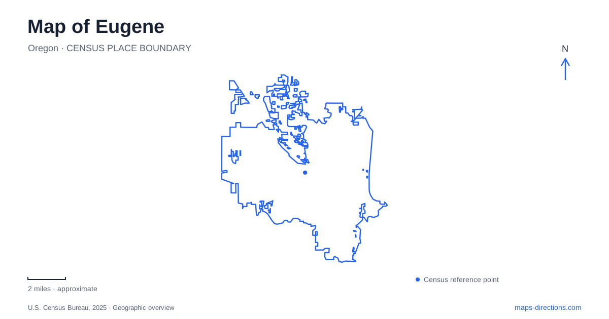
Street tiles load from OpenStreetMap when opened. The blue line shows the 2025 Census boundary.
- State
- Oregon
- Population · July 2025
- 178,618
- Land area
- 44.7 sq mi
- Water area
- 0.1 sq mi
Eugene is shaped by a river corridor and a contrasting southern skyline of wooded hills. The Willamette gathers parks, walking routes, bridges, and former industrial properties into a connected central landscape. The University of Oregon adds a separate but closely related cluster, where athletic facilities and campus streets help explain the city's running identity. Farther south, the Ridgeline rises above the developed valley. Keeping the river, campus, and hills visible together produces a useful map of how recreation and everyday movement overlap here.
A downtown butte with a working past
Skinner Butte Park occupies about 100 acres immediately north of downtown, between Third Avenue and the Willamette River. Dedicated in 1914, it combines the hill itself with lawns, paths, community facilities, and riverfront recreation. The park stretches between the Ferry Street and Interstate 105 bridges, which provide clear boundaries for locating it on a wider map.
The exposed basalt Columns reveal a less obvious part of this landscape. Stone was quarried from the butte during the late nineteenth century for foundations, steps, and other uses around the region. Quarrying ended in the early 1930s, and the rock face later became a climbing destination. The distinctive vertical forms therefore record both geology and extraction.
This mix gives central Eugene a landmark that is more than a viewpoint. RiverPlay, community gardens, and paths occupy lower ground, while the former quarry and summit create a different experience within the same park. An outing along the river need not involve climbing the hill, and the hill's compact map footprint should not hide its changes in elevation.
Riverbank paths and a changing waterfront
The Ruth Bascom Riverbank Path System follows the Willamette on both sides, with pedestrian and bicycle crossings allowing different combinations of routes. Its name recognizes a former mayor and advocate for cycling. The system functions as transportation as well as recreation, connecting riverfront destinations rather than serving only as a scenic loop.
The Downtown Riverfront Park adds a newer public space to that corridor. Completed in June 2022, it transformed former industrial ground into a park connecting downtown with the water. The nearby Steam Plant remains an important historical feature of the redevelopment area. City proposals describe adaptive reuse of the building, so its presence should not be confused with a completed visitor venue offering every use shown in redevelopment drawings.
For a map of Eugene, the riverfront is consequently a place to distinguish existing paths and public spaces from development proposals. The completed park already provides a substantial connection; the future of neighboring buildings represents another stage in the site's transition.
Running landscapes on both sides of the river
Pre's Trail winds through Alton Baker Park using a bark-covered surface inspired by routes Steve Prefontaine experienced in Scandinavia. The Frohnmayer Bicycle and Pedestrian Bridge connects this park landscape with the university side of the river. That crossing helps explain the close relationship between a public running environment and the campus rather than leaving them as isolated sports destinations.
Hayward Field, at 1530 Agate Street, represents the competitive side of the same tradition. The stadium's nine-story tower is a prominent architectural marker, while Hayward Hall interprets the university's track and field history. The complex belongs within the campus street network; it is not interchangeable with the paths in Alton Baker Park.
These places make Eugene's running culture geographically tangible. A bark trail, a river crossing, a university stadium, and a historical exhibition serve different purposes, yet their proximity and connections help explain why running is such a visible part of the local landscape. The appropriate destination depends on whether the visit is for a run, an exhibition, or an organized competition.
The southern hills are a different trail system
Spencer Butte rises to 2,058 feet and forms the highest point in the city's Ridgeline system. The surrounding parklands follow the southern edge of development, encompassing Douglas-fir forest, oak savanna, hilltop prairie, and stream headwaters. The rocky summit habitat differs from the more sheltered woodland on the approaches.
The city describes the Ridgeline as a series of partly connected natural areas. Named places such as Blanton Ridge, Mount Baldy, Amazon Headwaters, and Wild Iris Ridge therefore belong to a larger conservation landscape without forming one uninterrupted trail around the entire city. Trailheads on roads including Fox Hollow and Blanton serve different sections.
This southern setting completes the geographical picture of Eugene. The central river paths trace the valley's watercourse, Skinner Butte supplies an urban rise, and Spencer Butte stands within a broader belt of upland habitat. Showing each at the correct scale makes the contrast between a riverside journey and a hill walk clear without relying on a single generic park symbol.
Map and statistics: U.S. Census Bureau, 2025 Gazetteer, January 2025 generalized place boundaries and Vintage 2025 population estimates. Local references: City of Eugene; University of Oregon. Article prepared by Maps & Directions.