Map of Escondido
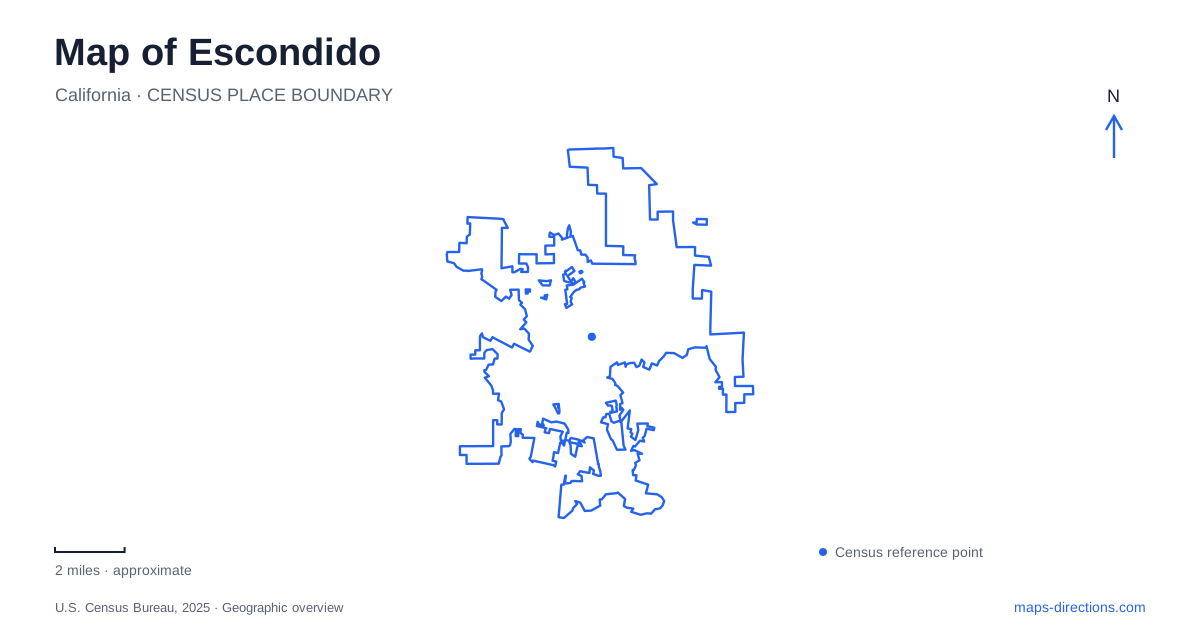
Street tiles load from OpenStreetMap when opened. The blue line shows the 2025 Census boundary.
- State
- California
- Population · July 2025
- 146,030
- Land area
- 37.4 sq mi
- Water area
- 0.1 sq mi
Escondido has a downtown cultural cluster and several larger outdoor destinations that require a wider map view. Grape Day Park, historic buildings and the California Center for the Arts form one useful starting area. Daley Ranch occupies a very different setting in the northeastern hills, while Kit Carson Park places another arts destination within a recreation landscape. These places are connected by the city, but they do not form one continuous attraction. Reading their positions first makes it easier to choose between an urban history walk, a performance, a rail arrival and a longer outdoor outing.
Grape Day Park preserves an agricultural story
Grape Day Park, at 321 North Broadway, recalls the harvest celebrations that drew visitors to the valley during the first half of the twentieth century. Its name reflects an agricultural industry, not simply a theme chosen for a modern playground. The city identifies it as its oldest park and a longstanding setting for community gatherings.
Heritage Walk brings several historic structures into this public setting. A Santa Fe depot, working barn and blacksmith shop help explain the connections between farming, transport and local trades. The depot is part of a historical collection; it should not be confused with the current passenger-rail terminal elsewhere in town. That distinction matters when comparing a heritage map with a transit map.
For someone exploring central Escondido, the park offers a way to connect open space with the area's earlier economy. Its buildings provide specific reference points within the grounds, so a visit can focus on the heritage collection rather than treating the entire green space as an undifferentiated park stop.
An arts campus has several destinations
The California Center for the Arts uses 340 North Escondido Boulevard as its address. The campus includes performance and museum spaces, with a sculpture courtyard forming another identifiable place within the grounds. This is why a ticket, exhibition notice or campus plan is more informative than a general search for the arts center alone: different activities lead to different parts of the same complex.
Its operator's arrival information also identifies the nearby transit center as a connection point for SPRINTER rail and BREEZE buses. The campus and the historic park can therefore be understood within the same downtown visit, while still retaining their separate purposes. A museum afternoon is organized around exhibitions and galleries; a performance is organized around a particular venue and admission time. The shared street address is the beginning of that navigation, not the entire itinerary.
Rail connects the inland city to the coast
The Escondido Transit Center is at 700 West Valley Parkway. North County Transit District's SPRINTER line runs between this inland endpoint and Oceanside through San Marcos and Vista, broadly following the Highway 78 corridor. This east–west relationship is the key regional pattern to recognize on a transit map.
Oceanside provides connections to other rail services, including COASTER, Metrolink and Amtrak. These are connections between services, rather than a claim that the same SPRINTER train continues along every coastal route. The distinction helps a visitor understand why a regional journey may involve a transfer even when the rail lines appear to meet neatly on a diagram. For local exploration, the terminal is a transport hub separate from the preserved depot at Grape Day Park.
Dixon Lake and the ranch beyond it
Daley Ranch lies north of Dixon Lake and west of Valley Center Road. Its principal southern approach is at the top of La Honda Drive, beside the lake recreation area. Other approaches reach different edges of the preserve, including Cougar Pass Road and Valley Center Road. Choosing an entrance therefore changes the starting position within a substantial landscape.
The city acquired the conservation property in 1996. Oak woodland, chaparral, coastal sage scrub and riparian areas occur within it, giving the trail network ecological variety beyond a single hillside view. The ranch house and barn add a historical destination within the preserve. They are reached along the internal route from the La Honda side, rather than standing directly beside every entrance.
On a map of Escondido, this northeastern area should be read as conservation land with designated trails. A straight line between two labels says little about the actual walking route through hills and habitat.
A sculpture destination within Kit Carson Park
Kit Carson Park's municipal map places Queen Califia's sculpture garden among a much larger collection of recreation features. Lakes, picnic areas, sports facilities and paths all occupy the same park setting. The city records that Niki de Saint Phalle's Queen Califia's Magical Circle opened here in 2003, adding a distinct public-art destination to the grounds.
Locating the sculpture garden within that broader plan is useful because a park address alone does not explain the internal arrangement. This southern recreation setting also differs from the downtown arts campus. Together, the two places show how visual art occupies both formal cultural facilities and outdoor public space across the city.
Map and statistics: U.S. Census Bureau, 2025 Gazetteer, January 2025 generalized place boundaries and Vintage 2025 population estimates. Local references: City of Escondido; California Center for the Arts, Escondido; North County Transit District. Article prepared by Maps & Directions.