Map of Erie
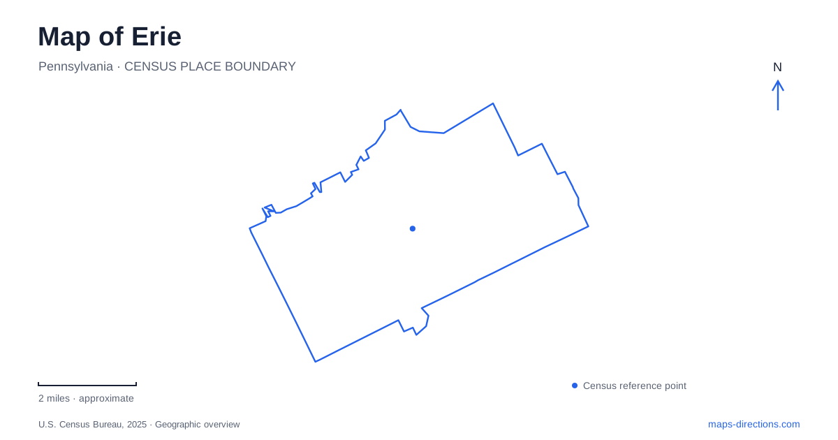
Street tiles load from OpenStreetMap when opened. The blue line shows the 2025 Census boundary.
- State
- Pennsylvania
- Population · July 2025
- 91,838
- Land area
- 19.1 sq mi
- Water area
- 0.2 sq mi
Erie's relationship with water is more complicated than a straight lakeshore. Presque Isle curves outward to form a sheltered bay in front of the city, creating an urban waterfront on one side and a park peninsula on the other. State Street leads toward Dobbins Landing, while Peninsula Drive reaches the park from the west. Those two approaches explain much of the local geography before individual attractions are added to the map.
State Street from the grid to the bay
State Street supplies a clear downtown reference line. Numbered streets run across it, with east and west designations helping locate addresses on either side. Perry Square sits within this grid, and the street continues north toward the waterfront. Dobbins Landing and its Bicentennial Tower mark the bay end of that progression.
The tower rises 187 feet and provides a view across the waterfront. At ground level, the landing places boats, piers, and the bay close to the downtown street system. It is a useful place to understand the difference between the water immediately in front of the city and the open expanse of Lake Erie beyond the peninsula.
The Bayfront Parkway follows the mainland waterfront, linking areas that the downtown grid approaches from the south. The convention center on Sassafras Pier lies west of the State Street landing, while the maritime museum and Blasco Library are farther east along Front Street. This east–west waterfront relationship is easy to lose when a map is zoomed tightly onto one pier.
Maritime history on East Front Street
The Erie Maritime Museum uses 150 East Front Street. Its association with the U.S. Brig Niagara connects the modern waterfront with the naval shipbuilding of the War of 1812. The museum's 2026 homecoming program for the ship included demonstrations of coopering, blacksmithing, and rope making, emphasizing the crafts needed to support a naval yard.
The historical connection extends beyond the modern harbor. The American squadron associated with Oliver Hazard Perry fought the 1813 battle near Put-in-Bay, at the western end of the lake. Understanding the distinction between the place where ships were built and the place where they fought adds geographical depth to a museum visit.
A ship alongside the museum is also an operating vessel with its own program. Museum exhibits, deck visits, and sailing opportunities should be treated as separate experiences governed by their respective schedules. The waterfront address establishes the historical center, while the day's ship program determines what can be visited aboard.
West Sixth Street and a museum campus
West Sixth Street presents a different history of Erie, visible in the large houses of Millionaires' Row. The Hagen History Center occupies 356 West Sixth Street and includes the Watson-Curtze Mansion, a carriage house, and additional exhibition buildings. Its campus layout makes the visit more like moving between connected settings than entering a single gallery.
The carriage house once accommodated the Watson family's transport, from carriages to automobiles. A newer exhibition building houses Frank Lloyd Wright's original San Francisco office, reconstructed after its relocation. That office was used by Wright and associate Aaron Green for northern California projects. Its presence here is therefore a museum relocation story, distinct from the mansion's local residential history.
Following West Sixth away from State Street connects the central grid with this architectural corridor. The buildings broaden the city's historical map from maritime labor and transport to domestic architecture, industry-associated wealth, and later preservation.
Around the peninsula
Presque Isle State Park occupies a roughly 3,200-acre sandy peninsula. Peninsula Drive reaches it through the narrow western connection to the mainland. The park map then separates lake-facing beaches, the bay shoreline, interior ponds, and the road system around them. A beach outing and a quiet pond-side walk can consequently begin in very different parts of the same park.
The Karl Boyes multipurpose trail provides a walking and cycling framework, while shorter named trails explore other habitats. Graveyard Pond Trail follows a pond shoreline and offers views toward lagoons and Big Pond. This inland water landscape contrasts with the exposed beaches along the outer shore.
At the eastern end, Gull Point protects sensitive habitat used by nesting and migrating birds. Public access is restricted seasonally, with observation reached by the designated trail. Park guidance also notes that changing water levels can make portions of the trail wet or covered by water. The Tom Ridge Environmental Center is the appropriate source for current trail conditions before setting out toward the point.
A map of Erie is most revealing when both shores remain visible: the downtown landing faces the bay, while the peninsula curves between that sheltered water and the open lake. Their proximity across water does not replace the longer road approach through Peninsula Drive.
Map and statistics: U.S. Census Bureau, 2025 Gazetteer, January 2025 generalized place boundaries and Vintage 2025 population estimates. Local references: VisitErie; Erie Maritime Museum; Hagen History Center; Pennsylvania DCNR. Article prepared by Maps & Directions.