Map of Enid
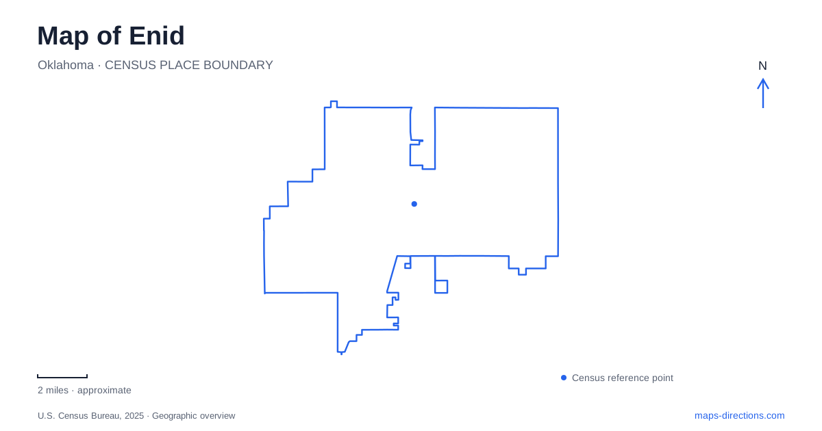
Street tiles load from OpenStreetMap when opened. The blue line shows the 2025 Census boundary.
- State
- Oklahoma
- Population · July 2025
- 50,297
- Land area
- 73.9 sq mi
- Water area
- 0.1 sq mi
Enid makes more sense when its downtown square is read alongside the springs and railroad lines that helped determine where the town developed. The courthouse is the civic center, but the story extends south to the Cherokee Strip Regional Heritage Center and north to a former freight depot. These places describe different kinds of movement: cattle passing through, settlers registering claims, and agricultural products reaching distant markets. A useful map brings those relationships into view instead of treating each museum as an isolated attraction.
A town center shaped by a railroad dispute
The original railway station stood about three miles north of the town site eventually selected by federal officials. The railroad initially refused to stop at the southern settlement, creating a serious conflict over which location would become the principal town. The dispute escalated to the destruction of a trestle in 1894 before federal intervention secured a stop. This history explains why northern place names and the present downtown cannot simply be collapsed into one original settlement.
The Garfield County Courthouse, built in 1934, supplies a later landmark for the center of Enid. Its construction belongs to an established county seat rather than the first days of the 1893 land opening. Keeping those periods separate makes the square easier to interpret: the street pattern records an early town, while the prominent civic building represents another stage of development. The town's growth subsequently depended heavily on the agricultural country around it.
Water before the street grid
Government Springs is an especially useful counterpoint to the formal square. The city's preservation plan describes natural water here as a resource for cattle drives following the Chisholm Trail between Texas and Kansas. That gives the park a regional meaning extending beyond present streets. Before the surrounding blocks became urban destinations, a dependable watering place helped organize travel through this landscape.
Boggy Creek also belongs in that geographical reading. The preservation plan connects the creek landscape with agriculture after the land opening. These water features help explain why an apparently straightforward prairie street grid has a history rooted in drainage and natural resources. On a map of Enid, the park and creek deserve attention alongside the railway corridors: both water and transport influenced the places people used and the activities that followed.
Buildings collected on South Fourth Street
The Cherokee Strip Regional Heritage Center stands at 507 South Fourth Street. Its exhibits cover life before and after the 1893 land run, along with the later influence of oil, gas, and Phillips University. The Cherokee Outlet was land associated with the Cherokee Nation before the federal opening; it should not be imagined as an empty landscape awaiting a town. The center provides a place to investigate that broader context.
Humphrey Heritage Village gathers buildings whose original locations were not all on this site. The 1893 United States Land Office formerly stood on the east side of the town square. Other structures include the 1902 First Episcopal Church, the 1896 Turkey Creek schoolhouse, and the 1905 Glidewell house from Helena. The Sneed cabin, added in 2024, came from near Cleveland. Together they make a compact architectural collection, but not a surviving original block. That distinction helps visitors connect the reconstructed village with the much wider region represented inside it.
The freight depot north of downtown
The Enid Railroad Museum occupies a restored 1920s Santa Fe freight depot at 702 North Washington. Its location and building type shift attention from civic administration to the handling of goods. Maps, telegraph equipment, depot clocks, and dining service collections show that railroads involved communication, scheduling, and passenger life as well as tracks and locomotives.
The collection also extends beyond the depot interior. A separate building contains model railway layouts, while outdoor rolling stock includes cabooses, freight cars, and the Frisco number 1519 steam locomotive. This arrangement makes the museum a useful place to compare the scale of an actual railway vehicle with the compressed network represented in a model. It also reinforces the connection between the town and the agricultural markets served by its rail lines.
A small landmark with its own journey
At Maine and Grand, a granite horse watering trough offers another way to read Enid. Given by the National Humane Alliance in 1910, it originally stood about 130 feet west of its present position. After a vehicle collision it was moved to Springs Park, then returned to the downtown area in 1989 through the efforts of Bob Klemme. Its travels connect the commercial center, animal transport, and the park in one modest object. Looking for such details turns the map into a record of changing uses, with the courthouse, springs, museum buildings, and railway depot each contributing a different chapter.
Map and statistics: U.S. Census Bureau, 2025 Gazetteer, January 2025 generalized place boundaries and Vintage 2025 population estimates. Local references: Visit Enid; City of Enid; Oklahoma Historical Society. Article prepared by Maps & Directions.