Map of Encinitas
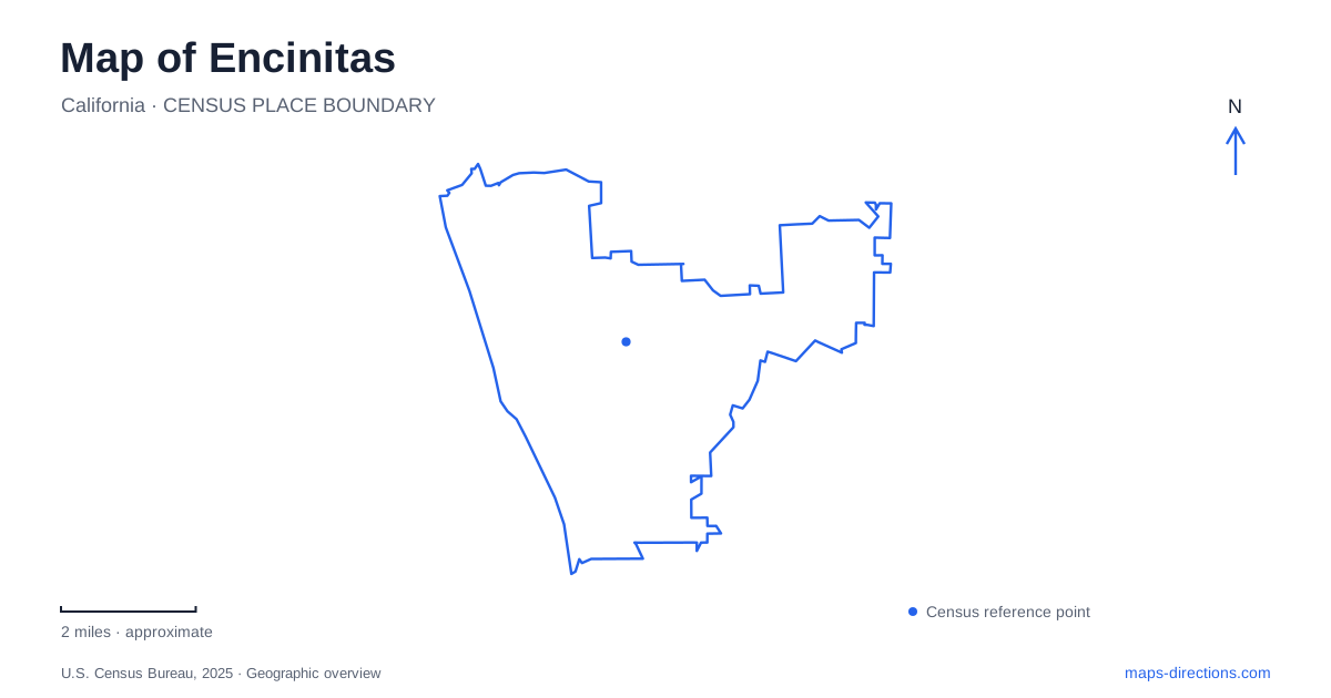
Street tiles load from OpenStreetMap when opened. The blue line shows the 2025 Census boundary.
- State
- California
- Population · July 2025
- 60,736
- Land area
- 19.1 sq mi
- Water area
- 1.1 sq mi
Encinitas is a coastal city with several community identities inside its boundary. Leucadia, Cardiff-by-the-Sea, and Olivenhain are not simply attraction names; they describe places with their own histories and landscapes. The ocean creates a strong western reference, but a useful local map also needs to show the inland garden district and the wetlands around San Elijo Lagoon. Looking only at the beach line leaves out much of the geography that makes the city distinctive.
Community names explain more than one center
The five communities that came together at incorporation in 1986 included Leucadia, Cardiff-by-the-Sea, Olivenhain, and the older and newer central districts. Their names continue to matter when describing where a destination belongs. A coastal address in Cardiff and a site associated with Olivenhain can both be within the same municipality while referring to different local environments.
For a map of Encinitas, this means that the city label is only the first level of orientation. The community name provides a second level, followed by the road and individual destination. This layered way of reading the map is especially helpful when a place is commonly advertised under a community identity rather than the municipal name.
Olivenhain's town council documents its role in the 1986 incorporation, preserving a reminder that the present boundary joins places with earlier identities. A map can therefore show one city while local descriptions continue to use several names. There is no contradiction: the names operate at different geographic scales.
Beach access has a specific street geography
Moonlight Beach is reached at B Street. The city's beach directory distinguishes it from Grandview and Beacon's, both associated with Neptune Avenue, and Stonesteps at South El Portal. Those street references are more useful than treating the entire shoreline as one continuous entrance. The beaches share an ocean edge, but their approaches emerge from different parts of the coastal street network.
The directory also separates beach access from viewpoints. H, I, and J Street viewpoints provide places to look toward the water without beach access. That is an important physical distinction on a bluff-lined coast: a street ending near the ocean can lead to an overlook rather than to the sand. A waterfront symbol alone cannot communicate that difference.
When exploring Encinitas, the named beach and its approach street should be read together. Moonlight's B Street setting includes a broad range of recreation facilities, whereas the smaller access locations have different arrangements. The choice of beach is consequently also a choice about which part of the street network and shoreline landscape to visit.
The garden away from the beach line
San Diego Botanic Garden stands on Quail Gardens Drive at Ecke Ranch Road. Despite its regional name, its actual location belongs to this city. The garden introduces a different map scale, with themed planting areas, children's spaces, a conservatory, and paths arranged within its own grounds.
Its visitor map distinguishes paved and unpaved paths, stairs, and steep sections. Those details explain the terrain within a destination that might appear as one simple green shape on a general map. The bamboo area, rainforest garden, and desert gardens are separate environments connected by the internal route network, not interchangeable labels for a uniform landscape.
This inland destination adds depth to Encinitas beyond the ocean frontage. A beach outing emphasizes access through coastal streets; a garden visit emphasizes movement among cultivated landscapes and buildings within a bounded property. Keeping both in view prevents the city from being reduced to a single strip along the water.
San Elijo Lagoon and its connected habitats
San Elijo Lagoon is an estuarine landscape where fresh water from inland creeks meets the ocean. The reserve's guide identifies Escondido and La Orilla creeks as important contributors. Salt marsh, brackish and freshwater areas, riparian habitat, and upland vegetation occur within the wider reserve, so the map shows a transition of environments rather than one open lake.
The nature center is on Manchester Avenue in Cardiff-by-the-Sea. Its loop paths and observation deck provide one particular introduction to the lagoon. Other trailheads serve different portions of the reserve, and the broader landscape reaches toward Solana Beach and Rancho Santa Fe. A single nature-center marker therefore represents one starting place within a much larger system.
For a broad understanding of Encinitas, the lagoon supplies a southern landscape reference that complements the open coast and inland gardens. Community names establish local identity, access streets explain how the shoreline is approached, and the creek-fed wetlands reveal the connection between inland terrain and the Pacific. Together those layers create a far more informative map than beach names alone.
Map and statistics: U.S. Census Bureau, 2025 Gazetteer, January 2025 generalized place boundaries and Vintage 2025 population estimates. Local references: Olivenhain Town Council; City of Encinitas; San Diego Botanic Garden; Nature Collective. Article prepared by Maps & Directions.