Map of Elyria
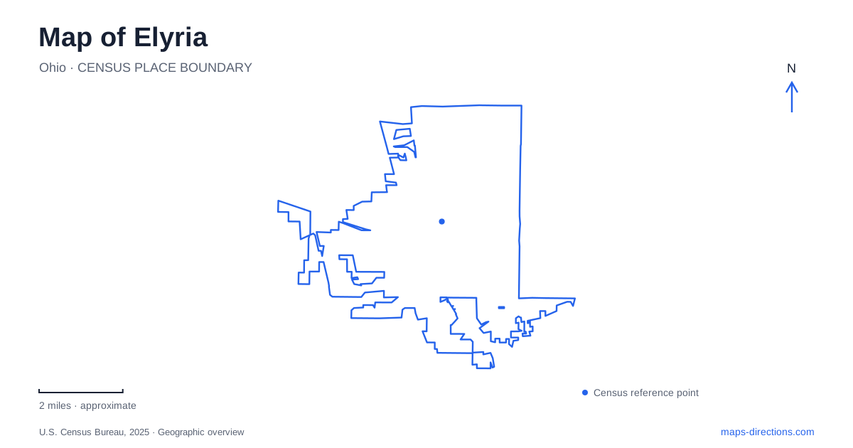
Street tiles load from OpenStreetMap when opened. The blue line shows the 2025 Census boundary.
- State
- Ohio
- Population · July 2025
- 53,634
- Land area
- 20.5 sq mi
- Water area
- 0.3 sq mi
Elyria developed around the power and meeting place of the Black River's branches. That geography remains visible today in two waterfalls, wooded ravines, and parks close to the older urban center. Ely Square supplies a civic reference, while Washington Avenue links historic residences now used as museums. Farther along the river, a regional reservation connects recreation areas toward Lorain. Reading the town through these relationships explains why a short map distance can contain both a formal downtown square and a rugged, wooded valley.
Ely Square and Broad Street
Ely Square is at Broad Street and Middle Avenue. Its fountain, gazebo, monuments, and veterans' memorial give the center a recognizable public space rather than simply an intersection. The gazebo stands south of the fountain, providing a useful internal reference within the small square. These details make it possible to orient a downtown visit around a specific civic setting.
The city's history connects the square with Heman Ely's donation of land for a courthouse. Broad Street became an early commercial corridor, including a wool-buying fair and a concentration of merchants. Industry meanwhile depended on the river: the Lorain Iron Company operated near West Falls, a history retained in the name Furnace Street. The street map of Elyria therefore contains clues to both its civic center and the water-powered enterprises that helped support it.
The relationship between square, commerce, and river is more revealing than a list of isolated historic buildings. It shows how the settlement combined trading, administration, and production within a relatively small area, while later development spread beyond those original functions.
Two waterfalls and a connected valley park
Cascade Park contains the East and West Falls on the two branches of the Black River. Berea sandstone forms their crests, and erosion has shaped the surrounding gorges. The main park entrance is at 387 Furnace Street, linking today's recreation landscape directly with the road name associated with earlier industry.
The park includes three distinct sections: the main grounds, the northern area called 19 Acres off Floradale Street, and Elywood on the east side of the river with access from Washington Avenue. A bridge installed in 2020 connects the main park with Elywood. This crossing gives the river a different role from its earlier industrial use, joining public spaces that the valley would otherwise separate.
A walking map of Elyria should retain the distinction between the different trail surfaces. The park system includes asphalt routes as well as natural trails among the ledges, with wooden bridges and stone steps. A paved path overlooking the valley and a route descending into rocky terrain are different outings, even when both appear inside the same green park boundary. The official trail description makes that variation clear without requiring visitors to infer it from a general-purpose street map.
Washington Avenue preserves two domestic landmarks
The Lorain County History Center occupies the Horace Starr House at 284 Washington Avenue. Completed in 1857, the Italianate residence now contains exhibit galleries, a bookstore, and a research library. The building places county-wide historical interpretation within one of the avenue's surviving nineteenth-century homes.
The Hickories is farther along at 509 Washington Avenue. Built for the Garford family, it interprets the household and the story of Arthur Garford, associated with the padded bicycle seat. Its visits are guided and require advance booking, whereas the History Center offers self-guided access during its opening hours. These are two distinct museum experiences rather than interchangeable names for the same property.
Together, the houses add a residential dimension to Elyria's industrial and civic story. Their shared avenue makes their relationship easy to recognize on a map, while the different street numbers preserve the distinction between a broader county history center and a particular family's house museum.
The river route continues toward Lorain
Black River Reservation extends the outdoor landscape beyond Cascade Park. High Meadows is at 1750 Ford Road and Bur Oak at 6150 Ford Road; Day's Dam, another access area, is in Lorain. The Bridgeway and Steel Mill trails follow the river through a combination of natural and industrial surroundings.
The Bridgeway route includes a long bridge that crosses the winding river twice, while the Steel Mill Trail passes landscapes shaped by steel production. That combination is characteristic of the regional river corridor: woodland and meadows coexist with evidence of heavy industry. The reservation should be selected by its individual access area when planning an outing, since its named recreation grounds occupy different points along the waterway.
A map of Elyria becomes coherent when the same river is followed through these changing roles. It powered early enterprises, frames the downtown waterfalls, separates and connects park sections, and carries a recreational corridor toward the neighboring city. Ely Square and Washington Avenue complete that picture with the civic and domestic places established around it.
Map and statistics: U.S. Census Bureau, 2025 Gazetteer, January 2025 generalized place boundaries and Vintage 2025 population estimates. Local references: City of Elyria; Lorain County Metro Parks; Lorain County Historical Society. Article prepared by Maps & Directions.