Map of Elkhart
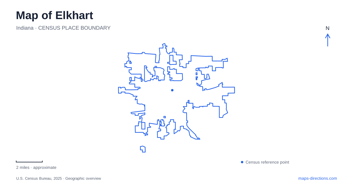
Street tiles load from OpenStreetMap when opened. The blue line shows the 2025 Census boundary.
- State
- Indiana
- Population · July 2025
- 54,092
- Land area
- 28.5 sq mi
- Water area
- 1.0 sq mi
Elkhart has a downtown shaped by the meeting of two rivers, but water is only one part of its geography. Main Street also links gardens, historic houses, performance spaces, and railway heritage. The St. Joseph River provides the larger watercourse, while the tributary bearing the city's name enters beside Island Park. Locating that confluence gives a useful starting point: the park occupies the water's meeting place, the Beardsley neighborhood looks toward it, and downtown cultural destinations extend along the street system nearby.
An island reached by three footbridges
Island Park belongs at the center of an Elkhart map because it makes the river junction tangible. The municipal park listing identifies pedestrian approaches from Sycamore Street, Lundquist-Bicentennial Park, and Pulaski Park on Beardsley Avenue. Vehicles do not enter the island. These approaches connect the same green space with several surrounding parts of downtown, so a riverside walk can be organized around a particular bank rather than a single conventional parking entrance.
The children of Havilah Beardsley donated the island in 1887. Later improvements included a Works Progress Administration shelter and a stone drinking fountain. The bandstand has a separate origin: it was moved from the C. G. Conn musical-instrument factory in 1980. That small structure adds an industrial and musical layer to the park's river scenery. The local story that the island resembles an elk's heart is best understood as a naming legend, rather than a precise description of its outline.
Beardsley Avenue's house-museum landscape
Across the surrounding river landscape, Ruthmere's campus occupies the Beardsley Historic District. Ruthmere Mansion stands at 302 East Beardsley Avenue, while the Havilah Beardsley House is at 102 West Beardsley Avenue. The two historic homes form one interpretive organization but remain distinct buildings along the avenue. Their relationship to the confluence helps explain why this neighborhood is a useful continuation of a downtown history outing.
Tours now begin at the Beardsley Discovery Center, 819 North Main Street. That arrangement makes North Main a practical point of arrival even when the historic house itself has a Beardsley Avenue address. It also joins the house-museum campus to the same street used by Wellfield farther north. Reading these locations together creates a connected picture of residential heritage and landscape, instead of reducing the district to a single mansion photograph.
A garden that still supplies drinking water
Wellfield Botanic Gardens occupies 1011 North Main Street, north of downtown Elkhart. Its name describes an actual infrastructure function. The city continues to own and operate thirteen active wells on the grounds, which supply most of the community's drinking water. The garden's long-term lease therefore overlays horticulture and public use on an operating municipal resource.
The property covers thirty-six acres, approximately half of them water. Its ponds and garden spaces make the water supply story visible in a way that a buried distribution network cannot. The local Rotary Club conceived the garden project in 2002; responsibility passed to its board in 2005, and earthmoving began the following year. Those dates distinguish the modern botanical institution from the older well field, which had supplied water and hydraulic energy since the nineteenth century.
Main Street's theater and railway heritage
South Main Street contains another pair of cultural anchors. The Lerner Theatre stands at 410 South Main Street. Built in 1924, it underwent a substantial interior restoration before reopening in 2011. The restoration contractor describes archival research, decorative painting, and plasterwork as parts of that effort. Its continued use as a performance venue makes the building more than a preserved facade within the commercial streetscape.
Farther along at 721 South Main Street, the National New York Central Railroad Museum interprets the rail network that helped connect Elkhart with wider markets. The railway arrived in 1851, and the museum opened in 1987. This is a municipal museum within a city that still has major freight operations, making it possible to distinguish preserved railway equipment from an industry that remains active around it.
The museum's South Main Street and Freight Street approaches are different sides of the arrival area. Use its visitor guidance to select the appropriate entrance, particularly if street work changes access from the main corridor. This is a useful distinction at the southern end of a Main Street itinerary: the institution's postal address and the most practical visitor approach need not be identical, and a restriction on one approach does not describe all of downtown.
River habitat beyond the central blocks
The municipal environmental center at 1717 East Lusher Avenue extends the outdoor map of Elkhart beyond the downtown confluence. Its grounds include prairies, wetlands, woodland, and riverfront habitat, with public trails open from dawn to dusk. The seasonal landscape and educational programs provide a different encounter with water from either Island Park or the formal gardens.
Together, these places show three local roles for the natural landscape: a downtown gathering space at the river junction, a working water resource within a botanical garden, and habitat interpreted through environmental education. Main Street and Beardsley Avenue supply the historical and cultural connections between those outdoor settings.
Map and statistics: U.S. Census Bureau, 2025 Gazetteer, January 2025 generalized place boundaries and Vintage 2025 population estimates. Local references: City of Elkhart; Ruthmere; Wellfield Botanic Gardens; Visit Elkhart County; EverGreene Architectural Arts. Article prepared by Maps & Directions.