Map of Elgin
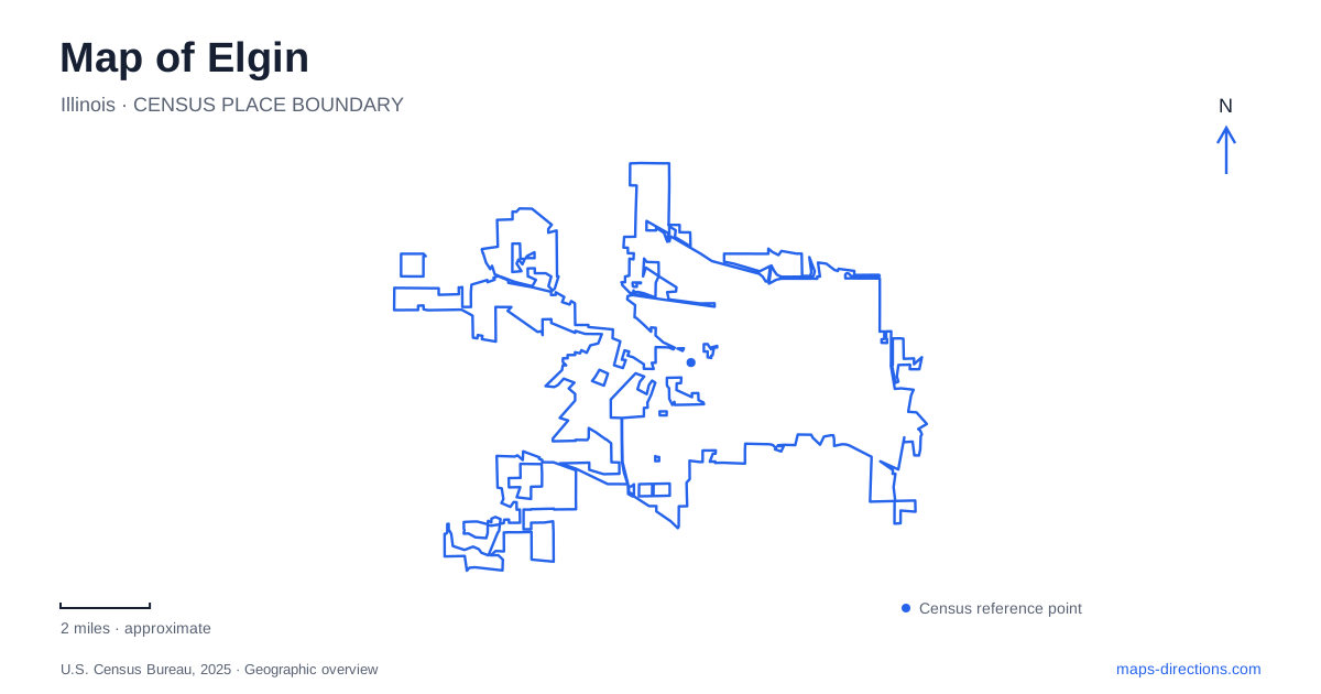
Street tiles load from OpenStreetMap when opened. The blue line shows the 2025 Census boundary.
- State
- Illinois
- Population · July 2025
- 115,476
- Land area
- 38.3 sq mi
- Water area
- 0.6 sq mi
Elgin brings river geography, manufacturing history, and cultural institutions into a relatively compact central map. The Fox River supplies the main landscape reference, with Walton Island and public buildings giving the downtown waterfront recognizable destinations. Park Street leads to a former school that now interprets the city's past, while the railway offers several distinct arrival points. Beyond the center, Lords Park provides a different kind of outing, with recreation facilities and an established animal collection.
An island in the downtown river
Walton Island lies just south of the downtown dam. Created through the Works Progress Administration program in the 1930s, the island park was dedicated to the city by the Izaak Walton League. Its roughly four-and-a-half acres contain paths and a pavilion, making it a designed public landscape within the river rather than simply an undeveloped patch of land.
The island is opposite the Hemmens and the Centre, which helps place it within the civic and cultural district. The Hemmens Cultural Center stands at 45 Symphony Way, at North Grove Avenue. These references tie the river setting to named streets and public buildings. An outing here can combine a performance destination with a short outdoor visit without making the island the sole reason for coming downtown.
On an Elgin map, the dam, island, and Symphony Way cluster provide a useful alternative to navigating only by business names. Their physical relationship remains legible even when a particular performance or event changes. The Fox River Trail adds another way to experience the river corridor, while the park paths allow a smaller excursion within the downtown setting.
Old Main explains the city beyond its waterfront
The history museum occupies Old Main at 360 Park Street. Built in 1856 as a private school, the Greek Revival building originally combined classrooms, residential space for the principal's family, and a student dormitory. Its later rehabilitation and reuse as a museum preserved a structure whose original purpose was education, while changing the audience and the material being taught.
The building's portico, triangular pediments, and bell tower make architecture part of the visit. The museum's collections cover manufacturing, road racing, immigration, and everyday life. Watches and other locally made products help explain why Elgin became known beyond the Fox River Valley. Looking at those objects after seeing the central streets connects the city's reputation with the people and institutions that produced it.
The museum has a mobility-accessible rear entrance and an elevator serving its floors. Visitors needing that entrance can contact staff or use the doorbell. This is useful practical information for a historic building whose most prominent architectural face is not the only way inside. It also demonstrates how the old school's physical arrangement has been adapted for a different public role.
Three railway addresses describe different arrivals
Metra's Milwaukee District West line serves three local station locations: National Street at 85 National Street, the downtown station at 109 West Chicago Street, and Big Timber Road at 2025 Big Timber Road. The addresses matter because they distribute rail access across different parts of the city. A trip to the downtown riverfront and a trip organized around the Big Timber Road area should begin with different station comparisons.
For Elgin visitors arriving from Chicago, the downtown station's West Chicago Street address is a useful first reference when assessing the rest of a journey. The other stops remain separate options with their own locations, rather than alternative names for one terminal. The rail line connects the city with Chicago Union Station, but the local street map determines the walking or connecting trip after arrival.
Keeping all three stations visible also improves planning for a visit involving more than one destination. The museum on Park Street, the riverfront cultural buildings, and the larger outlying parks occupy different settings. The railway answers the regional travel question; the station address and the local streets answer where that regional trip actually leaves the visitor.
Lords Park offers a different public landscape
Lords Park uses 325 Hiawatha Drive as its address. The city's recreation guide distinguishes east, north, and west shelter areas: the east shelter is near the eastern playground, the north shelter near the pool, and the west shelter near the bison pens and western playground. These internal references are useful because a gathering or activity may take place in one particular part of the park.
The animal area includes bison, elk, and white-tailed deer, while the farm zoo operates seasonally. That combination gives the park a character unlike Walton Island's compact river setting. Elgin can therefore support two quite different outdoor visits: a downtown pause among paths and cultural buildings, or a park outing organized around animals, play areas, and recreation facilities. The distinction comes from the actual layout and uses of each place, not simply from their shared park designation.
Map and statistics: U.S. Census Bureau, 2025 Gazetteer, January 2025 generalized place boundaries and Vintage 2025 population estimates. Local references: City of Elgin; Elgin History Museum; Metra. Article prepared by Maps & Directions.