Map of El Paso
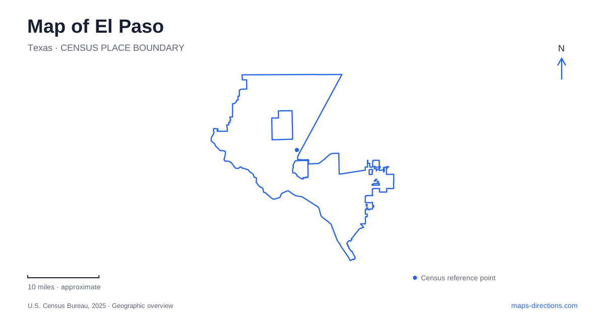
Street tiles load from OpenStreetMap when opened. The blue line shows the 2025 Census boundary.
- State
- Texas
- Population · July 2025
- 683,012
- Land area
- 258.8 sq mi
- Water area
- 0.5 sq mi
El Paso occupies a landscape where mountains, a river, and an international boundary influence the shape of everyday routes. The Franklin Mountains provide the strongest inland reference, with roads and neighborhoods approaching their eastern and western sides. Near the Rio Grande, the urban landscape meets Ciudad Juárez across the border. A useful map therefore needs to show more than a collection of attractions: it should reveal which side of the mountains a destination occupies and whether a route remains within the United States.
Two sides of the Franklin Mountains
The state park's access points make the mountain geography concrete. The Tom Mays Unit is on the west side, reached from Interstate 10 by Trans Mountain Road. McKelligon Canyon approaches the range from the east, with the state park directions using US 54 and Fred Wilson Road. These are different approaches to the same mountain system, rather than interchangeable entrances reached by one short park drive.
Trans Mountain Road, part of Loop 375, crosses the range and provides another reference at Smugglers Pass, where the Ron Coleman Trail has a trailhead. A fourth major access point lies in the northeastern park area at the end of Jon Cunningham Boulevard. On an El Paso map, plotting these four locations reveals the scale of the mountain barrier much more clearly than a single park symbol does. It also explains why a trail destination should determine the road approach.
The Tom Mays facility map distinguishes the access road from the hiking network. Mundy's Gap, North Franklin Peak, the Aztec Caves, and the Sunset trails belong to that finer-grained landscape. A connection drawn as a trail is not a road through the mountains. The distinction matters particularly here, where the mountain range forms a visible backdrop to developed areas but contains terrain quite unlike the surrounding street network.
Chamizal explains the border landscape
Chamizal National Memorial adds a historical explanation to the river line. Its story concerns changes in the Rio Grande's course and the resulting dispute over national jurisdiction. The settlement associated with the 1963 treaty led to a new channel and an exchange of territory. This history makes the memorial more than a convenient green space beside the boundary: it interprets why the boundary took its present form.
For a visit within El Paso, Paisano Drive is the immediate road reference. The memorial lies near I-10, Loop 375 along the border, and north–south US 54. The National Park Service identifies Paisano Drive and South San Marcial Street as the northwest corner of the site and a Sun Metro stop location. These surrounding roads connect the memorial to the larger urban network, but they also lead toward international approaches. Reading the destination and lane signs carefully is necessary in this particular setting, because an unintended border crossing is not equivalent to an ordinary missed city turn.
Keep the bridge names distinct
Paso del Norte, Stanton–Lerdo, and Ysleta–Zaragoza are separately named crossings in the city's bridge information. Bridge of the Americas is another crossing identified in the city's planning material. A map that reduces them to identical bridge symbols loses information important to understanding the border corridor.
The crossing name should remain attached to any itinerary involving Ciudad Juárez. The city's published crossing tables distinguish pedestrian, bicycle, passenger-vehicle, and commercial categories, rather than treating all users as one stream. That is a practical reason to pair the map with the relevant crossing information when planning an international journey. For a domestic itinerary, the same bridge labels serve as orientation features without becoming intermediate route destinations.
A university shaped by the foothills
The university campus offers a different kind of local map reference. UTEP's architecture draws on Bhutanese building traditions, a choice associated with the appearance of the Franklin Mountains foothills. Its original group of buildings was constructed in 1917, after a fire destroyed the earlier School of Mines building.
Old Main, Prospect Hall, Quinn Hall, and Graham Hall are the present names associated with that original group. Their shared architectural character gives the campus a recognizable identity, while the individual building names provide the detail needed for a campus visit. In El Paso, this connection between mountain setting and architecture is especially useful for understanding why the university looks distinct from an ordinary collection of institutional blocks.
Extend the view along the Mission Trail
The Mission Trail connects Ysleta, Socorro, and San Elizario along a historic nine-mile route. It forms part of the wider El Camino Real de Tierra Adentro National Historic Trail. These named places should remain visible when zooming beyond the central city, because the route tells a regional story rather than describing one downtown attraction.
That broader view completes a useful reading of El Paso: the mountain entrances explain inland movement, Chamizal explains the river boundary, the bridge names distinguish international connections, and the Mission Trail follows a historic corridor through several communities. Each layer adds a different kind of location information, allowing the map to reflect the area's actual geography rather than flattening it into a list of pins.
Map and statistics: U.S. Census Bureau, 2025 Gazetteer, January 2025 generalized place boundaries and Vintage 2025 population estimates. Local references: Texas Parks and Wildlife Department; National Park Service; City of El Paso; UTEP; Visit El Paso. Article prepared by Maps & Directions.