Map of El Monte
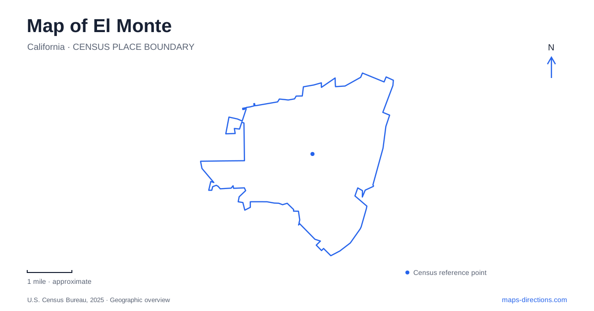
Street tiles load from OpenStreetMap when opened. The blue line shows the 2025 Census boundary.
- State
- California
- Population · July 2025
- 105,075
- Land area
- 9.6 sq mi
- Water area
- 0.1 sq mi
El Monte has a transportation identity that can create a surprisingly practical map problem: its major bus terminal and its Metrolink station are different places. Railroad Street and Santa Anita Avenue identify those facilities, while Ramona Boulevard carries the memory of an earlier electric railway. Away from the transit infrastructure, Tyler Avenue groups a museum, park, and senior center within a small area. The Rio Hondo supplies another route through the landscape, with trails that follow water rather than the commercial street grid.
Two stations with different addresses
The Metrolink station is at 10925 Railroad Street on the San Bernardino Line. Its platforms serve regional trains, and the operator lists connections with local and regional bus services. The street name is a useful mnemonic: Railroad Street is the address to retain for the train facility.
The large bus station uses 3501 Santa Anita Avenue. Metro's customer center is located there, and the terminal accommodates buses within a multilevel layout. Its reconstruction produced a new two-story facility that opened in 2012, with passenger circulation between different boarding levels.
An El Monte journey therefore needs both a mode and an address. Saying only station leaves out a meaningful part of the destination. The distinction also explains why a transfer between regional rail and a particular bus departure can involve travel between facilities rather than simply moving to another platform within one terminal.
The bus station's internal layout introduces a second scale. Santa Anita Avenue establishes the arrival point, but the relevant boarding level and bay organize movement after arrival. This is the geography of a substantial interchange, different from a curbside stop on an ordinary commercial street.
Ramona Boulevard and the earlier rail era
The city's cultural-resources history places the arrival of Southern Pacific tracks in 1873 and Pacific Electric service in 1907. The electric cars traveled east–west along the Ramona Boulevard corridor. Main Street had been paved the previous year, so road improvement and electric transit were part of the same period of urban change.
These details give El Monte's modern transport map a longer timeline. Railroad Street's current passenger service, the Santa Anita bus terminal, and the historic Ramona alignment represent distinct systems. Their proximity reflects a city repeatedly shaped by regional movement, not one station simply changing vehicles over time.
The general plan also describes the nineteenth-century settlement's attraction as fertile alluvial ground with water for agriculture. That context helps explain why transport and waterways both recur in local geography. Routes connected the settlement to other places, while the surrounding river landscape supported the activities that made settlement possible.
Tyler Avenue's public destinations
The historical museum uses 3150 Tyler Avenue. Tony Arceo Park is at 3125 North Tyler, and the Jack Crippen Multipurpose Senior Center and Gym uses 3120 North Tyler. Their close address range provides a compact public-service cluster within the larger city.
The park includes a walking path with distance markers, a band shell, and play structures. The senior center adds indoor recreation and community facilities. Together with the museum, these destinations serve different purposes along the same avenue: local history, outdoor gathering, and everyday programs.
For an El Monte map, this cluster is a useful counterpoint to the large transport terminals. Tyler Avenue offers several civic activities at neighborhood scale. The shared street reference makes the relationship clear while preserving the separate identity of each facility.
Following the Rio Hondo
The county describes a northern Rio Hondo River Trail approach at Peck Road and Rio Hondo Parkway. Farther along the corridor, the relationship between the riverbanks and paths becomes important. At Rush Street, the bicycle path follows the east side of the river, while the multiuse trail is on the west beside the Whittier Narrows Golf Course.
Those bank-specific details are more useful than treating the river as one generic trail line. Crossings and access points determine which side a traveler reaches. The corridor also connects the city with the larger Whittier Narrows landscape, giving walking and cycling a regional dimension beyond neighborhood streets.
Parks with different recreation roles
Gibson Mariposa Park, at 4140 Gibson Road, combines a walking path, basketball, play structures, and a splash pad. Lambert Park, at 11431 McGirk Street, adds an indoor gym and baseball facilities. Mountain View Park uses 12127 Elliott Avenue and includes lighted ballfields and community rooms.
These addresses show recreation distributed among several neighborhoods rather than concentrated beside one station or civic building. El Monte's map becomes clearer when the transit facilities, Tyler Avenue cluster, riverbanks, and individual parks remain visible as distinct systems. Each provides a different way to understand how people move through and use the city.
Map and statistics: U.S. Census Bureau, 2025 Gazetteer, January 2025 generalized place boundaries and Vintage 2025 population estimates. Local references: Metrolink; Los Angeles Metro; City of El Monte; El Monte Historical Society; Los Angeles County Parks and Recreation. Article prepared by Maps & Directions.