Map of El Centro
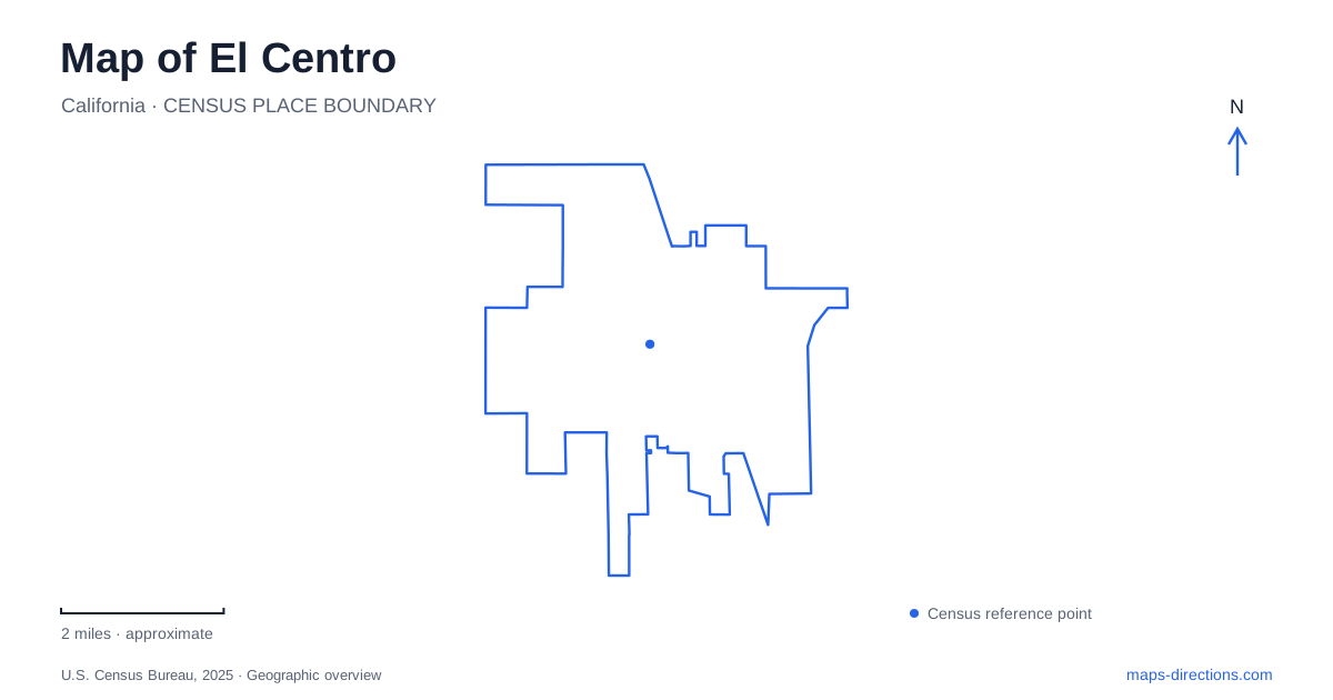
Street tiles load from OpenStreetMap when opened. The blue line shows the 2025 Census boundary.
- State
- California
- Population · July 2025
- 44,382
- Land area
- 12.1 sq mi
- Water area
- 0.0 sq mi
El Centro developed as a service and shipping center within the irrigated Imperial Valley. Its streets and public buildings belong to an urban community, but the wider landscape cannot be understood without the canals and agricultural land around it. Regional highways, newer road extensions, and civic facilities reveal successive stages of growth. The resulting map combines an early commercial grid with corridors that continue to organize movement beyond the original center.
Agriculture helped create the urban center
W. F. Holt and C. A. Barker purchased the townsite land in 1906, and the city incorporated in 1908. Its selection as the county seat helped establish a regional role during a period of strong competition among nearby valley communities. This was more than the growth of another farming settlement: administrative functions gave people reasons to travel into town from a much larger area.
By the 1940s, rail connections and Highways 80 and 99 supported vegetable shipping and related industries. Packing operations, ice plants, box factories, and other businesses belonged to the same agricultural economy. That history explains why an urban street map and an agricultural map are closely connected here. The city supplied the facilities through which crops were handled, packaged, and moved onward.
Today, Interstate 8 and State Routes 86 and 111 provide the broader road framework for El Centro. They place local streets within a regional network rather than replacing the city's older role as a center for surrounding communities and farmland.
The water comes from beyond the valley
The All-American Canal supplies Colorado River water to the Imperial Valley. Beginning at Imperial Dam near Yuma, the approximately 80-mile gravity-flow canal travels south and then west, crossing a stretch of sand dunes before reaching the valley's delivery network. The first water arrived through it in 1940, and it became the valley's sole water source in 1942.
Three main branches—the East Highline, Central Main, and Westside Main—distribute water to smaller lateral canals. This branching system helps explain the engineered character of the surrounding landscape. Fields depend on a connected delivery network, so channels shown on a regional map represent working infrastructure with a purpose different from a natural stream or recreational waterway.
For El Centro, that distant connection to the Colorado River is fundamental geographical context. The apparent contrast between cultivated fields and dry surrounding terrain is supported by an extensive water-transportation system. Understanding the canal hierarchy gives the agricultural setting a physical explanation without assuming the main river itself passes through the city.
Imperial Avenue extends south of the freeway
Street construction has changed the southern road pattern. The city's first two South Imperial Avenue extension phases created roadway from the new I-8 interchange to Wake Avenue and continued South Imperial Avenue toward Danenberg Drive. Wake Avenue was extended west from South Eighth Street, and Danenberg Drive was also extended west to meet the new corridor.
These are specific connections rather than a general promise of future development. Together, they establish a network south of the freeway with both north-south movement and east-west links. An older street map can miss that relationship, making the freeway look like a more complete break in the local road system than the constructed extensions now allow.
Civic buildings tell different stories
The Old Post Office Pavilion at 230 South Fifth Street preserves a 1932 building that served as the main postal facility until the 1970s. It subsequently became a cultural center and art museum through work by the city and the Imperial Arts Council. Its reuse gives the older central streets a public gathering space tied to an earlier government function.
The main library represents a different kind of change in El Centro. The former State Street library was severely damaged in the April 2010 earthquake, and the replacement at 1198 North Imperial Avenue opened in November 2022. The change of address reflects a prolonged rebuilding process, not simply a renamed building at the same site.
Recreation has several street anchors
Park Avenue contains a cluster of recreation facilities, including the aquatic center at 540 Park Avenue, the Conrad Harrison Youth Center, and the Dr. Martin Luther King Jr. Sports Pavilion. The aquatic center combines competition and instructional pools with children's water play and a lazy river, giving this corridor a concentrated recreation role.
Bucklin Park occupies a separate location at 1350 South Eighth Street, while Water Tower Park is identified at Eighth and Vine. On a map of El Centro, these addresses establish a distributed pattern of public spaces. The parks, newer library, and reused post office show how community destinations have developed across the street network rather than remaining concentrated around one historic civic block.
Map and statistics: U.S. Census Bureau, 2025 Gazetteer, January 2025 generalized place boundaries and Vintage 2025 population estimates. Local references: City of El Centro; Imperial Irrigation District. Article prepared by Maps & Directions.