Map of El Cajon
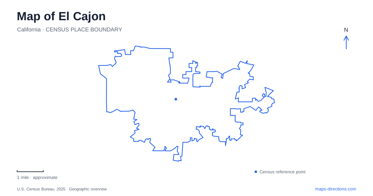
Street tiles load from OpenStreetMap when opened. The blue line shows the 2025 Census boundary.
- State
- California
- Population · July 2025
- 101,755
- Land area
- 14.5 sq mi
- Water area
- 0.0 sq mi
El Cajon's Main Street and Magnolia Avenue intersection has a long history as a place where journeys meet. Nineteenth-century freight teams stopped here on the route between San Diego and the Julian mining area, and the same crossroads later became the focus of the business district and civic center. Modern trolley transfers and aviation facilities add other transportation layers, while preserved houses and public gathering spaces make the downtown streets useful for a more detailed exploration.
The crossroads before the civic center
Amaziah Knox built a combined residence and hotel at the southwest corner of Main and Magnolia in 1876. Teamsters had already used the area as an overnight stopping place, making the hotel a response to an established travel pattern. Their route connected the mining country with San Diego through the valley and Grossmont Pass.
Agriculture supplied another reason for settlement. Large wheat-ranching tracts were subdivided, and the valley later supported citrus, avocados, grapes, and raisins. The commercial crossroads served that surrounding productive landscape as well as travelers passing through it. When the civic center opened in 1976, it reinforced the importance of the same central intersection in a substantially changed city.
This continuity makes Main and Magnolia a useful starting point for reading El Cajon's map. The streets identify more than a convenient junction: they mark a location that shifted from a freight stopping place to a business center and then a civic focus.
Historic buildings that changed location
The surviving Knox Hotel building is now at 280 North Magnolia Avenue, at West Park Avenue. Municipal historic-resource documentation records moves in 1944 and 1972, the latter bringing it to its present site. Its historic association with Main Street therefore differs from its current address.
The Olaf Wieghorst house has a similar distinction. It was moved from 301 West Renette Avenue to a site beside the museum at 131 Rea Avenue. The museum interprets the artist, who lived locally from 1945 until 1988, and includes a botanical garden. Rea Avenue and nearby municipal parking around Magnolia Avenue and Civic Center Way provide practical references for the museum setting.
These two relocations are unusually useful facts for anyone comparing old photographs with a current map. Both buildings retain historical significance, but neither should be assumed to occupy the exact surroundings shown in every earlier image. Their preservation brought important local stories into the downtown area while changing the relationship between building and street.
Prescott Promenade's public space
Prescott Promenade adds an outdoor gathering place within the central district. The city describes a small stage surrounded by trees, benches, and grassy knolls, near shops and restaurants. Its scale is different from a large regional park: the promenade functions as part of the downtown pedestrian environment.
Placed alongside the museums and civic buildings, it helps explain how El Cajon's center works as a collection of complementary spaces. A historic-house visit, a performance, and a meal can involve different buildings and outdoor areas within the same district. The promenade's open ground gives that group a public meeting place between the enclosed destinations.
The trolley transfer that changed the route map
The Copper Line began operating in September 2024 as the East County Connector. It runs between El Cajon Transit Center and Santee Town Center, serving Arnele Avenue and Gillespie Field along the way. The Green and Orange lines end at the transit center, where passengers continuing north transfer to Copper Line service.
That arrangement replaced the previous through-service pattern north of the interchange. Older trolley maps can therefore show a different line color continuing toward Santee. The physical railway corridor remains recognizable, but its service organization changed. MTS explains that the single-track section near Cuyamaca Street and the Mission Gorge Road intersection influenced the decision to separate this portion of the system.
Aviation northwest and a creek park farther east
Gillespie Field occupies the city's northwestern corner. It began as a Marine Corps parachutist facility in 1942, became a county-leased public airport in 1946, and passed into county ownership in 1952. Today its runways sit among aviation businesses, flight schools, maintenance operations, and aircraft storage. That extensive working landscape differs from the smaller downtown blocks and helps explain the shape of the northwestern area.
For an outing farther east in the broader valley, Flinn Springs County Park uses 14787 Olde Highway 80. Oak groves, a stream, meadows, and hiking paths define its setting. It is a county recreation destination reached by a named older highway corridor, rather than another square within the downtown street grid.
Together, these places give a map of El Cajon several clear reference systems: the historic Main–Magnolia crossroads, downtown's preserved buildings and public spaces, the trolley interchange, the aviation district, and the older eastward road leading toward creekside recreation.
Map and statistics: U.S. Census Bureau, 2025 Gazetteer, January 2025 generalized place boundaries and Vintage 2025 population estimates. Local references: City of El Cajon; Olaf Wieghorst Museum; MTS; San Diego County; San Diego County Parks. Article prepared by Maps & Directions.