Map of Edina
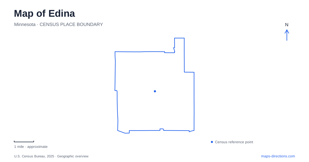
Street tiles load from OpenStreetMap when opened. The blue line shows the 2025 Census boundary.
- State
- Minnesota
- Population · July 2025
- 54,356
- Land area
- 15.5 sq mi
- Water area
- 0.5 sq mi
Edina has several recognizable centers, and each occupies a different relationship to roads, water, and neighboring communities. The 50th & France district sits at a city boundary, Grandview adjoins Highway 100, and the Greater Southdale area contains a larger pattern of commercial development and public recreation. Nine Mile Creek provides another kind of connection through wetlands and woodland. A useful map shows how these places differ, rather than treating the whole city as a single shopping destination.
A commercial district across a boundary
The name 50th & France is unusually helpful because it identifies the intersection around which the district is organized. Its businesses occupy land in both Edina and Minneapolis. The municipal boundary therefore does not divide the commercial experience into two self-contained shopping areas. Stores and restaurants on opposite sides of the district can belong to different cities while remaining part of the same local destination.
Grandview is a separate commercial district adjacent to Highway 100. Its geography is tied to that north-south highway corridor rather than to the 50th Street and France Avenue intersection. Recognizing the difference helps when comparing a business address with a broad district name. A journey to Grandview and an outing at 50th & France are different local trips, even though both may be described casually as shopping in the same city.
Historic buildings on Eden Avenue
The Cahill School and Minnehaha Grange Hall provide a small-scale historical destination at 4918 Eden Avenue. The historical society uses the one-room schoolhouse and the 1879 Grange Hall for educational programs and tours. Together they introduce public education and community organization in an earlier period, offering a different perspective from the modern business districts.
The Grange Hall also served as a village hall, while the school represents a setting in which children of different ages learned together in one room. Seeing the two buildings as a pair makes their relationship particularly useful: schooling and local government both depended on shared community spaces. The Eden Avenue address should be used for these historic buildings; the historical society's museum and mailing address on West 70th Street identifies another location. Their common operator does not place every historical activity on one campus.
A designed lake landscape in Southdale
Centennial Lakes Park is a major public-space anchor in Edina at 7499 France Avenue South. Its paths, gardens, public art, and water features sit within a larger mixed-use development. The park map divides the grounds into north, central, and south areas, with Hughes Pavilion, the putting course, and Maetzold Amphitheater providing recognizable internal landmarks.
The layout rewards attention to the lake paths rather than only the surrounding roads. A visitor may arrive from France Avenue but spend the outing moving around the water and between activity areas. Seasonal uses also change the purpose of a visit: paddleboats and putting belong to warmer-weather recreation, while skating is associated with winter conditions. The walking landscape remains the organizing feature around those changing activities.
The Promenade extends the pedestrian network
The Edina Promenade extends the Centennial Lakes setting through the Greater Southdale area. The city's district plan describes separate pedestrian and bicycle paths, spaces for public art, and stormwater features. This is an intentional connection among retail, residential, and recreational uses, rather than an incidental sidewalk around a parking lot.
That design helps explain how a district often viewed from arterial roads can also be explored at walking scale. The lake, landscaped paths, and public artwork form a connected outdoor experience among larger buildings. On a map, following the pedestrian network reveals relationships that are less obvious when looking only at driveways and property boundaries. A visit to the park can therefore be understood as part of a broader public-space system.
Boardwalks along Nine Mile Creek
Nine Mile Creek Regional Trail offers a contrasting route through Edina. Managed by Three Rivers Park District, it links several communities and includes both paved sections and extensive wooden boardwalk. Wetlands and woodland influence the trail's form, giving it a different character from the carefully landscaped paths at Centennial Lakes.
Walnut Ridge Park at 5801 Londonderry Road provides parking directly along the regional trail. Bredesen Park at 5901 Olinger Boulevard offers another access option, but the parking is on the east side and the regional trail lies along the south, reached through city park paths. Those relationships are useful when choosing a start for a walk or ride. They turn a long regional line into specific local approaches.
Taken together, the boundary-spanning commercial district, highway-side Grandview, historic Eden Avenue buildings, designed lake park, and creek boardwalks reveal several ways the city has developed. Keeping these settings distinct makes it easier to select a route that fits the outing and to understand what lies beyond the most familiar business address.
Map and statistics: U.S. Census Bureau, 2025 Gazetteer, January 2025 generalized place boundaries and Vintage 2025 population estimates. Local references: City of Edina; Edina Historical Society; Three Rivers Park District. Article prepared by Maps & Directions.