Map of Eau Claire
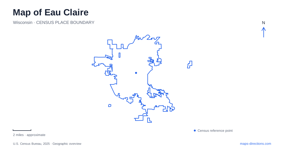
Street tiles load from OpenStreetMap when opened. The blue line shows the 2025 Census boundary.
- State
- Wisconsin
- Population · July 2025
- 72,465
- Land area
- 34.4 sq mi
- Water area
- 2.1 sq mi
Eau Claire is a city where water explains much of the map. Two rivers meet downtown, an old river bend forms Half Moon Lake, and the university occupies land beside the Chippewa River. These are different water landscapes with different relationships to surrounding streets and buildings. The confluence provides a downtown reference point, the lake wraps around a major park, and river crossings connect campus and trail routes. Understanding those forms makes the city's recreation and industrial history easier to place.
Beginning at the confluence
Phoenix Park lies where the Eau Claire River joins the Chippewa River. This meeting of waterways gives downtown a recognizable geographic anchor. Wisconsin's Department of Natural Resources identifies the park as the starting point of the 30-mile Chippewa River State Trail, which travels south through river-bottom habitat, prairie, sandstone bluffs, and wetlands.
The trail gives the confluence a regional role as well as a local one. A person can use the park as a downtown destination, while a cyclist may see it as one end of a much longer corridor. The water and trail together therefore establish both a place to stop and a route extending beyond the urban core.
This relationship is useful when comparing maps at different scales. At street level, bridges, paths, and adjacent blocks organize movement around the rivers. At the regional scale, the Chippewa corridor continues through a much broader landscape. Neither view replaces the other; they explain different lengths and kinds of outing.
The old river bend around Carson Park
Half Moon Lake is an oxbow, separated from the Chippewa River's former course. Its curved outline surrounds the Carson Park peninsula, creating one of the most distinctive shapes on a map of Eau Claire. The lake is now maintained by rainfall, runoff, and water pumped from wells near the river, rather than functioning as an ordinary flowing river channel.
Carson Park covers approximately 134 acres. It contains the Chippewa Valley Museum, the seasonal Paul Bunyan Logging Camp, athletic grounds, playgrounds, and picnic facilities. The logging camp was built in the 1930s as a representation of an 1890s camp, an important distinction for visitors interested in which structures are original and which interpret an earlier period.
The park's baseball stadium adds another historical layer. Hank Aaron played here in 1952, before his major-league career. The presence of sports grounds and museums within the same peninsula gives the park several identities: a place to learn about the region, attend a game, or spend time beside the lake.
Following the lake edge
The lake has multiple public approaches. Braun's Bay in Carson Park provides a landing and an accessible fishing pier, while Half Moon Beach, Lakeshore Park, and Rod and Gun Park serve other sections of shoreline. Internal-combustion engines are not allowed on the lake, distinguishing its recreational use from that of many larger boating destinations.
A boardwalk project completed in 2024 strengthened the connection between Carson Park and Rod and Gun Park. It combines a concrete trail with three branching elevated boardwalks through the Half Moon Lake and Braun's Bay wetland setting. This gives walkers a closer view of the shoreline environment while linking two established parks. The route is particularly useful for understanding how the peninsula relates to public land around the outside of the lake.
Campus beside the Chippewa
The university brings another relationship between land and water into Eau Claire. Its main campus address is 105 Garfield Avenue, while the Davies Student Center is at 77 Roosevelt Avenue. The campus footbridge carries pedestrians and bicycles across the Chippewa River, making the crossing part of ordinary campus movement as well as a recognizable landmark.
Elevation also matters here. Garfield Avenue's hill connects upper and lower campus areas, so a flat-looking overview does not fully describe a campus walk. The river crossing and hillside together explain why destination-specific campus information is more useful than treating the university as a single point.
A factory landscape with a continuing role
Banbury Place at 800 Wisconsin Street preserves a different part of local development. Tire production began there in 1917, and the complex later operated under the Uniroyal name before the factory closed in 1992. Reuse of the property kept its large industrial buildings active instead of removing that history from the cityscape.
The Uniroyal Tire Factory Gallery, in Building 13, interprets the workers and production history through objects and photographs. A separate mural gallery occupies hallways in Building 6. These spaces make the complex's industrial scale and later cultural uses visible together.
From confluence to oxbow lake, campus bridge to reused factory, Eau Claire offers a map whose shapes and buildings explain one another. Waterways remain the strongest organizing feature, while the places along them show how recreation, education, and industry have used the same landscape in different ways.
Map and statistics: U.S. Census Bureau, 2025 Gazetteer, January 2025 generalized place boundaries and Vintage 2025 population estimates. Local references: Wisconsin DNR; City of Eau Claire; Chippewa Valley Museum; UW-Eau Claire; Banbury Place. Article prepared by Maps & Directions.