Map of Eastvale
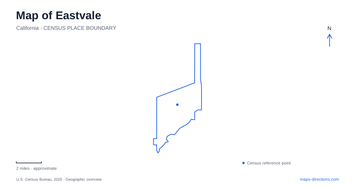
Street tiles load from OpenStreetMap when opened. The blue line shows the 2025 Census boundary.
- State
- California
- Population · July 2025
- 70,594
- Land area
- 12.7 sq mi
- Water area
- 0.4 sq mi
Eastvale's map combines a broad network of residential streets with a river corridor along its southern side. The Santa Ana River provides a clear landscape reference, while Hamner, Archibald, Hellman, and Bellegrave avenues help organize the recreation system. These roads also reveal an administrative detail that matters locally: parks within the city are served by more than one district. Understanding those relationships makes it easier to compare a riverside outing, a neighborhood park visit, and a program in an indoor community facility.
A local trail within a much larger river project
The riverside trail managed by Jurupa Community Services District runs between Archibald and Hamner avenues. It provides 2.61 miles for walking, cycling, and horseback use and forms a small part of the Santa Ana River Trail. The larger regional project is intended to connect the coast with the San Bernardino Mountains; that eventual ambition should not be mistaken for a statement that every section is already complete.
The local trail itself developed in stages. The first portion opened with Riverwalk Park in 2008, and later sections extended the corridor through 2014 and 2016. This history explains why the route connects several park and neighborhood edges rather than existing as one isolated trailhead.
For an Eastvale river walk, the district identifies approaches at Grapewin Street and Archibald Avenue, Dearborn and Tisdale streets, and Harrison Avenue and Chandler Street. Riverwalk Park adds access from the Cobble Creek Drive and Potter Drive area and from Soaring Bird Court. These neighborhood connections allow an outing to begin at different points along the same river landscape.
Hamner Avenue divides recreation responsibilities
The JCSD parks territory is bounded by Bellegrave Avenue on the north, Hellman Avenue on the west, Hamner Avenue on the east, and the Santa Ana River on the south. Within this area, the district manages parks and public landscaping as well as recreation facilities.
The city identifies a different arrangement east of Hamner Avenue, between that road and Interstate 15. Cambria Park, Delaware Greenbelt, Harmony Park, and Moon River Park belong to Jurupa Area Recreation and Park District. This is a service boundary within the city, not a reason to omit those neighborhoods from an Eastvale map.
For everyday use, the distinction explains why a park reservation or program search may lead to a different agency depending on the location. It also gives Hamner Avenue a second role beyond carrying traffic: the road helps organize how local recreation is delivered.
Comparing the neighborhood parks
Dairyland Park at 14520 San Remo includes a dog park, picnic areas, and water play facilities. American Heroes Park at 6608 Hellman Avenue combines a dog area with a playground and soccer field. Farther within the street network, Harada Heritage Park at 13099 65th Street provides ballfields, basketball, a skate park, and other recreation spaces.
These parks offer different combinations of activity rather than a uniform set of facilities repeated across the city. A family seeking a splash area, a group heading to a field, and someone walking a dog may therefore use different places. Plotting San Remo, Hellman Avenue, and 65th Street creates a more useful picture of neighborhood recreation than selecting whichever green area happens to appear largest on the screen.
The Eastvale Community Center occupies 13820 Schleisman Road, where indoor basketball, a gymnasium, meeting rooms, and banquet facilities add another type of destination. Its function differs from the open-air parks even though the same district manages them.
A house that recalls the ranch landscape
The Desi House at 13215 Altfillisch Court provides a tangible connection to an earlier landscape. Its operator explains that Desi Arnaz Sr. built the home in 1960, taking inspiration from his childhood home in Santiago de Cuba. The house served as a retreat from Hollywood amid the area's ranchlands.
Today, the property is used for meetings, weddings, and intimate gatherings under the district's recreation program. That reuse makes it a historic building with an active community role, rather than simply a monument viewed from the street. Its court address also places it at a smaller neighborhood scale than the major avenues used to orient across the city.
An Eastvale exploration can bring these scales together: the broad Santa Ana River corridor, the avenues defining park-service territory, individual neighborhood parks, and a preserved house from the ranch era. The map then shows how the community's public spaces relate to both its present residential pattern and the landscape that preceded it.
Map and statistics: U.S. Census Bureau, 2025 Gazetteer, January 2025 generalized place boundaries and Vintage 2025 population estimates. Local references: Jurupa Community Services District; City of Eastvale. Article prepared by Maps & Directions.