Map of East Lansing
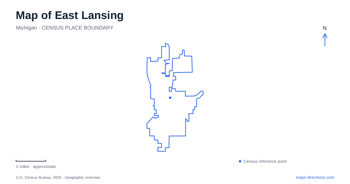
Street tiles load from OpenStreetMap when opened. The blue line shows the 2025 Census boundary.
- State
- Michigan
- Population · July 2025
- 49,355
- Land area
- 13.4 sq mi
- Water area
- 0.1 sq mi
East Lansing developed alongside Michigan State University, and that relationship remains visible in the meeting of downtown streets and campus grounds. Grand River Avenue is the principal reference for this interface, while the Red Cedar River supplies a second organizing line inside the university landscape. Northward, Abbot Road leads toward civic facilities and a separate system of parks and trails. A visitor benefits from keeping these three settings distinct: downtown, the river campus and the northern neighborhoods.
A community beside the college
Faculty Row houses appeared on the college campus in the 1850s, before the surrounding settlement became a city. Botanist William James Beal and mathematician Rolla C. Carpenter helped lay out a residential tract north of campus. Collegeville and adjacent neighborhoods received their municipal charter in 1907. This sequence explains why university history and neighborhood history overlap so closely without being identical.
For East Lansing, the commercial district developed along the campus edge rather than around a distant industrial waterfront or courthouse square. Grand River Avenue therefore works as both a through route and a place where city and university activities meet. Moving north along Abbot Road changes the emphasis again: City Hall is at number 410, while the Hannah Community Center is at 819. The community center also hosts regular City Council meetings, so a civic event may be held farther north than the City Hall address suggests.
West Circle Drive and the Red Cedar
The MSU Museum at 409 West Circle Drive stands immediately east of Beaumont Tower and north of the Main Library. These three landmarks make a compact orientation group within the older campus. The museum reopened in January 2026 after renovation, returning exhibitions and programming to its campus building. A university destination should therefore be located by its individual building, rather than by a general campus marker.
Beal Botanical Garden occupies the space south of West Circle Drive between the Main Library and I.M. Circle, just north of the Red Cedar River. The garden directs drivers toward 330 West Circle Drive, distinct from its administrative mailing address. Its metallic entrance gates and lower garden setting make the transition from campus road to planted landscape recognizable.
The earliest teaching garden began in 1873 in Sleepy Hollow near today's Beaumont Tower. That area remains part of the botanical garden even though West Circle Drive separates it from the other planting areas. This is a revealing detail in the geography of East Lansing: a named garden can extend across a road, and its oldest portion may not be where a visitor first enters. The layout records the development of teaching collections over time.
Downtown's western park
Valley Court Park lies on the west side of downtown. It provides a setting for the farmers market and other community events, along with play and court facilities. Delta Street connects Grand River Avenue with Valley Court, making it a useful approach reference for this pocket of public space.
The park is different in character from the university's botanical garden. One is a municipal gathering place beside downtown streets; the other is a teaching landscape arranged around plant collections and the river. Including both on a local map avoids treating every green area near campus as university property with the same purpose or access arrangements.
The station is on South Harrison Road
The Capital Area Multimodal Gateway occupies 1240 South Harrison Road beside the MSU campus. Operated by CATA, it brings together Amtrak, intercity buses and local transportation. Amtrak's Blue Water service connects with Chicago and Port Huron. The modern facility opened in November 2015, replacing the earlier station building.
For arrivals in East Lansing, this is a separate destination from the downtown Grand River Avenue corridor. The station's boarding bays, waiting areas and designated pickup spaces support a transfer between modes rather than a campus sightseeing stop. Harrison Road is the useful first street reference for someone meeting a train passenger; a downtown parking garage would place that meeting elsewhere.
Northern Tier paths and park approaches
The Northern Tier Trail offers about 5.8 miles of paths through the city's northern neighborhoods and recreation areas. Its main trunk was completed in 1999, with branches and extensions added later. The route also buffers the Sanderson and Remy Chandler drains, so its green setting reflects drainage geography as well as recreation planning.
Several approaches serve different parts of the network. Azaadiikaa Park and the aquatic center are reached from Abbot Road north of Lake Lansing Road. Harrison Meadows Park is approached via Gainsborough Drive and Roxburgh Avenue, while the soccer complex is reached from Coleman Road. These entry points allow a walk to begin in the part of the trail system that suits the intended outing.
Together, Grand River Avenue, West Circle Drive, South Harrison Road and the northern trail approaches provide a practical framework for East Lansing. Each leads into a distinct local landscape, connecting the college town's origins with its present civic, transportation and outdoor spaces.
Map and statistics: U.S. Census Bureau, 2025 Gazetteer, January 2025 generalized place boundaries and Vintage 2025 population estimates. Local references: City of East Lansing; Michigan State University Museum; Michigan State University; Capital Area Transportation Authority. Article prepared by Maps & Directions.