Map of Durham
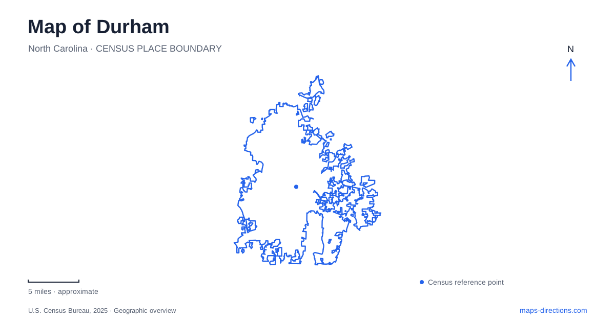
Street tiles load from OpenStreetMap when opened. The blue line shows the 2025 Census boundary.
- State
- North Carolina
- Population · July 2025
- 305,561
- Land area
- 119.9 sq mi
- Water area
- 0.8 sq mi
Durham has several overlapping landscapes: a compact industrial downtown, a university setting with substantial gardens, and a river corridor that feels quite removed from the warehouse blocks. Understanding those differences makes the city more legible than treating every attraction as part of one central district. The most useful starting points are Blackwell Street for the tobacco campus, Parrish Street for an important Black business history, and the university gardens for a different scale of walking. Farther northwest, a reconstructed farmstead and wooded river accesses introduce another chapter of the area's geography.
Warehouses that explain the downtown landscape
The American Tobacco Campus at 300 Blackwell Street occupies buildings associated with tobacco manufacturing from 1874 to 1987. Structures accumulated over more than a century, which helps explain the variety of building forms within the complex. Their present offices, restaurants and gathering spaces occupy a landscape originally organized around industrial production. The preserved architecture provides a way to read that transition without imagining the campus as a purpose-built modern shopping center.
Brightleaf Square offers a smaller comparison. Its two warehouses date to 1904, placing another recognizable piece of the tobacco economy within the downtown area. Reading the two complexes together reveals why large masonry buildings remain prominent among today's businesses. Durham's warehouse districts are therefore useful historical reference points as well as places to spend time. Their shared industrial background does not mean their buildings, layouts or subsequent uses developed identically.
Parrish Street and the institutions behind Black Wall Street
Parrish Street around Mangum Street became a center of Black-owned enterprise in the late nineteenth and early twentieth centuries. The story rests on identifiable institutions, including North Carolina Mutual and Mechanics and Farmers Bank, rather than simply a neighborhood nickname. John Merrick, Charles Spaulding and Aaron McDuffie Moore are central figures in this history. Their work connected insurance, finance and community institution-building in a period of segregation.
Mechanics and Farmers Bank occupies the historic insurance company building at 116 West Parrish Street. Nearby Black Wall Street Gardens, at Parrish and North Mangum streets, was dedicated in 2013. Public works including Stephen Hayes's The Prism and David Wilson's The Book Tree add a contemporary layer to the commemorative landscape. This concentration of buildings, institutions and public art gives central Durham a history that can be followed at street scale. It also complements the manufacturing story: the economic life of the city extended well beyond the tobacco factory floor.
Four garden areas within the university landscape
Sarah P. Duke Gardens covers 55 acres and contains about five miles of paths. The grounds comprise four principal areas, making a visit more varied than the single garden label suggests. The Historic Gardens include the Italianate terraces dedicated in 1939. Their formal composition offers a different spatial experience from the surrounding collections.
The roughly 6.5-acre Blomquist Garden of Native Plants emphasizes flora of the southeastern United States. The Culberson Asiatic Arboretum extends across about 18 acres, while the Gateway Gardens form the fourth main area. These collections give visitors several ways to organize a walk: by garden design, regional plant communities or contrasting settings. Because the acreage includes many paths, the amount of ground covered depends on which areas a visitor combines. The gardens introduce a substantial planted landscape within the university surroundings, rather than a small ornamental stop beside a building.
A farmstead between opposing headquarters
Bennett Place, at 4409 Bennett Memorial Road, preserves the setting of negotiations between Joseph E. Johnston and William T. Sherman in April 1865. Their headquarters were in Greensboro and Raleigh respectively, and the farm lay between the opposing lines. Three meetings culminated in the April 26 surrender agreement covering Confederate forces in the Carolinas, Georgia and Florida.
The farmhouse, kitchen and smokehouse seen at the site are reconstructions. That distinction helps a visitor understand the property as a historical interpretation of the rural setting, rather than an intact collection of original domestic buildings. In the wider Durham landscape, the site provides a clear counterpoint to downtown's later industrial development. Its historical significance comes from the meeting place and events, not from the scale of a monumental building.
Following the river northwest
Eno River State Park lies about ten miles northwest of downtown and extends through both Durham and Orange counties. Its shallow, rocky river and upland forests create a different pattern of movement from city streets. Multiple access areas serve different parts of the river; the park is a corridor with separate approaches rather than one compact enclosure. State park notices should be checked before selecting an access, since individual areas can close independently. The river landscape completes the broader picture: warehouses, financial institutions, gardens and a historic farmstead belong to a city whose surroundings also include substantial wooded terrain.
Map and statistics: U.S. Census Bureau, 2025 Gazetteer, January 2025 generalized place boundaries and Vintage 2025 population estimates. Local references: Discover Durham; Duke University; North Carolina Historic Sites; North Carolina State Parks. Article prepared by Maps & Directions.