Map of Duncanville
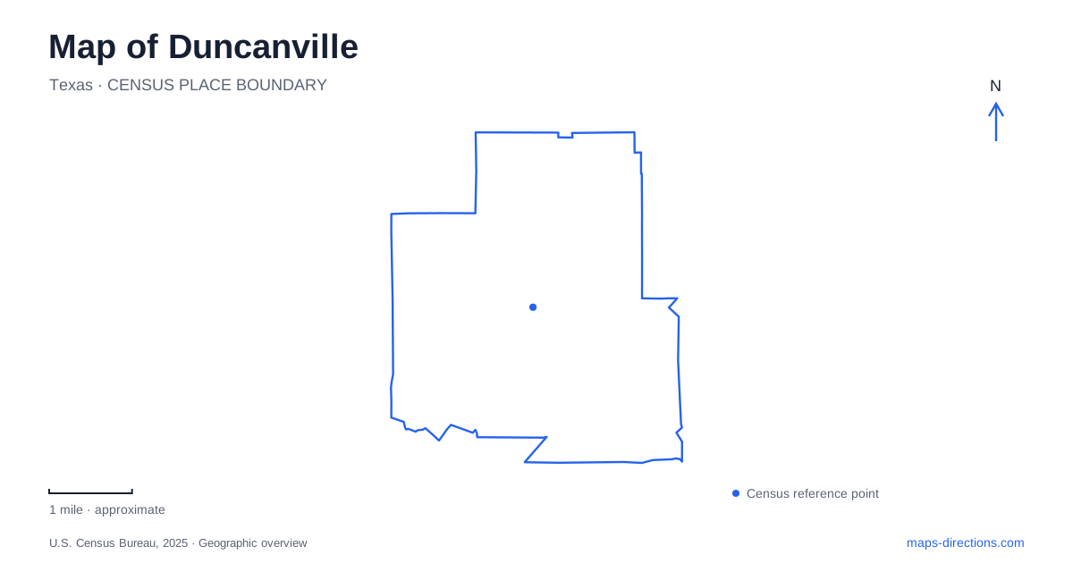
Street tiles load from OpenStreetMap when opened. The blue line shows the 2025 Census boundary.
- State
- Texas
- Population · July 2025
- 38,915
- Land area
- 11.2 sq mi
- Water area
- 0.0 sq mi
Duncanville's older center developed beside a railway, while its present public spaces reveal later changes in land use and community priorities. Main Street, Wheatland Road and James Collins Boulevard provide useful reference points for civic life. Farther away, larger sports parks and a creek-side nature preserve serve different purposes. Reading these places together shows a city with a history of adaptation, from a rail switch and general store to recreation, public art and conservation.
A switch became a settlement name
The Chicago, Texas and Mexican Central Railroad connected Dallas and Cleburne in the early 1880s. A switching point in the local farming landscape became known as Duncan Switch. The city's history describes Charles Nance arriving in 1881, deciding to remain and establishing a store in partnership with Chris Horne. The railway gave the small settlement a point around which businesses could gather.
The current city name also reflects a postal complication. A proposed post office name conflicted with an existing Texas office called Duncan, so the longer form was adopted. A depot followed beside the tracks, and early businesses included stores, a cotton gin and a doctor's office. Duncanville's older commercial pattern therefore grew from the practical needs of transport, trade and communication. The DuncanSwitch name still commemorates that origin, even though modern Main Street serves a much broader community than the early rail settlement.
Volunteer institutions left their own map
The fire department's history records a 1946 meeting at a service station on Main and Davis streets, where local businessmen discussed forming a volunteer organization. Members contributed money, and community labor helped build a one-room station at Orange and Davis. These are small street-corner references, but they show how essential services emerged within the established town rather than arriving as fully developed institutions.
The department later added paid staff and moved into a broader professional role. Its history identifies a station built on West Camp Wisdom in 1966 and the takeover of ambulance operations from a local funeral home in 1971. These changes reveal the growth of public services behind the modern city map. The older gathering place, first station and later facilities belong to successive stages, not interchangeable addresses for a single unchanged operation.
Armstrong Park connects civic and cultural uses
Armstrong Park occupies land associated with the former Air Force station. The city's arts initiative dates acquisition of the parkland to 1971 and describes the area as a focus for performances, public art, festivals and community gatherings. This earlier military use gives the present lawns and paths a history that is not obvious from their recreational appearance.
The park is listed at 100 James Collins Boulevard, with the library and recreation center nearby at 201. The senior center and other civic destinations reinforce this cluster. For Duncanville, the area functions as a public campus with different activities within walking proximity, rather than a park detached from everyday municipal life. A library visit, a class and an outdoor event may share the same general setting while using different buildings or spaces.
Kidsville is a continuing name with renewed equipment
The original Kidsville playground was built by volunteers in 1989. The city later approved its replacement and the addition of a splash pad, while community input favored retaining a similar imaginative theme. The council's project material explains that the newer playground uses wood-alternative composite materials instead of the original timber construction.
The municipal project page now marks the replacement and splash-pad work complete. That matters when reading older descriptions that still present the original wooden playground as the current facility. Duncanville preserved a familiar recreational identity while renewing the physical equipment. The name links generations of use, but the present installation is not simply the untouched structure from the late twentieth century.
Sports grounds and the creek preserve
Lakeside Park, at 515 Hill City Drive, combines playing fields, courts, picnic areas and a walking trail. Harrington Park, at 1815 South Cockrell Hill Road, provides another substantial sports setting with baseball and soccer facilities. The city's recreation inventory treats them as separate community parks; an event assigned to one cannot be located merely by searching for the largest nearby green space.
The Charles F. Ladd Nature Preserve offers a different landscape at 609 West Danieldale Road. Its approximately fifty acres follow Tenmile Creek through woodland, prairie and wetland settings, including limestone creek beds. The city describes soft-surface paths, boardwalks, overlooks and outdoor learning areas, with conservation of Blackland Prairie habitat among its purposes. This is a nature and education destination, rather than another athletic complex.
Duncanville's public places consequently tell several connected stories. The railway explains the early center, volunteer services show community organization, the former military land became a civic recreation campus, and the creek preserve protects a different kind of local resource. Those distinctions make the map useful for understanding the city as well as locating a particular entrance or street.
Map and statistics: U.S. Census Bureau, 2025 Gazetteer, January 2025 generalized place boundaries and Vintage 2025 population estimates. Local references: City of Duncanville; Duncanville Arts Commission initiative. Article prepared by Maps & Directions.