Map of Dubuque
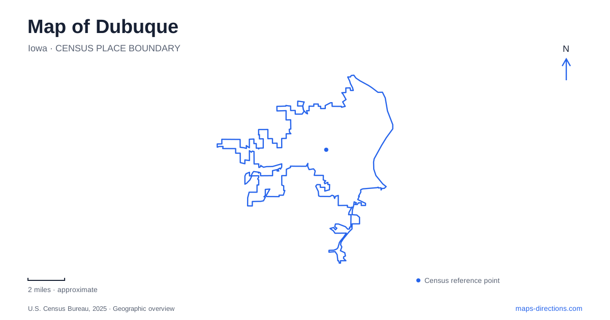
Street tiles load from OpenStreetMap when opened. The blue line shows the 2025 Census boundary.
- State
- Iowa
- Population · July 2025
- 59,148
- Land area
- 31.3 sq mi
- Water area
- 1.1 sq mi
Dubuque is a city where a map needs to show height as well as distance. The Mississippi Riverwalk occupies the waterfront, the Fenelon Place Elevator climbs a bluff above the business district, and Eagle Point Park looks down toward the river and Lock and Dam No. 11. These are different vantage points on the same broad landscape. Adding Bee Branch Creek to the picture reveals how water also shapes neighborhoods away from the main riverfront.
The port offers a close view of the Mississippi
The Mississippi Riverwalk provides a public route beside the river, with overlooks, seating and landscaped spaces. The marina sits at one end of this waterfront setting. It is a place to experience the scale of the river from close to water level, unlike the higher overlooks elsewhere in the city. A short stroll here can remain focused on the river rather than becoming a longer journey through residential streets.
The National Mississippi River Museum and Aquarium is at 350 East Third Street in the port area. This address helps connect the outdoor waterfront with an indoor destination devoted to the river. The museum and the Riverwalk are complementary parts of an outing, but their names refer to different experiences: one is a visitor institution, the other a public recreational route.
On a Dubuque map, keeping East Third Street and the port visible together gives the central riverfront a practical shape. The museum can anchor a visit of several hours, while the outdoor path can be used for a shorter look at the water. Deciding which is the main purpose avoids treating every riverfront attraction as a brief stop of equal length.
Fourth Street reaches a very different level
The Fenelon Place Elevator, also called the Fourth Street Elevator, carries passengers from Fourth Street up to Fenelon Place. Its operator describes a rise of 189 feet along a 296-foot railway. Those dimensions illustrate a steep change in elevation compressed into a short horizontal distance. The attraction's upper address is 512 Fenelon Place, while the operator directs buses to the lower approach at Fourth and Bluff streets.
This is a particularly useful map lesson for Dubuque. A place that appears just behind downtown can be well above it. The elevator makes that change of level explicit, connecting the lower street setting with views over the business district and Mississippi. Choosing the upper or lower approach depends on the intended experience, not simply on which address appears first in a search.
The bluff also changes how the surrounding streets should be understood. The elevator operator notes narrow streets and parking along the upper area. For a downtown pedestrian outing, the lower approach retains the connection with the central streets; an arrival at Fenelon Place begins with the elevated setting instead.
Eagle Point combines overlook and designed landscape
Eagle Point Park is at 2601 Shiras Avenue on the northeast side of the city. From its elevated position, the park overlooks the Mississippi and Lock and Dam No. 11, with views across the three-state area. This is a separate park destination, not the upper end of the downtown elevator.
The grounds also contain a designed landscape associated with Alfred Caldwell and the Prairie Style. Pavilions, native materials and the relationship between buildings and terrain are part of the park's interest. A visitor can therefore approach it as more than a viewpoint: the architecture and gardens reward time within the grounds.
The Trolley Line Trail adds another connection between terrain and transportation history. It follows the former streetcar route from the Ham House Museum parking area toward the old turnaround inside the park. For someone exploring Dubuque on foot or bicycle, this named route explains a specific approach to the elevated grounds. It is different from simply following the park's entrance road by car.
Bee Branch reveals the working landscape of water
The Bee Branch Creek Greenway extends from the North End toward the Mississippi at Chaplain Schmitt Island. The city describes it as both flood-control infrastructure and a linear park, with a multi-use trail, overlooks, gathering spaces and planted areas. This dual purpose is central to understanding the place: recreation occupies a landscape also designed to carry stormwater.
Parking references include Twenty-second and Prince streets and nearby Comiskey Park on East Twenty-fourth Street. Those addresses locate a neighborhood-scale starting area, distinct from the port's East Third Street setting. The greenway gives a visit another water-related option without requiring the experience to remain on the main riverbank.
A map of Dubuque becomes much more informative when those settings remain separate. The port offers river-level access, the elevator demonstrates the downtown bluff, Eagle Point combines elevated views with park design, and Bee Branch shows water management woven into neighborhood recreation. Their relationships explain the city's form as clearly as its street names do.
Map and statistics: U.S. Census Bureau, 2025 Gazetteer, January 2025 generalized place boundaries and Vintage 2025 population estimates. Local references: City of Dubuque; National Mississippi River Museum and Aquarium; Fenelon Place Elevator Company. Article prepared by Maps & Directions.