Map of Dublin
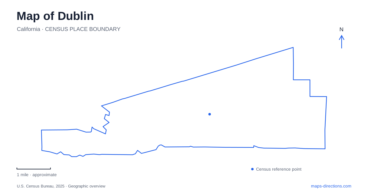
Street tiles load from OpenStreetMap when opened. The blue line shows the 2025 Census boundary.
- State
- California
- Population · July 2025
- 71,602
- Land area
- 15.2 sq mi
- Water area
- 0.0 sq mi
Dublin, California has a map shaped by successive forms of travel. Stagecoach routes met near today's heritage park; Interstate 580 and regional rail now carry people along the valley; hillside trails climb into a much older grassland landscape. These layers help explain why a small historic precinct, large transportation structures, and open ridges can appear close together. Exploring the city becomes more rewarding when those places are read as parts of a changing crossroads rather than unrelated attractions.
The old crossroads at Donlon Way
Heritage Park and Museums occupies ten acres at Dublin Boulevard and Donlon Way. The location once brought together stage routes connecting the Bay Area with Stockton and Martinez with San Jose. Nearby Alamilla Spring provided water where travelers could refresh themselves and change horses. The spring's role helps explain the settlement more clearly than a street grid alone: a transportation junction needed resources as well as intersecting roads.
The park preserves historic buildings, Pioneer Cemetery, lawns, and picnic spaces. St. Raymond Church and the cemetery were already part of the developing settlement by the later nineteenth century. Within this compact area, civic memory is concentrated in a walkable landscape rather than dispersed across a large museum campus. Its Donlon Way setting is a useful starting point for seeing how an older route junction survives inside the modern valley.
Ranch buildings that changed location
The Kolb House adds a different kind of historical evidence. The Craftsman bungalow was completed in December 1910, and the family moved in the following January. Much of its furniture and many personal objects belonged to the people who lived there. That continuity gives the interior a domestic specificity that would be absent from a house furnished only with representative antiques.
The building's present location is not its original ranch site. In 2010, the house and several associated structures were moved to Heritage Park. These included the Hay Barn, Old House, Pump House, and Sunday School Barn. The latter had already changed location earlier in its history and returned close to its original setting when incorporated into the park.
For someone reading a historic map, those moves matter. The preserved ensemble communicates ranch life, but it should not be interpreted as an untouched farmstead occupying the same footprint throughout its history. It is also a story of preservation decisions made as the valley's land uses and transportation corridors changed.
Two stations along the interstate
West Dublin/Pleasanton station lists 6501 Golden Gate Drive as its address. BART describes it as straddling the municipal boundary along Interstate 580 near Stoneridge Shopping Center. The station's name identifies a shared access point between two communities, which helps explain why destinations on opposite sides of the freeway can use the same rail stop.
The other station, Dublin/Pleasanton, lists 5801 Owens Drive in Pleasanton and also spans the interstate boundary. It connects regional rail with several local and regional bus operators. Its parking arrangements include both surface areas and a garage, with some nearby parking privately operated. The two stations therefore need to be distinguished by their complete names and their surrounding streets when organizing a pickup, transfer, or walk from the train.
The interstate and rail alignment also create a different scale from the heritage grounds. Here, the useful map detail is the relationship between station access, connecting buses, and the correct side of the highway. The presence of a regional stop does not make the surrounding transportation infrastructure read like a traditional town square.
Climbing from Donlon Point into open country
Dublin Hills Regional Open Space Preserve protects roughly 654 acres in the hills above the valley. Its ridge extends from Donlon Point toward Wiedemann Hill, which lies on adjacent private property. Steep canyons and seasonal drainages cut into that ridge, so the landscape is more varied than the smooth outline of a park boundary might suggest.
Donlon Point Staging Area provides the main arrival reference. The trail network includes part of the Calaveras Ridge Regional Trail and offers routes for hikers, cyclists, and equestrians. A contour map is useful here because it reveals the climbs and the separation between ridges and canyon bottoms. The district's map also marks private property and identifies a narrow trail where bicycles and horses are excluded.
This hillside setting completes the local contrast. The heritage park explains travel through the valley in an earlier era, BART represents the present regional network, and the preserve offers a view of the land those systems cross. Keeping all three in view makes the city's geography legible without treating a historic walk, a transit journey, and a ridge hike as interchangeable experiences.
Map and statistics: U.S. Census Bureau, 2025 Gazetteer, January 2025 generalized place boundaries and Vintage 2025 population estimates. Local references: City of Dublin; BART; East Bay Regional Park District. Article prepared by Maps & Directions.