Map of Douglasville
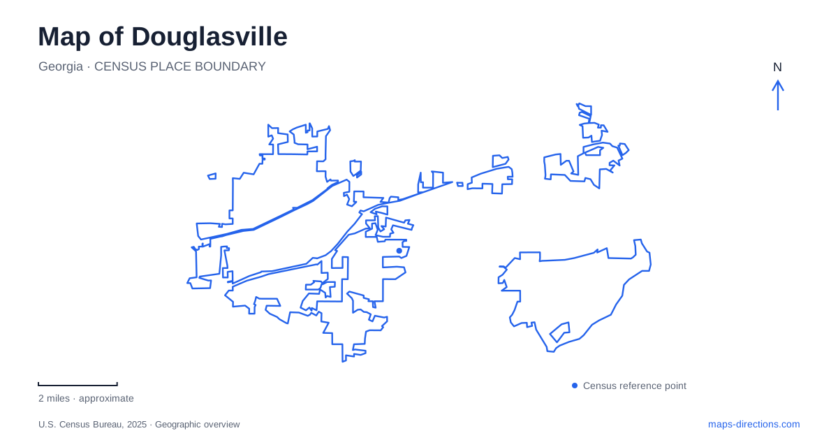
Street tiles load from OpenStreetMap when opened. The blue line shows the 2025 Census boundary.
- State
- Georgia
- Population · July 2025
- 41,523
- Land area
- 22.9 sq mi
- Water area
- 0.1 sq mi
Douglasville's historic center follows a ridge and an east–west railroad corridor. Its commercial buildings face the sidewalk, a courthouse site anchors the western end of downtown, and public gathering spaces fit within the established blocks. Interstate 20 created a separate development corridor farther south. Reading both layers helps explain why the historic center has a different scale and appearance from the larger roadside commercial areas encountered when arriving from the highway.
From a chestnut landmark to a railroad town
The area was originally known as Skint Chestnut, after a conspicuous tree used as a landmark. Local history places it on the ridge west of today's old courthouse site, near the meeting of earlier trails. The name therefore began as a way of identifying a location in the landscape before the town's formal street pattern existed.
The General Assembly established the town in 1875. Railroad development then reinforced its role as a county seat and commercial center. Regular service to Atlanta began in 1882, and the line to Birmingham was completed the following year. These dates explain why much of the downtown environment belongs to the late nineteenth and early twentieth centuries rather than to a much older settlement period.
Douglasville's commercial historic district was laid out in relation to both the railroad and the courthouse square. Its grid reflects those organizing features. A close look at the map consequently shows more than a collection of old buildings: it reveals the framework within which commerce, county government and rail transport developed together.
Storefronts and a different kind of courthouse
The historic commercial area includes one- and two-story brick buildings with architectural details associated with several Victorian-era styles. Many stand directly against the sidewalk, producing a continuous pedestrian edge. That form differs from shopping areas where individual buildings sit behind broad parking lots. The difference is one of street organization as well as building age.
The former Douglas County Courthouse introduces a striking contrast. Completed in 1958, it is an International Style building at the western end of downtown, on a square bounded by West Broad, West Church, Pray and Bowden streets. Its long horizontal form, glass surfaces and projecting roof belong to a different architectural period from the older storefronts nearby.
The building now houses the county's Museum of History and Art at 6754 Broad Street. Its preservation makes the courthouse itself part of the historical experience. In Douglasville, a building described as the old courthouse is therefore a mid-twentieth-century landmark, not necessarily the columned nineteenth-century structure a visitor might imagine from that phrase alone.
O'Neal Plaza within the downtown blocks
O'Neal Plaza supplies a public gathering area among the downtown buildings. Its Church Street address and relationship to the Welcome Center on Veterans Memorial Highway help locate it within the street network. The visitor center occupies the plaza's western side, while an outdoor games area is on the eastern side.
This arrangement gives the plaza a practical everyday role alongside special events. A small public space can connect visitor information, nearby shops and restaurants, and informal recreation without requiring a large park outside the center. Its usefulness comes partly from that position within the existing blocks, where several reasons to stop overlap.
A downtown visit to Douglasville can therefore combine architecture and public space at a compact scale. The railway corridor explains the district's overall orientation, the former courthouse supplies an architectural counterpoint, and the plaza creates a place to pause between the surrounding buildings.
Recreation north of downtown
Jessie G. Davis Memorial Park lies approximately a mile north of the historic center, off Highway 92 North at 7775 Malone Street. Its facilities include community and senior centers, a gymnasium, a swimming pool and Harvey Jones Field. This is a substantial community recreation setting rather than an extension of the downtown plaza.
The mix of indoor and outdoor facilities also gives the park a different spatial character from a simple walking green. Activities occur in separate buildings and on sports grounds, with their own entrances and schedules. The Malone Street location is the clearest geographic reference for that cluster, while the downtown museum and plaza remain tied to Broad, Church and Veterans Memorial Highway.
The highway corridor south of the ridge
Interstate 20 drew retail activity toward the roads serving its exits, including the Highway 5 and Highway 92 corridors. The resulting development added another commercial layer south of the old railroad town. The historic center and the interstate area therefore represent different phases of movement and investment.
A map of Douglasville becomes more useful when those phases are visible together. The ridge landmark, rail-oriented grid, preserved storefronts, modernist courthouse and northern recreation complex each explain a particular part of the city. Their relationships provide a more complete picture than using the interstate interchange as the sole reference point.
Map and statistics: U.S. Census Bureau, 2025 Gazetteer, January 2025 generalized place boundaries and Vintage 2025 population estimates. Local references: Douglasville Convention and Visitors Bureau; City of Douglasville; National Park Service; Douglas County Museum / Explore Georgia; City of Douglasville Parks. Article prepared by Maps & Directions.