Map of Detroit
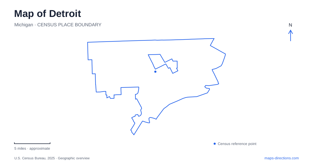
Street tiles load from OpenStreetMap when opened. The blue line shows the 2025 Census boundary.
- State
- Michigan
- Population · July 2025
- 649,095
- Land area
- 138.7 sq mi
- Water area
- 4.2 sq mi
Detroit is organized by several overlapping networks: major avenues leading toward the center, a chain of downtown public spaces, riverfront paths, and former transportation corridors adapted for recreation. Woodward Avenue provides a particularly useful starting line. It connects the central business district's parks with the cultural institutions farther inland. The waterfront supplies a different axis, while Eastern Market and the Dequindre Cut introduce a route between a working commercial district and the river.
Woodward connects several downtown reference points
Campus Martius occupies a central position on Woodward Avenue. The park's operator associates the site with the city's point of origin and the street plan envisioned by Augustus Woodward in 1805. Grand Circus Park lies farther along the avenue, while Hart Plaza sits at the riverward end of the downtown sequence. Their positions establish three recognizable reference areas without requiring a visitor to treat the whole center as one destination.
Other public spaces fill out the pattern. Cadillac Square adjoins the Campus Martius area, and Capitol Park lies between Woodward Avenue and Washington Boulevard. The downtown park map also shows Beacon Park toward the west and the stadium district near Grand Circus Park. These relationships give a short visit a geographic structure: the riverfront, the central squares, and the northern entertainment area form different clusters within the same downtown map.
Michigan, Grand River, Gratiot, and Jefferson avenues add important approaches around that framework. The city's transportation map makes their connections visible alongside the smaller downtown streets. Looking at the avenues first, then the local blocks, is more useful than assuming that every nearby street follows the same direction through the center.
The cultural corridor continues inland
The Detroit Institute of Arts is in Midtown's cultural center. Its address context includes Woodward Avenue, Farnsworth Street, Kirby Street, and John R Street. The museum's own directions distinguish these sides of the building, which helps turn a broad cultural-district label into a specific location.
That street arrangement also shows why Woodward remains useful beyond downtown. It is a continuous reference for moving between the central parks and the museum district, while cross streets identify individual blocks. The museum lists bicycle parking at several entrances, including Farnsworth, Kirby, and John R. For someone combining different forms of travel, those smaller street names supply the detail missing from a citywide attraction marker.
Eastern Market is a district of streets and sheds
Eastern Market's identity comes from both its public sheds and its surrounding food businesses. The historic district report places most of the prominent sheds on the east side of Russell Street. Gratiot Avenue cuts diagonally across the southern part of the area's more regular street pattern. That contrast helps explain the district's shape on a map.
The market's development also followed commercial and transportation relationships. Its history describes food-related businesses along the western part of the neighborhood and meatpacking activity along Orleans Street, aided by nearby rail lines. The present district map still needs several kinds of labels: numbered sheds, individual businesses, streets, and the recreational corridor. A visit to Detroit's market area therefore benefits from identifying the intended shed or business before deciding which part of the neighborhood to approach.
A railway cutting became a greenway
The Dequindre Cut occupies a former Grand Trunk Railroad corridor. Now a nearly two-mile path below street level, it connects Eastern Market with the riverfront and the neighborhoods between them. Its lower elevation is one of its defining map features: streets can cross above it while users continue along the path underneath.
Access ramps occur at named points including Atwater Street, Franklin Street, Woodbridge Street, Lafayette Street, Gratiot Avenue, Wilkins Street, and Mack Avenue. Those ramps make the relationship between the street network and the greenway explicit. The paved path includes separate walking and cycling lanes, and its bridges and walls also form settings for urban artwork. This combination of inherited infrastructure and recreational use gives the corridor a character different from a conventional sidewalk route.
The riverfront and the island are different landscapes
Along the Detroit River, the Riverwalk joins parks and public spaces into a shoreline network. Belle Isle is a separate island landscape within the river, reached from the city by the MacArthur Bridge. It is not simply another section of the mainland promenade.
The island contains the James Scott Memorial Fountain, Anna Scripps Whitcomb Conservatory, Belle Isle Aquarium, and Ralph Wilson Gateway. The gateway is identified by the state as the southern trailhead of the Iron Belle Trail. These destinations occupy a substantial park landscape rather than one small attraction site, so an island map adds useful detail after the bridge approach has been established.
A map of Detroit is most informative when these local differences remain visible. Woodward organizes a sequence of civic and cultural places; the market retains a commercial street pattern; the Cut preserves a railway alignment; and Belle Isle introduces an island crossing. Their connections explain how the city fits together without making each destination seem geographically interchangeable.
Map and statistics: U.S. Census Bureau, 2025 Gazetteer, January 2025 generalized place boundaries and Vintage 2025 population estimates. Local references: Downtown Detroit Partnership; Detroit Institute of Arts; City of Detroit; Eastern Market Partnership; Detroit Riverfront Conservancy; Michigan DNR. Article prepared by Maps & Directions.