Map of DeSoto
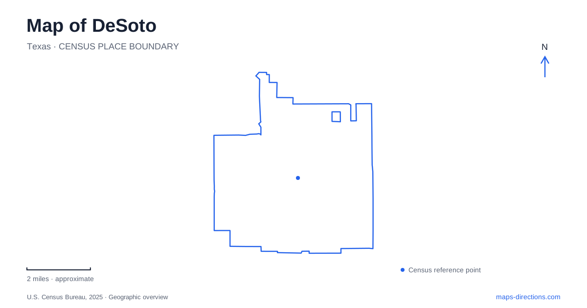
Street tiles load from OpenStreetMap when opened. The blue line shows the 2025 Census boundary.
- State
- Texas
- Population · July 2025
- 56,681
- Land area
- 21.6 sq mi
- Water area
- 0.0 sq mi
DeSoto has a landscape that becomes clearer when its creeks are read alongside its roads. Westmoreland Road, Hampton Road, Pleasant Run Road, and Belt Line Road provide recognizable street references, but Tenmile Creek supplies another organizing line through the community. The Roy Orr Trail follows that watercourse past neighborhoods and parks, while Windmill Hill preserves a more wooded and uneven landscape. Nance Farm adds a surviving piece of agricultural history within a residential subdivision. Together, these places explain more of the local map than a highway approach alone.
Following the creek through town
The Roy Orr Trail gives DeSoto a useful connection between its residential areas and Town Center. Dallas County's trail map describes the route running from Westmoreland, south of Wintergreen Road, toward the Belt Line and Interstate 35 area. Ernie Roberts Park and Murphy Hills Park are among the named places that help break this long corridor into understandable sections. The creek bends, so the trail's direction changes even where nearby roads maintain a simpler north–south or east–west arrangement.
A walk here can therefore be organized around a section of the watercourse rather than a distance measured along a main road. Pleasant Run Road is an important reference across the central area, while Hampton Road helps locate the civic and commercial setting. The creek route reveals connections between those everyday destinations and neighborhood green space. It also offers a way to understand why a trail can pass close to several streets without following their geometry.
The city identifies erosion mitigation along this corridor as an active planning matter. That reflects the physical setting: the same creek that gives the route continuity also shapes its banks. A trail map describes the corridor, while temporary notices at the trail govern any local restrictions caused by repair work or changing ground conditions.
Woodland terrain at Windmill Hill
Paul S. Dryer Preserve at Windmill Hill occupies a different part of the outdoor map of DeSoto. Its address is 1410 North Duncanville Road, and the city describes 75 acres set aside jointly with Dallas County. Soft surface trails pass through heavily vegetated land, including slopes that range from gentle to steep. This is a place to choose for woodland walking and changes in elevation rather than for an extension of the paved creek corridor.
The preserve also crosses Ten Mile Creek by a bridge, bringing the same named waterway into another landscape. That relationship is useful: one creek can link very different experiences across a city, from a neighborhood trail to a shaded preserve. The Windmill Hill name may appear on older references, while the full current name honors Paul S. Dryer. Both identify this preserve, not separate parks that need to be fitted into an itinerary.
Because the paths have natural surfaces and uneven grades, the preserve's scale should be judged by terrain as well as acreage. A short line on a screen does not describe the effort of climbing a hill or following a winding woodland path. The local distinction is concrete: select Roy Orr for a developed trail corridor and Windmill Hill for the character of its wooded ground.
A farmstead inside a subdivision
Historic Nance Farm stands at 1325 Greenbrook Drive in the Mantlebrook subdivision. The city's history traces it to Otway Bird Nance's 1851 purchase of 640 acres. Family ownership continued into the twentieth century, while surrounding acreage was later divided into residential lots. By the city's 2007 purchase, the surviving property covered only a little more than two acres. This sharp change in scale is essential to understanding what the present map shows.
In DeSoto, a historic farm label now identifies a compact remnant embedded in later housing. The house also records change: a Greek Revival appearance gave way to Victorian features before 1883. Accessory structures include agricultural and water supply features such as a milking barn, windmill, and wells. Those elements retain evidence of the larger working property even though its former landholding cannot be read from today's parcel outline.
Relating the historic site to nearby parks
The farm's planning documents place Mirkes Park and Moseley Park within a mile of the site. They also identify Meadowbrook Park to the south along Greenbrook Drive and describe connections toward Roy Orr Trail and the civic center. Some improvements in those documents are proposals, including new amenities and expanded bicycle connections. Their value for orientation is the relationship among existing places, rather than an assumption that every illustrated feature is finished.
A map of DeSoto can thus be read through three linked histories: the creek's continuing influence, the conversion of agricultural land into neighborhoods, and the public parks that preserve or reconnect portions of that landscape. Starting with one of those themes makes the city's roads, trails, and historic farmstead easier to place in context.
Map and statistics: U.S. Census Bureau, 2025 Gazetteer, January 2025 generalized place boundaries and Vintage 2025 population estimates. Local references: Dallas County; City of DeSoto. Article prepared by Maps & Directions.