Map of Des Plaines
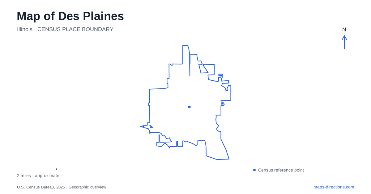
Street tiles load from OpenStreetMap when opened. The blue line shows the 2025 Census boundary.
- State
- Illinois
- Population · July 2025
- 58,772
- Land area
- 14.2 sq mi
- Water area
- 0.1 sq mi
Des Plaines has a downtown shaped by the railway and a wider recreation landscape shaped by water. Miner and Ellinwood streets establish the central commercial setting, while Lake Opeka and the river's forest preserves offer quite different outdoor environments. Keeping those places distinct makes the city easier to understand: a train-centered downtown walk, a lakefront afternoon, and a river-trail outing each reveal a different part of its geography.
Commerce around Miner and Ellinwood
The city traces commercial activity on Miner and Ellinwood streets back to the 1870s. Its downtown inventory identifies the theater, former Masonic Temple now known as the Leela Arts Building, and former Brown's Department Store among the area's recognizable buildings. This is a downtown with successive uses layered into existing structures, rather than a single-purpose shopping development.
The Union Pacific Northwest Metra station sits in the downtown core. Miner Street also serves as a bus corridor, so the railway is only one part of the area's transportation role. A map of Des Plaines becomes more informative when the station is read alongside the two commercial streets: arrival, shopping, entertainment, and civic activity occupy the same central area.
Metropolitan Square lies just north of Miner Street and contains a plaza and mixed commercial, office, and residential space. Its location provides a useful counterpoint to the older storefront blocks. Moving between the two shows how newer development fits into a center whose commercial history long predates it.
Pearson Street brings local history close to the station
The History Center is at 781 Pearson Street, one block south of the downtown station. Its visitor information also places the public library parking garage one block west, at Prairie Avenue and Center Street. These short relationships make the museum area a coherent addition to a downtown visit rather than a separate cross-city excursion.
The 1907 Kinder House is part of the history experience, with tours arranged by appointment. The visitor center has street-level access, while the house requires stairs. That difference is worth understanding when deciding which parts of the site suit a group; the two buildings offer different physical experiences despite belonging to the same institution.
For visitors interested in Des Plaines beyond its transport connections, this cluster gives the central streets a human scale. A commercial building or railway platform describes how people moved and worked, while a house museum brings domestic history into the same itinerary. Pearson and Prairie provide the street references that connect those experiences.
Lake Opeka between Howard and Touhy
Lake Park occupies the west side of Lee Street between Howard Avenue to the north and Touhy Avenue to the south. Lake Opeka is the water body within that larger park setting. The park district identifies a golf course, marina, picnic shelters, Memorial Pavilion, and Flight 191 Memorial among the grounds' features.
This arrangement gives the lakefront a clear rectangular street frame even though the shoreline itself is irregular. Howard Avenue is especially useful for the golf and marina area, whose published address is 1015 Howard. The Lakeview Center is farther along the same avenue at 1177 Howard. These named facilities explain why several map labels appear around one lake.
Lake Park adds a substantial open-water landscape to Des Plaines, but it also contains spaces for remembrance and organized recreation. The golf course, shelters, and memorials make the grounds more varied than a simple shore path. A visit can remain focused on the water or include those additional features without treating every activity as part of a single marina outing.
Big Bend and the river landscape
Big Bend Lake is reached from Bender Road south of Golf Road. The Forest Preserves of Cook County describes a twenty-seven-acre lake with a boat launch and access to the river trail system. Unlike a self-contained ornamental pond, it connects to the river through a spillway, so its water level can change markedly during flooding.
The river trail extends through numerous forest preserves, giving this location a regional outdoor role. Walking or cycling from Big Bend therefore follows a different kind of landscape from strolling among downtown buildings or around Lake Opeka. The preserve setting emphasizes a long water corridor, wooded land, and connections beyond an individual park.
The relationship between these three environments gives Des Plaines much of its map interest. Miner and Ellinwood concentrate commerce around rail transport; Howard, Lee, and Touhy frame a lake-centered park; Bender and Golf provide access to the river corridor. Those named streets offer a concrete way to compare the city's different outings before deciding how much of each to include.
Map and statistics: U.S. Census Bureau, 2025 Gazetteer, January 2025 generalized place boundaries and Vintage 2025 population estimates. Local references: City of Des Plaines; Des Plaines History Center; Des Plaines Park District; Forest Preserves of Cook County. Article prepared by Maps & Directions.