Map of Deltona
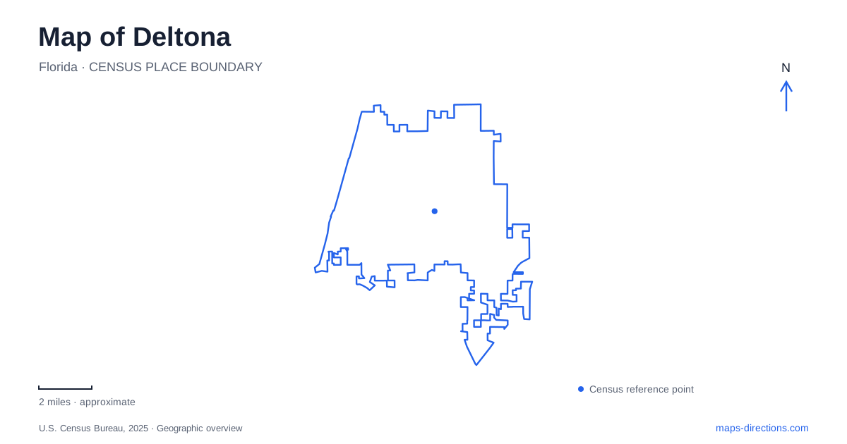
Street tiles load from OpenStreetMap when opened. The blue line shows the 2025 Census boundary.
- State
- Florida
- Population · July 2025
- 100,267
- Land area
- 37.3 sq mi
- Water area
- 3.5 sq mi
Deltona's map reflects a planned residential community built among lakes, with older river settlements nearby and a substantial patch of protected scrub within the urban area. Providence Boulevard, Saxon Boulevard, and Eustace Avenue identify different public destinations, while Enterprise-Osteen Road leads into the southern trail landscape. Understanding the contrast between dry sandy habitat and the Lake Monroe shoreline is especially helpful: the area's outdoor places occupy very different environments despite appearing close together on a regional map.
A planned community beside an older river history
The Mackle brothers began the residential development in 1962, and the first residents arrived in April 1963. Municipal incorporation came much later, at the end of 1995. Those dates explain why the community's development history and its history as an incorporated city are separate stories.
Enterprise, on Lake Monroe, belongs to an earlier chapter. Steamboat traffic on the St. Johns River supported settlement at its landing during the nineteenth century. This older lakeshore community helps explain the historic references along Enterprise-Osteen Road, whereas the inland residential street system reflects twentieth-century development. A map of Deltona becomes more informative when it retains Enterprise as a distinct place name rather than treating every nearby destination as part of the same municipal origin story.
The Eustace Avenue environmental campus
Lyonia Preserve's entrance and parking are at 2150 Eustace Avenue, beside the regional library and Lyonia Environmental Center. The center provides indoor exhibits, environmental classrooms, a gallery, and a pollinator garden. It acts as a gateway to the preserve, allowing the same visit to move from an indoor introduction to the habitat itself.
The preserve protects 360 acres of Florida scrub. Low oaks, open white sand, and limited tree cover characterize this environment. Florida scrub jays and gopher tortoises are among the species associated with it, and management keeps the vegetation suitable for scrub-dependent wildlife. The relatively open appearance is part of the habitat's character, not evidence that the land lacks ecological interest.
For walking in Deltona, Lyonia is different from a shaded lakefront park. The county describes soft, deep sand and no shade on the preserve trails. The shared Eustace Avenue address identifies the arrival area, but the building complex and the sandy routes provide very different surfaces and levels of exposure. That distinction is more useful than simply categorizing the entire property as a park.
Saxon and Providence identify different recreation areas
Dewey O. Boster Sports Complex is at 1200 Saxon Boulevard. Soccer and football facilities, a nature walking and jogging trail, picnic areas, and an outdoor performance stage give it a community recreation role. Its field-based layout contrasts with Lyonia's conservation purpose, even though both offer opportunities to walk.
Thornby Park is at 110 Providence Boulevard, on wooded land with St. Johns River shoreline. Opened in 2011, it includes an inclusive playground within a much larger natural setting. Check the city's Thornby Park facility guidance for the playground separately from the surrounding woodland and riverfront grounds. A family planning around the play equipment should identify that specific facility rather than relying on a general park pin.
These named roads also help keep two different Deltona outings separate. Saxon Boulevard identifies organized sports and community activity, while the lower-numbered Providence Boulevard destination brings visitors toward wooded riverfront land. Using the facility names with their road addresses makes the city's dispersed public spaces easier to understand.
Green Springs and the regional trail junction
Nearby Green Springs Park is at 994 Enterprise-Osteen Road in Enterprise. Its green sulfur spring is the central natural feature, accompanied by overlooks and paved and natural trails. Swimming and fishing are prohibited, so the spring should be treated as a landscape to observe rather than a swimming destination.
The park is also a trailhead for both the Spring-to-Spring Trail and the East Central Regional Rail Trail. This junction gives it importance beyond the spring itself: it is a place where a local nature visit and a longer regional walk or bicycle outing can begin from the same area. The county's historical account also connects the spring with nineteenth-century health tourism and Frederick deBary's estate.
Lake Monroe's working waterfront access
The city's Lake Monroe boat launch is at 966 Lakeshore Drive. Its location belongs to the broader St. Johns River and lake landscape, separate from the inland ponds and scrub trails. The ramp, docks, seawall and western part of the site are distinct pieces of the launching area; use the city's boating guidance to establish the appropriate arrival and usable facilities.
For a Deltona map focused on water access, that project is a reason to use current ramp information rather than assuming a launch symbol guarantees availability. Taken together, the Eustace Avenue campus, Saxon sports grounds, Providence river park, Enterprise trail junction, and Lakeshore Drive launch explain the area's varied recreational geography.
Map and statistics: U.S. Census Bureau, 2025 Gazetteer, January 2025 generalized place boundaries and Vintage 2025 population estimates. Local references: City of Deltona; Volusia County. Article prepared by Maps & Directions.