Map of DeLand
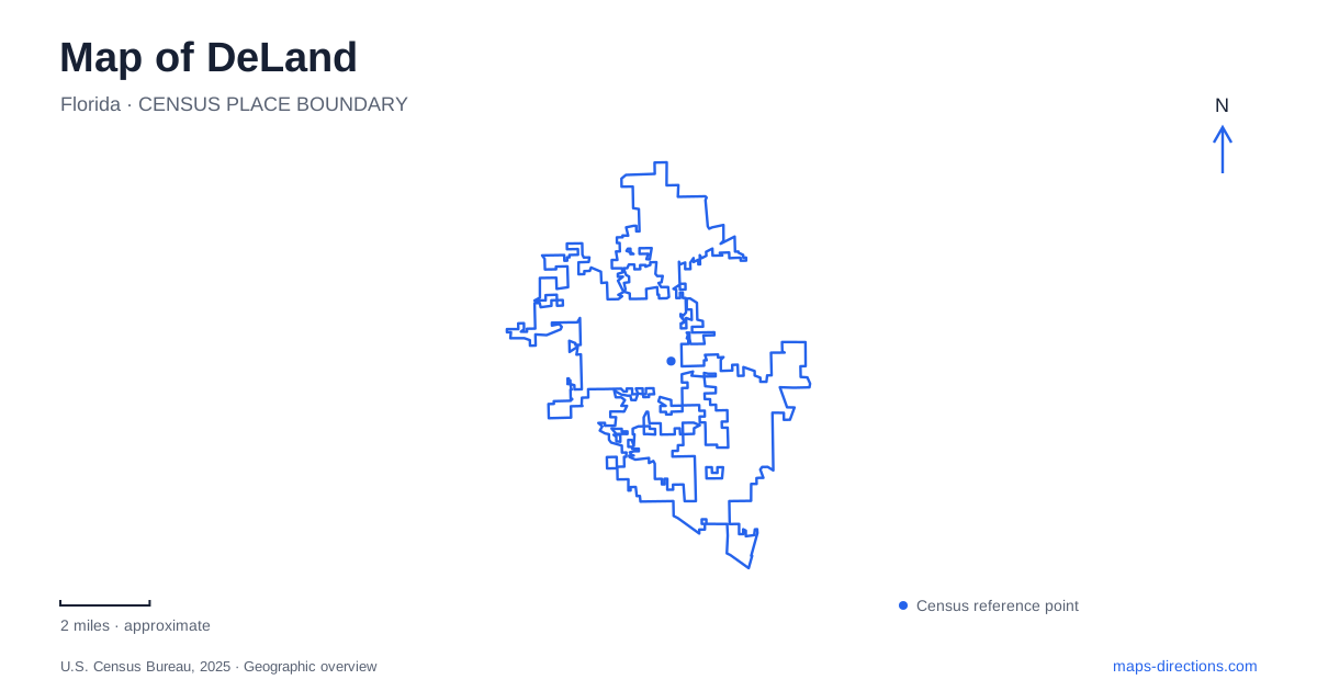
Street tiles load from OpenStreetMap when opened. The blue line shows the 2025 Census boundary.
- State
- Florida
- Population · July 2025
- 46,346
- Land area
- 19.5 sq mi
- Water area
- 0.2 sq mi
DeLand has a downtown organized around Woodland Boulevard, a university campus at its edge, and a very different landscape to the west near the St. Johns River. The railway station belongs to that western side rather than the center of the historic shopping streets. Farther into the river landscape, trails, lake margins, and an island park change how a journey works. Reading these settings separately makes the map more useful than assuming every destination is part of one downtown circuit.
Woodland Boulevard is the historic organizing street
The city's National Register information places the downtown historic district around Woodland Boulevard and New York Avenue. Municipal design guidance describes the traditional buildings as generally one to three stories, with storefronts at street level and other uses above. That arrangement explains the scale of the older commercial blocks and their suitability for a visit focused on individual buildings and shopfronts.
This is a street-based historic district, not a single enclosed attraction. The intersection provides orientation, while the surrounding blocks hold the actual urban fabric. A walking plan can follow that pattern by selecting a portion of Woodland Boulevard and its cross streets instead of treating the district label as one precise destination.
Historic designation also describes significance rather than current business tenancy. An old directory can be useful for architecture and building history while being unreliable as a list of shops operating today. Reading the buildings and reading their present occupants are separate tasks.
Stetson continues the cultural landscape northward
Stetson University lists its local campus at 421 North Woodland Boulevard and describes downtown as beginning at the campus edge. The relationship is close enough to explain why a visit to the historic center often includes an interest in the university, while the campus remains a distinct set of buildings and grounds.
The city recognizes the university's historic district separately from downtown. That is a helpful map distinction: the commercial blocks and academic setting are connected through the boulevard, but they represent different patterns of use. A campus tour, an arts event, and a downtown stroll can share a general area without having the same destination.
Stetson also operates in Gulfport and Tampa. For an event or appointment, the local campus name matters as well as the university name. A map of DeLand should not imply that every Stetson program is based on these Woodland Boulevard grounds.
The station is several miles west
The DeLand / Amtrak station is at 2491 Old New York Avenue, near Grand Avenue South. SunRail describes it as several miles west of downtown and identifies it as the northern end of its commuter railway. This is one of the most consequential distinctions on the local transport map.
The station name identifies the community served, rather than a platform amid the historic storefronts. A rail journey and a downtown visit therefore have a connecting stage between them. SunRail lists transit and other onward travel options, but the essential geographic point is the separation itself. It deserves to be visible before a visitor assumes that leaving the train means immediately entering the central shopping district.
Old New York Avenue is also a different named reference from the downtown Woodland Boulevard intersection. Retaining the full station address prevents the shared New York wording from obscuring where the rail facility actually stands.
Lake Beresford offers a trail junction
Lake Beresford Park, at 2100 Fatio Road, sits within a county greenway. Its roughly 1.8-mile multi-use perimeter trail connects with the Spring-to-Spring Trail, which extends toward Blue Spring State Park. Two nature trails occupy the northern portion of the park, giving the site both a paved recreation connection and a more natural walking option.
For someone exploring the surroundings of DeLand, that distinction offers a practical choice. A circuit within the park is a different undertaking from continuing onto the longer trail connection. Both start from the same recreation landscape, but the scale of the outing changes once the route leaves the perimeter loop.
The Fatio Road address also distinguishes this public park from a general search for the lake. The water body supplies the broader setting, while the park provides a particular place to enter and use the trail network.
Hontoon is an island, not a drive-through park
Hontoon Island State Park is surrounded by waterways: the St. Johns River to the north and east, the Hontoon Dead River to the west, and Snake Creek to the south. Florida State Parks identifies access by private boat or passenger ferry. A driving route to the River Ridge Road address therefore reaches the access setting rather than continuing by road around the island itself.
This water boundary is part of the park's identity. Its trails and evidence of long Indigenous habitation belong to a landscape reached through a change of travel mode. The mainland address, boat crossing, and island paths are successive parts of the visit.
A map of DeLand consequently connects several different journeys: storefront blocks on Woodland Boulevard, an adjoining academic district, a western railway arrival, a greenway trail outing, and a boat-access island. Preserving those differences gives the map its practical value and the area its distinctive character.
Map and statistics: U.S. Census Bureau, 2025 Gazetteer, January 2025 generalized place boundaries and Vintage 2025 population estimates. Local references: City of DeLand; Stetson University; SunRail; Volusia County; Florida State Parks. Article prepared by Maps & Directions.