Map of Deerfield Beach
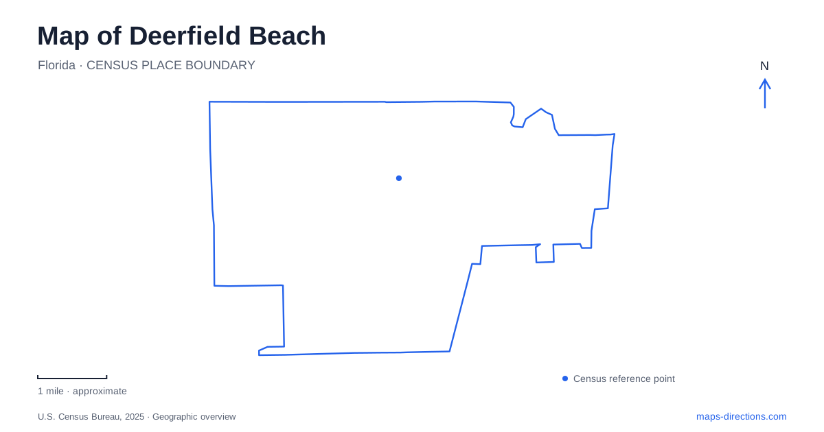
Street tiles load from OpenStreetMap when opened. The blue line shows the 2025 Census boundary.
- State
- Florida
- Population · July 2025
- 89,339
- Land area
- 15.0 sq mi
- Water area
- 1.3 sq mi
Deerfield Beach has an oceanfront identity, but its older settlement and much of its public life lie inland. Hillsboro Boulevard links several of those places: a working railway station, a preserved family home, commercial streets and the approach toward the Intracoastal Waterway. The Hillsboro Canal adds another east–west line through the landscape. Reading these corridors together reveals a city shaped by agriculture and transportation before tourism became a major part of its economy.
The business center before the beach era
By 1910, the intersection of Hillsboro Boulevard and Dixie Highway was a focus of stores, lodging and civic activity. Farmers brought produce to a shed beside the railway depot for shipment north. Tomatoes and other crops depended on that connection to distant markets, making the railway essential to the settlement's growth.
The town incorporated in 1925 under the shorter name Deerfield. The addition of Beach in 1939 anticipated a stronger association with the oceanfront, and tourism expanded after World War II. This sequence explains why the old business area and historic homes are not concentrated directly beside the sand. They belonged to a farming and transport economy with its own center of activity.
The Hillsboro River was also altered for transportation and drainage. Dredging in 1911 made it part of the canal connection toward Lake Okeechobee. The present waterway therefore records engineering as well as natural geography, with the canal and nearby streets reflecting different stages in the development of the same corridor.
A depot that still serves passengers
The station at 1300 West Hillsboro Boulevard stands west of Interstate 95, separate from the beach district. Built in 1926 for the Seaboard Air Line, its Mediterranean Revival design includes stucco walls, arched entrances, a tiled roof and a two-story tower. The building belongs to a period when Florida railway architecture helped present an image of the state to arriving passengers.
Tri-Rail began using the station in 1989. Amtrak also identifies it as a passenger stop, while the former freight room houses the South Florida Railway Museum. These uses combine transportation with interpretation of its history. For Deerfield Beach, the depot remains a working connection with the wider region, not simply a preserved object whose transport role has ended.
A house built from magazine plans
In Deerfield Beach, the Butler House at 380 East Hillsboro Boulevard offers a more domestic view of the same era. James D. and Alice Butler used plans published in the September 1923 issue of Ladies' Home Journal for their Mediterranean Revival home. Hollow tile walls and a Spanish terra-cotta roof gave the house a substantial form, while its grounds occupied nearly four city lots.
The historical society received the house and grounds in 1977 and uses the property as a museum and headquarters. Surviving furnishings help connect the building with the family's daily life. The house's location along the same boulevard as the station makes it possible to understand two different aspects of early development: the infrastructure that brought people and products through town, and the homes established by civic leaders within it.
Canal recreation and the Intracoastal edge
Pioneer Park occupies 13.7 acres beside the canal, with tennis, play areas and other recreation facilities. It developed from a Lions Club project begun in 1947. This history ties community organization to the creation of public waterfront space, rather than treating the park as an inevitable feature of the shoreline.
Farther east, Sullivan Park at 1700 Riverview Road faces the Intracoastal Waterway. Its pavilion and splash pad create a smaller waterfront gathering place. The distinction between these waterside locations matters: canal recreation, the Intracoastal edge and the Atlantic beach belong to connected waterways but offer different physical settings.
Deerfield Island adds a conservation landscape nearby. Broward County designates its mangrove area as a natural reservation. Mangroves occupy the meeting of land and tidal water, creating habitat whose form differs from a maintained lawn or open beach. An island outline on the map therefore marks ecological space as well as a recreation destination.
A planted landscape farther inland
Constitution Park & Arboretum at 2841 West Hillsboro Boulevard provides another contrast. The approximately nine-acre tree collection contains plants from several continents, arranged along a half-mile accessible walking path. Palms, tropical fruit trees, bamboo, native species and a butterfly garden form parts of the collection.
This is a cultivated educational landscape. Its purpose differs from protecting the island's mangroves: selected plants are displayed so visitors can compare their forms and growing habits. The adjacent community center and recreation facilities also make the park part of neighborhood life. Deerfield Beach consequently offers several kinds of green space along and near one major boulevard, each with its own origin and function.
The ocean and fishing pier remain prominent landmarks, but the inland sequence gives Deerfield Beach a fuller identity. Railway architecture, a magazine-inspired house, canal recreation and a varied tree collection explain how the city grew and how its residents continue to use the landscape.
Map and statistics: U.S. Census Bureau, 2025 Gazetteer, January 2025 generalized place boundaries and Vintage 2025 population estimates. Local references: City of Deerfield Beach; Amtrak Great American Stations; South Florida Regional Transportation Authority; Deerfield Beach Historical Society; Broward County. Article prepared by Maps & Directions.