Map of Decatur
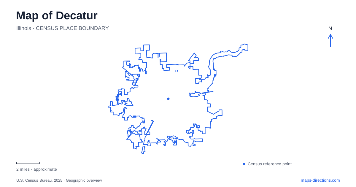
Street tiles load from OpenStreetMap when opened. The blue line shows the 2025 Census boundary.
- State
- Illinois
- Population · July 2025
- 67,884
- Land area
- 44.2 sq mi
- Water area
- 4.7 sq mi
Decatur's outdoor geography joins an engineered reservoir with parks, gardens, and a river conservation area. Water is central to the landscape, but the lakefront and the wooded river trails offer different experiences. Historical buildings add another scale: a mansion on West William Street tells a domestic and political story, while a nineteenth-century farmhouse survives within the conservation district's broader landscape. Reading these places together shows how industry, recreation, preservation, and natural terrain occupy different parts of the same community.
A reservoir built for a working city
Lake Decatur was created by impounding the Sangamon River in the early 1920s. The city records construction in 1922 and dedication in 1923. Its watershed plan identifies water supply for households, commerce, industry, and agriculture as central purposes. The reservoir is therefore much more than the blue backdrop to a park or a boating destination.
The city's lake history connects its beginnings with the Staley manufacturing operation. A temporary dam and pumping station preceded completion of the permanent dam; the pump house combined industrial machinery below with a clubhouse above. That unusual pairing captures the overlap between work and recreation around the water. The modern shoreline can be read through the same dual role: it supports public outings while remaining part of the infrastructure that serves a working city. A reservoir map and a park map consequently explain different aspects of the same place.
Nelson Park has several recognizable destinations
Nelson Park's listed address is 2475 Pavilion Drive. Its facilities include walking and cycling trails, lakefront areas, picnic shelters, a dog park, and disc golf. Nearby named recreation venues have their own street references: Overlook Adventure Park and Splash Cove are on East Nelson Park Road, while the Devon Lakeshore Amphitheater is on East Cantrell Street.
These addresses help break a broad lakefront district into understandable pieces. Someone attending a performance has a different destination from someone looking for a waterpark or a quiet garden. The Anna Bethel Fisher Rock Garden adds a more intimate setting within Nelson Park. Built in 1927 and renovated in 2019, it combines flowering plants, boulders, and cypress trees. For a map of Decatur, this range is significant: the lakefront supports both large programmed attractions and smaller designed landscapes rather than one uniform park experience.
Scovill links family institutions with outdoor art
Scovill Zoo and the Children's Museum of Illinois form another identifiable cluster. The sculpture park lies between them, with artworks arranged along about 800 feet of connecting walkways. This is a particularly concrete pedestrian relationship: the outdoor art occupies the space between two institutions and gives that space a purpose of its own.
The Scovill landscape also retains the garden created by Guy and Rose Scovill during the 1920s and 1930s. The family deeded its farm to the park district in 1948. That history adds depth to what might otherwise look like a collection of contemporary visitor facilities. Gardens, institutional buildings, and connecting paths occupy a former private landscape that developed into a public setting. The zoo's address on South Country Club Road supplies a useful reference for this cluster, distinct from the Pavilion Drive and East Nelson Park Road destinations.
Rock Springs follows a different waterside landscape
Rock Springs Conservation Area and its nature center are at 3939 Nearing Lane on the southwestern edge of Decatur. The district's approach directions use Route 48 and Rock Springs Road. Here the emphasis shifts from the reservoir's recreation facilities to woodlands, prairie, ponds, the Sangamon River, and environmental interpretation. The nature center includes exhibits and a wildlife-viewing area, while a restored nineteenth-century farmhouse supplies a human-history component.
The trail map makes the variety more precise. The short Discovery Trail explores woodland near the nature center; the Bluestem Loop passes through prairie grasses and flowers. The longer River Trail includes Turtle Ponds and the historic bottling-plant site. A separate paved Bike Trail connects toward Fairview and Kiwanis parks. These routes should not be collapsed into one assumed all-purpose loop: they cross different habitats and serve different forms of movement. Their names explain what kind of landscape a visitor is choosing.
West William Street holds a separate historic house
The Governor Richard J. Oglesby Mansion stands at 421 West William Street. The Oglesby family left in 1882, and the Bering family and descendants occupied the house until 1972. The conservation district then acquired it, with restoration beginning in the 1970s. Photographs left by James Bering helped guide the restoration of interiors.
The mansion is separate from the farmhouse at Rock Springs, despite the conservation district's connection with both properties. For Decatur, that distinction opens two different historical perspectives: a prominent urban household and a rural property interpreted within a conservation landscape. Together with the reservoir, gardens, and cultural park cluster, they give the city a map whose landmarks explain how land and water have been used over time.
Map and statistics: U.S. Census Bureau, 2025 Gazetteer, January 2025 generalized place boundaries and Vintage 2025 population estimates. Local references: City of Decatur; Decatur Park District; Macon County Conservation District; Governor Oglesby Mansion Inc.. Article prepared by Maps & Directions.