Map of Dayton
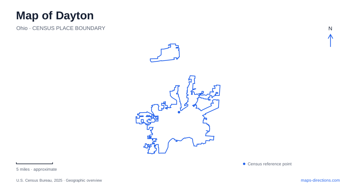
Street tiles load from OpenStreetMap when opened. The blue line shows the 2025 Census boundary.
- State
- Ohio
- Population · July 2025
- 136,688
- Land area
- 55.8 sq mi
- Water area
- 1.2 sq mi
Dayton's geography is especially important when planning an aviation-history visit: several places share the Wright brothers' story without sharing one location. The urban visitor center, a flying field and the national military aviation museum require separate map searches. Meanwhile, the downtown riverfront provides another organizing system built around water, bridges and trails. A good overview keeps those two systems visible without collapsing a regional collection of attractions into a single city-center destination.
Find the urban aviation starting point
The National Park Service identifies the Wright-Dunbar Interpretive Center at 16 South Williams Street, immediately south of West Third Street and west of downtown. That intersection is a useful anchor because it describes an ordinary urban arrival, with a specific building rather than a large open-air site. Keep the interpretive center name in the search so that the result does not jump to another location associated with the Wright family.
This part of Dayton is also connected with the story of Paul Laurence Dunbar, whose house is a separate historic site within the national historical park's broader visitor offering. The presence of several sites under one park name means that a general search for the park may not identify the intended doorway. Start with the particular property or visitor center, then inspect the surrounding streets. The shared historical theme explains the connection; it does not eliminate the journey between sites.
The riverfront has its own center of gravity
RiverScape MetroPark is a downtown reference at East Monument Avenue. The park district's map places it on the Great Miami River and identifies the confluence with the Mad River nearby, along with the Riverside Bridge. This is a different set of orientation cues from the West Third Street area. Rivers, bridges and the riverfront path system become the important features, especially for someone arriving on foot or by bicycle.
A downtown Dayton map should distinguish the park's street arrival from the trails beside the water. RiverScape's map includes the Great Miami River Trail, a bike hub and a pedestrian connection toward Deeds Point. These features explain why a walking or cycling route can differ from a driving approach. A river crossing marked for pedestrians should not be treated as another vehicle bridge simply because it appears to connect two convenient points.
Read the confluence before choosing a path
Where waterways meet, following the wrong bank can take a traveler away from the intended destination even while the river remains in view. At RiverScape, identify whether the route follows the Great Miami or the Mad River, and which side contains the next stop. The confluence is a useful orientation feature precisely because it forces that distinction. A general instruction to follow the river is incomplete here.
The park map also separates the pavilion, landscaped areas and river facilities. For a meeting, a named feature such as the pavilion is clearer than a pin placed in the water beside the park. For a longer trail journey, use the regional path map in addition to the downtown view. These are different levels of planning: one locates a gathering point, while the other establishes a continuous route through the wider river system.
Huffman Prairie is geographically separate
Huffman Prairie Flying Field belongs to Dayton's aviation story but is not beside the urban interpretive center. The National Park Service describes it as a separate site in Bath Township, on Wright-Patterson Air Force Base. The agency advises visitors to consult the flying field interpretive center about access conditions. That is a significant distinction from an ordinary city park: the historic landscape lies within an active military installation.
Do not join these destinations by assuming that one national park label represents a single continuous property. Save the interpretive center and flying field separately, and follow the relevant visitor directions. Historic replica structures and prairie paths explain the site's character, but they do not establish unrestricted access at every time. The correct map is the one that identifies the authorized approach, not merely the nearest road to the field boundary.
The military museum has another entrance
The National Museum of the United States Air Force lists 1100 Spaatz Street as its address and identifies its public entrance on Springfield Street at historic Wright Field. Its directions discuss the regional approach through Interstate 675 and connecting roads. The museum is therefore another distinct destination, not an alternative name for the flying field or the urban visitor center.
For a Dayton itinerary, retain all these names rather than shortening every stop to “aviation museum.” The urban historical center anchors one part of the story, Huffman Prairie another, and the Air Force museum a much broader collection. Add the riverfront only if it fits the actual route and purpose of the day. Clear geographic separation makes the plan realistic without inventing drive times, parking availability or current access conditions.
Map and statistics: U.S. Census Bureau, 2025 Gazetteer, January 2025 generalized place boundaries and Vintage 2025 population estimates. Local references: National Park Service; Five Rivers MetroParks; National Museum of the United States Air Force. Article prepared by Maps & Directions.