Map of Davie
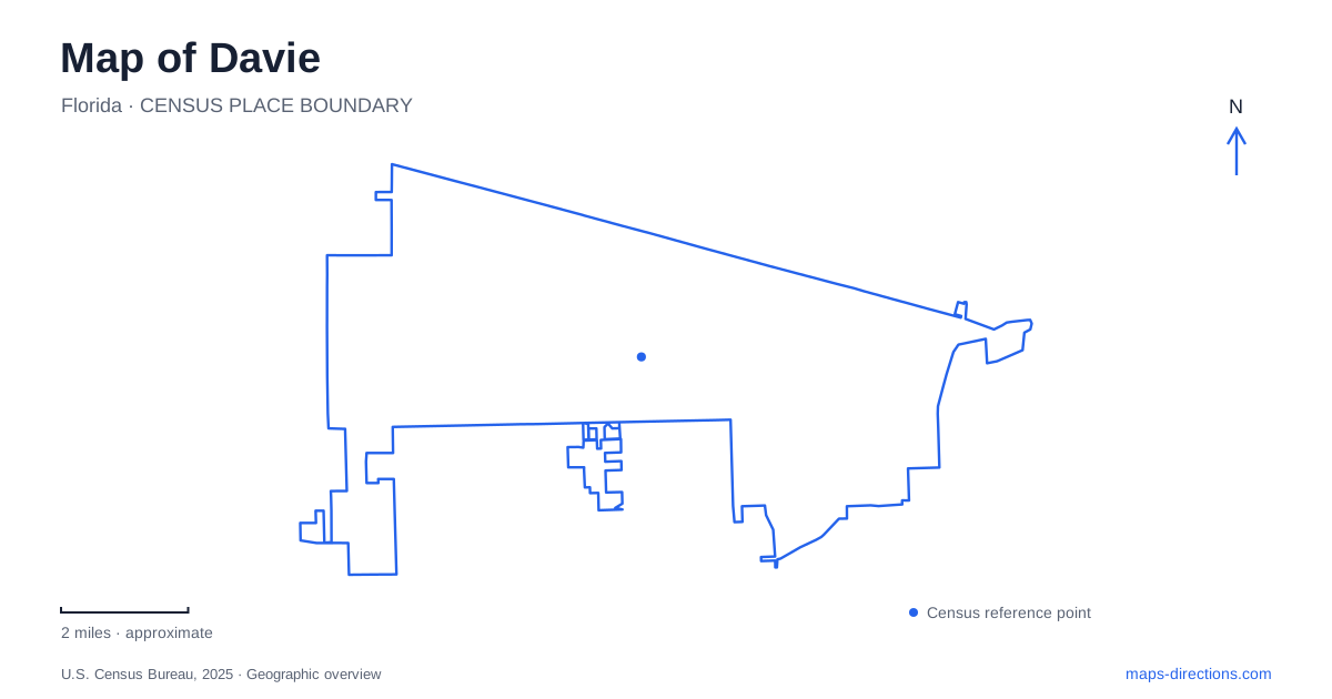
Street tiles load from OpenStreetMap when opened. The blue line shows the 2025 Census boundary.
- State
- Florida
- Population · July 2025
- 110,851
- Land area
- 35.0 sq mi
- Water area
- 0.8 sq mi
Davie's map combines a western-themed downtown with equestrian routes, wooded natural areas, and the remnants of a citrus-growing landscape. The rodeo grounds provide one recognizable center, but the town's outdoor destinations extend across several road corridors. Tree Tops Park, Pine Island Ridge, Flamingo Gardens, and Vista View Park each explain a different part of the landscape. Reading their histories and physical settings helps distinguish places that may otherwise appear as similar green areas on a road map.
The rodeo grounds near Orange Drive
Bergeron Rodeo Grounds is in the historic downtown district near Orange Drive. The town lists the facility's physical address as 4201 Rodeo Way, while its location description also uses Southwest 65th Way. Those street references identify the arena grounds, distinct from the administrative mailing address at Pine Island Park.
The arena began with rodeo activity and expanded to accommodate other events, including concerts, horse shows, and exhibitions. Its indoor-outdoor arrangement makes it a large event destination within the older district. The western identity of downtown is therefore supported by an active venue, rather than only by decorative storefronts or a historical marker.
Regional approaches place the grounds south of Interstate 595 and west of Florida's Turnpike. The town's directions identify the Griffin Road exit from the Turnpike as a useful reference. On a closer map, Orange Drive and Rodeo Way matter more than the broad highway approach. They place the final destination within the local street setting where the arena and downtown activities meet.
Trails retain an equestrian dimension
Davie maintains routes intended to accommodate horse travel as well as recreational walking. The town describes eight equestrian trails extending through suburban and rural neighborhoods. This is a distinctive element of local movement: trail connections can reflect the needs of riders and horses, rather than functioning only as conventional urban sidewalks.
Linear Park's route runs west from the Florida Turnpike through the historic downtown area. Other named connections include Pine Island Ridge Trail and the Westridge-Robbins route, which links park and preserve destinations. These paths help explain why equestrian facilities, neighborhood open spaces, and historical sites appear within one wider recreation network.
For a local outing, the trail map supplies a different picture from the highway map. It emphasizes connections between green spaces and the routes through residential areas. That perspective is particularly useful when exploring Davie's quieter interior beyond the major roads used for regional travel.
Natural elevation at Pine Island Ridge
Tree Tops Park, at 3900 Southwest 100th Avenue, provides access to a landscape of wooded trails and restored wetland. County materials describe a boardwalk, viewing tower, picnic areas, and pedestrian and equestrian routes. The park's different surfaces and settings allow a visit to move between maintained recreation areas and more natural surroundings.
Pine Island Ridge Natural Area connects with Tree Tops by a paved path. Its high hammock forest includes live oaks and slash pines, and the ridge reaches about 29 feet above sea level, identified by the county as its highest natural elevation. In a region with generally low relief, that modest height is geographically significant.
The main trailhead for Pine Island Ridge Trail begins in Tree Tops Park. This relationship is useful when reading the map: the natural area and the park are connected, but they are not identical properties or landscapes. The ridge provides the elevated woodland setting, while Tree Tops supplies a broader collection of visitor facilities and access routes.
A citrus orchard preserved as gardens
Flamingo Gardens began as Flamingo Groves in 1927, founded by Floyd and Jane Wray. The original enterprise grew citrus on land around Long Key, while botanical collections developed alongside the agricultural operation. This history gives the gardens a direct connection with the earlier working landscape of Davie.
The Wray Home, built in 1933 on a native hammock, served as a weekend residence and a place for business and entertaining. It became a museum in 1975 and was later restored to interpret a South Florida country home of the 1930s. The house and garden setting therefore preserve domestic and horticultural history together, rather than presenting the plants without their local context.
A contrasting hill at Vista View
Vista View Park offers a useful contrast with Pine Island Ridge. The town describes its high ground as a former landfill, with a manmade elevation reaching about 65 feet above sea level. Walking, cycling, and viewpoint visits now give the site a recreational role.
The distinction between natural ridge and constructed hill adds depth to a map of Davie. Alongside the rodeo district, horse routes, and preserved citrus-grove setting, these two elevated landscapes show several different ways people and terrain have shaped the town. Each destination tells a specific story that becomes clearer when its location is read with its history.
Map and statistics: U.S. Census Bureau, 2025 Gazetteer, January 2025 generalized place boundaries and Vintage 2025 population estimates. Local references: Town of Davie; Broward County; Flamingo Gardens. Article prepared by Maps & Directions.