Map of Danville
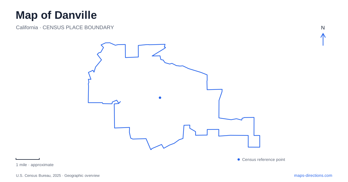
Street tiles load from OpenStreetMap when opened. The blue line shows the 2025 Census boundary.
- State
- California
- Population · July 2025
- 43,302
- Land area
- 18.1 sq mi
- Water area
- 0.0 sq mi
Danville is easiest to understand as a valley town with several distinct approaches into the surrounding hills. The downtown street pattern reflects an earlier commercial center and a later railway alignment, while the Iron Horse Trail preserves a long route through the valley. Tao House and the ridges of Sycamore Valley add very different destinations above that corridor. Together they explain why a compact-looking map contains several kinds of movement and terrain.
The railway shifted the commercial center
The Southern Pacific depot at 205 Railroad Avenue was built in 1891 after completion of the line from Avon to San Ramon. John Hartz sold land for the station and laid out neighboring lots. The town's historical account explains that the railway shifted commercial activity away from Front Street toward Hartz and Railroad avenues.
That change remains a useful way to read downtown Danville. The older street and the railway-oriented business area represent successive centers of movement. Passenger travel and freight handling helped determine which streets became commercially important, rather than the town developing around one unchanged main road.
The depot itself was later moved about one hundred yards north and turned around before restoration as the Museum of the San Ramon Valley. Its present orientation is therefore a preservation-era arrangement. The building survives as a strong historical reference, but its position should not be treated as an exact reconstruction of the original station site.
A transport corridor now carries walkers and cyclists
The Iron Horse Regional Trail follows the former Southern Pacific right-of-way through the valley. East Bay Regional Park District identifies the railway corridor as established in 1891 and abandoned in 1978. Its later conversion retained a continuous line through neighborhoods and commercial areas while changing the way people use it.
Through Danville, the route brings local destinations into a broader network extending north and south beyond the town. The trail is useful both for recreation and for travel between everyday places. Its relationship to the former depot makes the change in function particularly visible: railway architecture stands beside a corridor now associated with walking and cycling.
This is a different kind of route from a ridge trail. Its historical purpose was to carry trains through the valley, while hillside paths respond more directly to slopes, gullies, and viewpoints. Comparing those alignments helps establish the scale and character of an outing before choosing a destination.
Tao House is a hillside visit with a downtown starting point
The Eugene O'Neill National Historic Site preserves Tao House, where the playwright wrote works including Long Day's Journey into Night and The Iceman Cometh. The National Park Service describes the house as a secluded refuge with a courtyard, orchard areas, and an old barn that also supports theatrical programming.
Access is part of the site's distinctive geography. For house tours, visitors use the park service shuttle from downtown and cannot drive private vehicles directly to the historic property. Guided tours require advance reservations. The practical starting point is therefore the designated shuttle meeting place rather than a road route ending at the house marker.
For a cultural visit to Danville, this creates a connection between the commercial center and a deliberately secluded residential landscape. The house's setting is part of its story: it provided separation and space for writing while remaining connected to the town below.
Sycamore Valley has a park and a preserve
Sycamore Valley Park, around Holbrook Drive and Camino Tassajara, is a developed town recreation space with a play area, reflection pond, and paths. The similarly named regional preserve occupies hill country rather than the same kind of landscaped ground.
The preserve consists of two ridge areas. Short Ridge lies north of Camino Tassajara, while the Sherburne Hills unit lies to the south. Grassland dominates much of the landscape, with oak savanna and woodland in the northern unit. Steep-sided gullies drain toward Sycamore Creek, adding small wetland habitats within the larger dry uplands.
These features make the road a useful dividing reference. It separates two parts of the preserve while also serving the developed park and neighboring residential areas. A single label for Sycamore Valley cannot describe the different terrain on each side or the distinction between municipal facilities and regional open space.
Read the ridges at their own scale
The preserve's slopes contrast with the Iron Horse corridor through Danville. Its park district information specifically notes steep grades, even though accessible parking and facilities are available at the town park. Accessible facilities at the base do not turn the surrounding ridge trails into level routes.
The local map is most informative when those settings remain visible together: the railway-era commercial streets, a reused valley corridor, a shuttle-served literary house, and separate ridge units around Camino Tassajara. Each arose from a different relationship with the terrain, and each offers a distinct way to understand the town beyond its central shopping streets.
Map and statistics: U.S. Census Bureau, 2025 Gazetteer, January 2025 generalized place boundaries and Vintage 2025 population estimates. Local references: Town of Danville; East Bay Regional Park District; National Park Service. Article prepared by Maps & Directions.