Map of Danbury
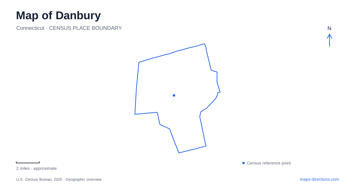
Street tiles load from OpenStreetMap when opened. The blue line shows the 2025 Census boundary.
- State
- Connecticut
- Population · July 2025
- 89,033
- Land area
- 42.0 sq mi
- Water area
- 2.2 sq mi
Danbury's Hat City nickname points to a landscape shaped by water, manufacturing and transport. The Still River helped support an industry that required large quantities of water, while railways connected local production with distant markets. Main Street preserves buildings associated with earlier community life, and surrounding parks reveal another side of the city: wooded estates, reservoirs and recreation land. These places explain why the city developed as more than a residential stop along a regional highway.
The river behind the hatting industry
Factories concentrated along the Still River because water was important to hat production. Dams and reservoirs became part of the wider industrial system, linking the visible manufacturing buildings with infrastructure beyond their immediate sites. The river consequently belongs to the city's economic history as well as its natural setting.
Much of the downtown watercourse is now hidden underground. This makes it easy to overlook when navigating by streets alone, but its historical role remains essential to understanding where businesses and factories developed. A river need not be continuously visible to have shaped the arrangement of an urban center.
The city's industrial identity is also reflected in Hatters Park. Its recreation grounds include a pond, playground, pavilion and other community facilities. The name carries the memory of manufacturing into a setting used for leisure, illustrating how an older economic identity can remain part of everyday public life after the industry itself has changed.
Several histories gathered on Main Street
The museum campus at 43 Main Street brings together buildings with different origins. The John and Mary Rider House dates to 1785 and occupies property where an earlier house was destroyed during the British raid of 1777. Its preservation provides a physical connection with the town's post-Revolutionary rebuilding.
The John Dodd Hat Shop dates to 1790, but the museum explains that Dodd used the structure as a law office. It was relocated from a nearby Main Street site in 1958 and now houses hatting exhibits. The present name describes its interpretive role, rather than proving that every part of its original use was industrial.
Danbury also preserves Marian Anderson's rehearsal studio. Her husband, architect Orpheus Fisher, designed it at their Marianna Farm property on Joe's Hill Road. The studio moved to the museum campus in 1999 and opened after rehabilitation in 2004. Its presence brings music and personal creative work into a collection otherwise strongly associated with civic and industrial history.
Union Station and the working rail yard
The railway museum occupies the restored Union Station built in 1903. Inside are artifacts, photographs, tools, timetables and other objects associated with rail travel. Behind the station, a large collection of historic rolling stock gives the site a different scale from an ordinary indoor museum.
The station ceased functioning as the regular passenger terminal before the museum occupied it in 1996. Commuter trains still pass nearby, but the historic building and the current passenger operation have different roles. This distinction helps readers understand the railway landscape without confusing a museum visit with boarding a train.
A turntable in the yard adds evidence of the practical work once performed here. The museum describes the yard as a major New York, New Haven & Hartford Railroad hub in the early and middle twentieth century. Turning and servicing locomotives required space and specialized structures beyond the passenger platforms, explaining the broad railway footprint within Danbury.
Tarrywile's estate landscape
Tarrywile Park occupies 722 acres in the southern part of the city. Wooded trails, former farm structures and historic buildings make it a landscape with several layers of use. It is not simply a large lawn around a mansion: the property includes extensive terrain that reflects both estate development and later public recreation.
Hearthstone Castle stands in a wooded hilltop setting east of Brushy Hill Road. Built as a summer estate in the late nineteenth century, it is now a ruin rather than an intact house museum. The park operator prohibits entry beyond its protective fence. That condition is part of an accurate description of the site; an old photograph or architectural name should not imply that visitors can tour restored rooms.
The castle and Tarrywile Mansion are separate buildings within the broader estate history. Their locations and differing conditions help explain why the park should be read as a collection of landscapes and structures rather than one attraction with a single entrance experience.
Two lakes with different purposes
Candlewood Lake was created for pumped-storage hydroelectric power. Filling began in February 1928, transforming the valley into a reservoir connected with the Rocky River generating project. Its irregular shoreline therefore reflects flooded terrain and engineering decisions, even though recreation is now a prominent part of its identity.
Candlewood Town Park gives Danbury a public beach setting along that larger lake. Lake Kenosia serves another role: the city identifies it as a backup drinking-water source and prohibits swimming there. Similar blue shapes on a map thus represent waters with different histories and permitted uses.
The hidden river, Main Street buildings, railway yard, wooded estate and reservoir shoreline together give Danbury a distinctive geography. Water supported industry, railways enlarged its reach, and preserved buildings now explain the people and institutions that occupied those changing landscapes.
Map and statistics: U.S. Census Bureau, 2025 Gazetteer, January 2025 generalized place boundaries and Vintage 2025 population estimates. Local references: City of Danbury; Danbury Museum; Danbury Railway Museum; Tarrywile Park Authority; Candlewood Lake Authority. Article prepared by Maps & Directions.