Map of Daly City
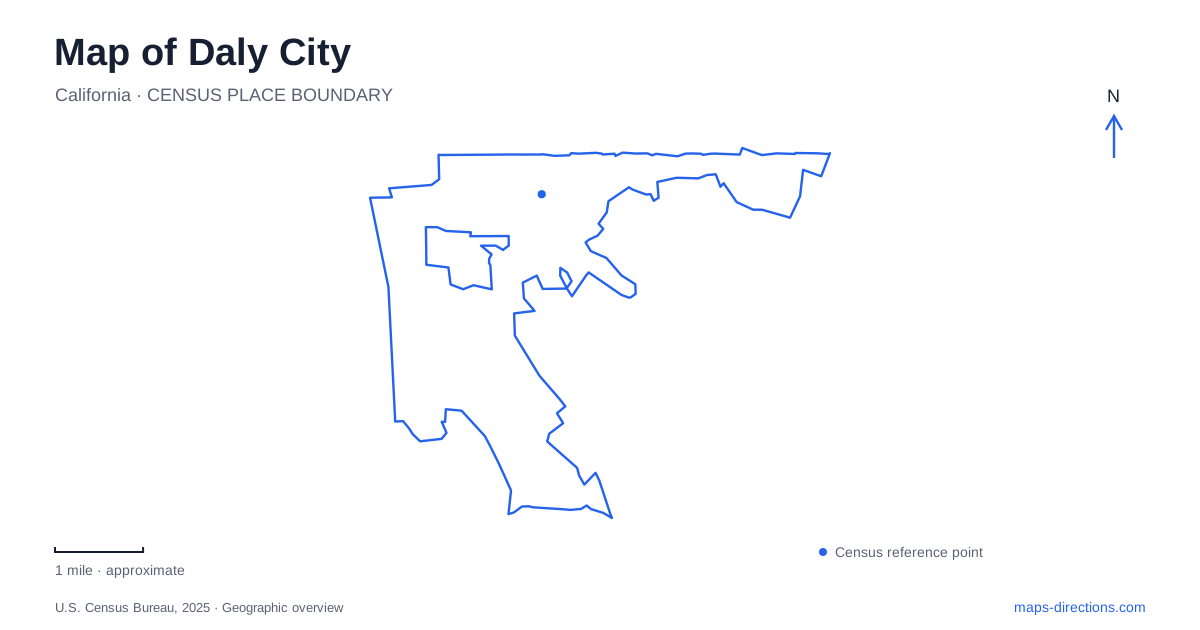
Street tiles load from OpenStreetMap when opened. The blue line shows the 2025 Census boundary.
- State
- California
- Population · July 2025
- 101,261
- Land area
- 7.7 sq mi
- Water area
- 0.0 sq mi
Daly City occupies the northern end of San Mateo County, where San Francisco's streets meet a landscape of coastal bluffs, residential hills, and the slopes of San Bruno Mountain. Its map has several centers rather than one dominant downtown. Mission Street carries the older settlement story, Westlake represents a later planned community, and the Cow Palace draws attention toward Geneva Avenue. Reading those districts separately explains why a trip across town can involve a very different landscape from a journey south along the peninsula.
Mission Street and the older settlement
The city's history traces an early road junction at the top of the hill, where travelers could continue toward the Mission or the Presidio. That fork helps explain Mission Street's significance beyond its present commercial role. A mission bell outside the War Memorial recalls the old El Camino corridor, adding a visible historical reference to a street otherwise read through storefronts and intersections.
The 1906 earthquake accelerated settlement outside San Francisco. John Daly subdivided land in 1907, and incorporation followed in 1911. Those dates place the older neighborhood pattern in a different era from the postwar developments farther west. A map of Daly City therefore records successive expansions, with an established street corridor and later residential districts sharing a municipal boundary without sharing the same origins.
Westlake and the civic center
Henry Doelger began the Westlake development in 1947. It was conceived with housing, shops, offices, medical facilities, churches, and schools rather than as housing alone. The area joined the municipality in 1948. Its planned mix of uses makes the shopping district a useful reference for understanding surrounding residential streets and everyday trips within the western part of town.
Broadmoor needs a separate boundary label: the city's historical account specifically notes that this neighboring community was not annexed. Continuous development can conceal that distinction on an aerial image. Municipal services and local place names do not always follow the apparent edge of a built neighborhood.
The civic center supplies another identifiable block. Its site is bounded by 90th Street, Sullivan Avenue, 92nd Street, and Edgeworth Avenue. Those four streets give a more precise orientation than treating the municipal offices as part of the Mission Street commercial strip. They also show how the administrative center developed beyond the earlier city hall on Wellington Avenue.
Rail connections along John Daly Boulevard
Daly City BART station is at 500 John Daly Boulevard. The station's pedestrian tunnel connects with a smaller parking area south of the boulevard, and elevators serve that connection. This matters when approaching on foot: the station is a collection of rail platforms, circulation spaces, and access points divided by a major street, rather than a single roadside doorway.
Colma station, at 365 D Street in the neighboring town, is a separate stop. Keeping both station labels on a peninsula map helps distinguish a local destination from the broader rail corridor. John Daly Boulevard is also an east-west geographical reference, continuing toward Skyline Boulevard and the coast rather than simply functioning as the station's address.
Geneva Avenue and the mountain
The Cow Palace anchors the Geneva Avenue side of Daly City at 2600 Geneva Avenue. Opened in 1941, the arena and event grounds are associated with the Grand National rodeo as well as other gatherings. The Bayshore area was annexed in 1963, another reminder that today's outline combines districts acquired at different stages.
San Bruno Mountain forms a substantial open-space counterpart to the developed streets. The county park entrance is on Guadalupe Canyon Parkway. Its Summit Loop begins at trailhead parking southeast of the parkway; vehicle access to that lot is through the main entrance. The route follows April Brook, crosses footbridges, climbs Bitter Cherry Ridge, and crosses Radio Road near the summit area. These named features make a trail map far more informative than a simple green mountain polygon.
The Pacific edge
The western edge of Daly City requires particular care when interpreting beach symbols. California State Parks explicitly states that Thornton State Beach has no beach access and is not available to the general public. Its location is at the end of Thornton Beach Road, reached from the John Daly and Skyline Boulevard intersection. A shoreline label should therefore not be read as an invitation to descend the bluffs.
The state's directions separately locate the Bay Area Ridge Trail beginning on Mayfair Drive, southeast of that intersection. Distinguishing the upland trail from the beach preserves the actual geography: coastal recreation here involves different elevations and access arrangements. Together, Mission Street, Westlake, Geneva Avenue, the mountain, and this bluff edge provide a coherent picture of a compact but varied peninsula community.
Map and statistics: U.S. Census Bureau, 2025 Gazetteer, January 2025 generalized place boundaries and Vintage 2025 population estimates. Local references: City of Daly City; BART; Cow Palace; San Mateo County; California State Parks. Article prepared by Maps & Directions.