Map of Dallas
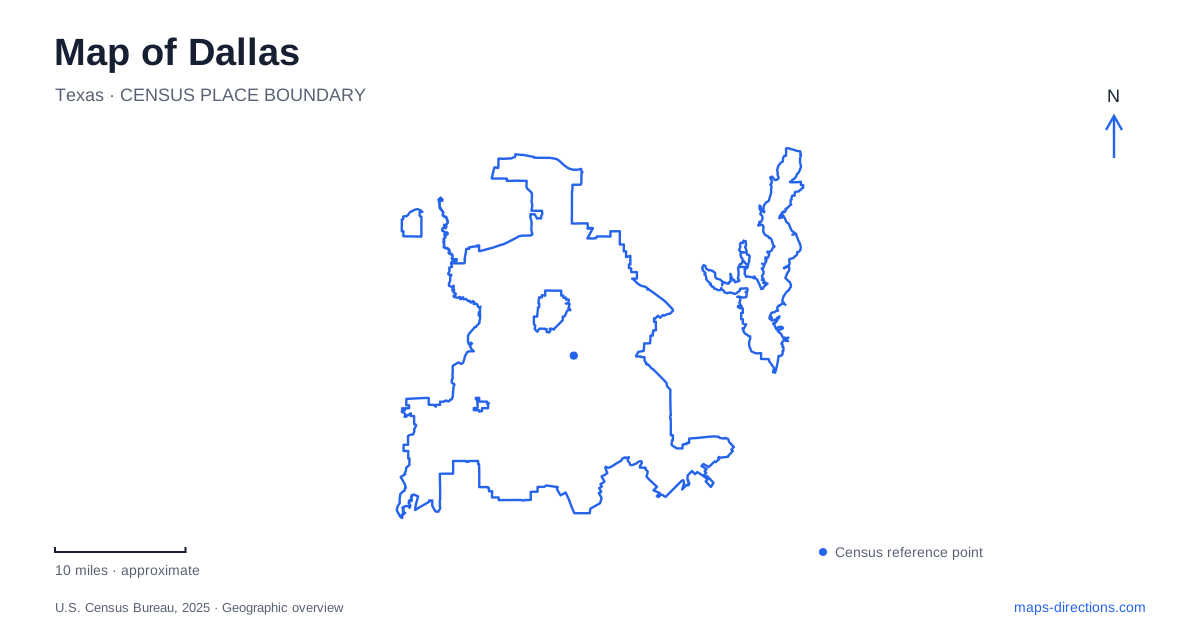
Street tiles load from OpenStreetMap when opened. The blue line shows the 2025 Census boundary.
- State
- Texas
- Population · July 2025
- 1,329,491
- Land area
- 339.7 sq mi
- Water area
- 44.0 sq mi
Dallas has several overlapping map systems that are useful for different reasons. Downtown street names describe the final approach to a building, DART's rail diagram explains connections across the region, and landmark maps show how parks and river crossings fit into the center. Reading them together avoids a common mistake: assuming that two places sharing a district or airport label also share an entrance or transit connection. Establish the named destination first, then choose the map that explains how to reach it.
A park built above a freeway
Klyde Warren Park occupies a deck over the recessed Woodall Rodgers Freeway between Pearl and St. Paul streets. The city's parks department describes it as a connection between downtown and Uptown. This is a useful landmark precisely because two kinds of space overlap there: the freeway below and a public gathering place above. A flat overview can make that relationship less obvious than it is on the ground.
For a Dallas park visit, use the published park address at 2012 Woodall Rodgers Freeway together with the pedestrian approach or parking instructions. Do not interpret a freeway line beneath the green space as the place to stop. The park foundation also lists a separate office address, so distinguish the public destination from its administrative contact location when choosing a search result. The matching organization name alone does not prove that a result is the desired entrance.
Downtown station names are useful geographic anchors
DART identifies Pearl/Arts District, St. Paul, Akard and West End as downtown transfer locations among its rail lines. These station names also provide a practical way to place destinations within the central area. A hotel or venue described merely as downtown may still require a different final walk from each station. Compare its street address with the station map before selecting a stop.
Keep the venue entrance and the rail stop as two saved places when a trip involves walking between them. That makes the intended connection visible instead of hiding it behind a general downtown label. A rail diagram is designed to make line relationships legible; it should not be treated as a precise scale drawing of the surrounding blocks. Return to the street map for the last part of the journey.
Love Field involves a rail-to-bus connection
DART's airport guidance describes Route 5 Love Link between Inwood/Love Field Station and the airport. The station is served by the Green and Orange lines, but the airport terminal is a separate destination reached through that connection. A station name containing the airport's name can otherwise create a misleading impression that the rail platform is inside the terminal.
For Dallas air travel, preserve the full airport identity in directions and reservations. Love Field and DFW Airport are not alternative names for the same place. DART describes using Love Link followed by an Orange Line train toward DFW for travel between them. That is a transfer itinerary involving two airports, not a short movement between terminals of one airport. Check the operating details for the actual departure day rather than inferring them from the map alone.
DFW terminal labels require particular care
The rail-system map distinguishes DFW Airport Terminal A, Terminal B and Airport North labels. Their similar names identify different points in the regional system. Selecting a result because it contains “DFW” leaves an important question unanswered: which station or terminal matches the intended journey? Match the result to the transport service and terminal information supplied for the trip.
A Dallas regional map also includes places such as Irving, Plano, Garland and Fort Worth. Those labels explain why an airport or rail search can extend beyond the municipality's outline. The wider network serves several cities, while this page's outline identifies one city. Regional connectivity is useful, but it does not turn every station on the diagram into a downtown destination or place it within the same local street grid.
River crossings belong in the broad view
The Margaret Hunt Hill Bridge is a recognizable Trinity River crossing associated with the relationship between the center and western neighborhoods. Its presence on the map helps orient that side of the city. For an actual visit, however, select the destination on the appropriate side of the river and inspect its approach rather than treating the bridge itself as a universal arrival point for the river corridor.
Use a broad Dallas map to recognize the crossing and the downtown–Uptown relationship, then switch to more specific views for the park, station or airport. These scales answer different questions. The broad view explains where a stop belongs; the detailed view explains how a traveler enters it. Keeping those questions separate produces directions that remain understandable even when a route changes or a different travel mode is chosen.
Map and statistics: U.S. Census Bureau, 2025 Gazetteer, January 2025 generalized place boundaries and Vintage 2025 population estimates. Local references: Dallas Parks; Klyde Warren Park; DART; City of Dallas Trinity River Corridor. Article prepared by Maps & Directions.