Map of Cypress
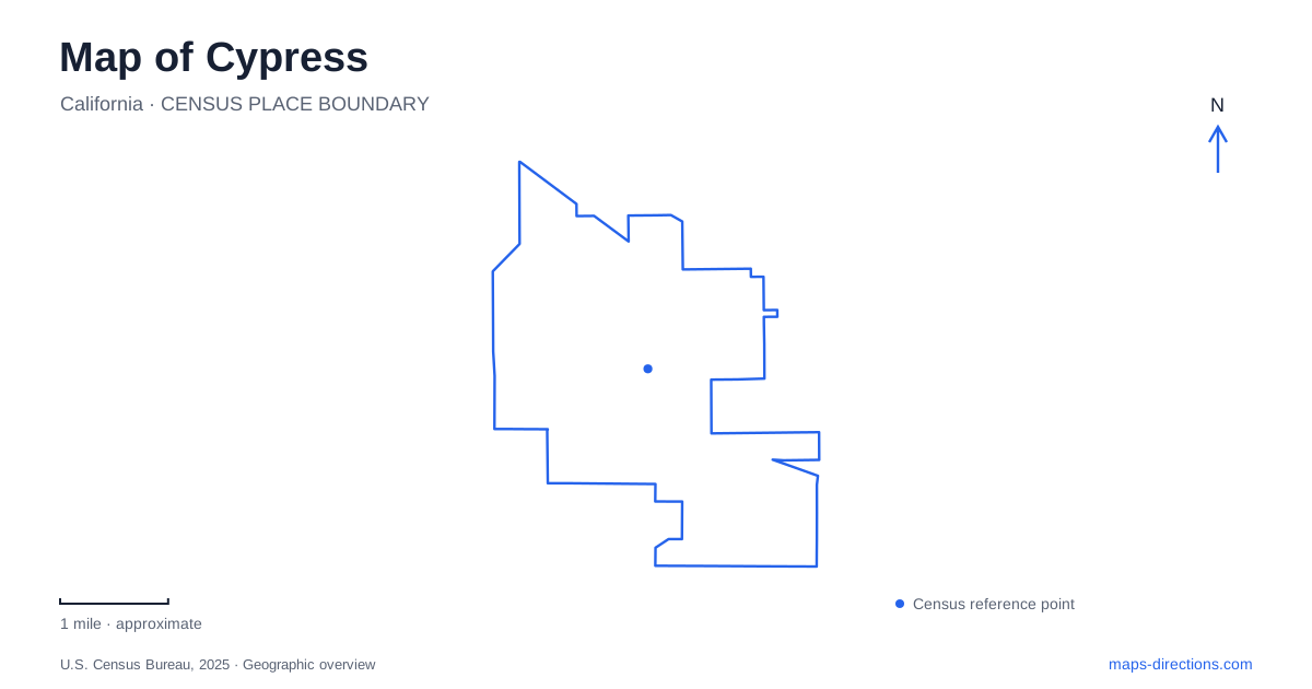
Street tiles load from OpenStreetMap when opened. The blue line shows the 2025 Census boundary.
- State
- California
- Population · July 2025
- 48,781
- Land area
- 6.6 sq mi
- Water area
- 0.0 sq mi
Cypress is a suburban Orange County community whose familiar streets cover a much older agricultural landscape. Dairy farms once defined local identity, while the present map emphasizes schools, public buildings, residential blocks, and recreation grounds. Orange Avenue, Valley View Street, Graham Street, and Cerritos Avenue provide useful reference lines because they lead to different kinds of community destinations rather than converging on one traditional courthouse square.
Dairy City and the change of name
The municipality incorporated as Dairy City on July 24, 1956. Residents supported a change to the present name in an August 1957 straw ballot, with 208 votes in favor and forty-one opposed. This sequence is more informative than treating the current city name as the only identity the community has held.
The local anniversary history describes dairy farming as the leading industry by the 1940s. Later housing, schools, and civic facilities replaced much of that working landscape. The college opened in 1966 and the civic center followed in 1967, marking the rapid institutional growth of the postwar community. Older agricultural references in local histories therefore describe the same general place at a different stage of development, not a separate lost town somewhere beyond the suburbs.
A campus built from temporary beginnings
Cypress College occupies a substantial educational site at 9200 Valley View Street. Its own historical photographs document an unusually rapid beginning: classes opened in September 1966, seventy-four days after the district closed escrow on property that had primarily been a dairy farm. Portable buildings made that start possible, while some existing houses accommodated administrative functions.
The later campus developed around a pond, plazas, and an elevated pedestrian level known as the piazza. Historical images show a road beside the pond that no longer carries traffic through the center. That change helps explain why an old campus photograph and a current walking map may show different movement patterns even when the buildings remain recognizable.
A campus map is especially useful here because ground-level routes and the piazza form different layers. Building names, stairs, and elevators add information that a simple street address cannot provide. The institution is a district of destinations within the wider city rather than one building behind a single front door.
Orange Avenue's public facilities
The civic center is listed at 5275 Orange Avenue, while the community center is at 5700 Orange Avenue. These are separate facilities on the same road. The recreation department operates from the latter, which serves classes, activities, and private gatherings. The senior center is another distinct destination at 9031 Grindlay Street.
For a Cypress appointment, this small cluster of names deserves care: city business, a recreation class, and a senior program may involve different buildings. The road network provides the broad orientation, but the facility name and number identify the actual destination. These public spaces also illustrate how civic life is distributed through the developed community rather than confined to one all-purpose municipal building.
Oak Knoll and Lexington serve different outings
Oak Knoll Park at 9600 Graham Street covers twenty-two acres. Its north and south areas include playing fields, basketball, picnic space, playgrounds, and a jogging trail. The municipal directory distinguishes parking areas and sports facilities within the grounds, making the park name a starting point rather than a complete meeting instruction.
Lexington Park is a separate nine-acre site at 4600 West Cerritos Avenue. It combines natural and synthetic turf fields, shaded play areas, fitness equipment, picnic pavilions, and a walking path of roughly a third of a mile. Its multipurpose court accommodates different sports at scheduled times. A field booking and a casual walk can use the same park but involve different parts of it.
Within Cypress, comparing these parks by size and facilities is more useful than assuming that every green map shape offers the same activities. Oak Knoll’s larger grounds and Lexington’s compact combination of fields and walking space support different arrangements for a group visit.
A basin with an environmental role
The Nature Park at 4201 Ball Road has a different purpose again. It occupies a flood-control basin that the city adapted for observing local plants and wildlife. Collected water is eventually pumped into Carbon Creek Channel and continues toward Long Beach Harbor, connecting this small inland site with a much wider drainage system.
Public access is managed through specified opening opportunities and reservations; it should not be treated as an always-open shortcut. The city also notes that wildlife conditions can prompt temporary closure. Its value on a local map lies in showing that open land can serve drainage, habitat, and education together. Reading these functions alongside the former dairy landscape, campus, civic buildings, and sports parks gives a map of Cypress a distinctly local story.
Map and statistics: U.S. Census Bureau, 2025 Gazetteer, January 2025 generalized place boundaries and Vintage 2025 population estimates. Local references: City of Cypress; Cypress College. Article prepared by Maps & Directions.