Map of Cuyahoga Falls
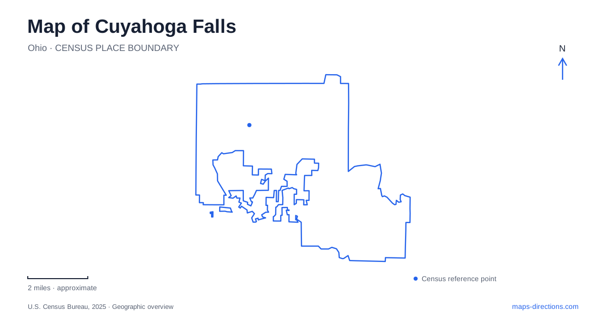
Street tiles load from OpenStreetMap when opened. The blue line shows the 2025 Census boundary.
- State
- Ohio
- Population · July 2025
- 50,975
- Land area
- 25.8 sq mi
- Water area
- 0.1 sq mi
A map of Cuyahoga Falls brings together a riverfront manufacturing town and a much broader landscape of wooded slopes, former township roads, and performance grounds. Front Street supplies the compact downtown reference point. West Steels Corners Road introduces another setting entirely, where the outdoor pavilion at Blossom Music Center occupies a natural bowl. Following the river between urban and wooded surroundings reveals why a single downtown view cannot explain the city's full shape.
Front Street and the old river town
The community began in 1812 under the name Manchester. William Wetmore's home stood at Front Street and Portage Trail, an intersection that remains a useful historical anchor. The house later operated as a hotel, while nearby river power supported mills and factories. The street pattern and river should therefore be read together: the business district grew beside a working waterway, rather than around a detached civic square.
Portage Trail also preserves a transportation story older than the street itself. The city's historical account describes Native travelers leaving the difficult river passage and continuing overland along the route now associated with that road. On a map of Cuyahoga Falls, the name points to the relationship between land travel and the river's steep descent. It helps explain why this crossing corridor carries more historical meaning than an ordinary numbered street.
A downtown that changed its circulation
Front Street reopened to vehicles in June 2018 after its period as a pedestrian mall. The transformation brought on-street parking, streetscape improvements, and renewed attention to the buildings along the corridor. Paddle Park occupies the Front Street and Portage Trail corner, giving the old intersection a small public gathering space within the shopping district.
The southern continuation has a separate redevelopment history. Work on South Front Street and the RiverLoop boardwalk began in summer 2025, linking discussion of the river edge with Riverfront Parkway. A construction rendering explains that relationship but does not establish an uninterrupted walking route. Check the city's pedestrian access information for the segment you intend to use, particularly when combining a downtown meal with a walk beside the river.
High Bridge Glens Park, listed at 1817 Front Street, provides another named riverfront landmark. Its observation deck and walkway identify a place for looking into the river landscape. Together, the downtown blocks and this park give Cuyahoga Falls a sequence of urban river settings rather than one single overlook.
Reading the gorge as terrain
Gorge Metro Park reveals a more rugged side of the waterway. Glacial debris diverted the river from an earlier course, and the resulting gorge exposes a shale riverbed between ledges of Sharon conglomerate sandstone. Old Maid's Kitchen is a rock shelter within that setting. These formations explain the uneven slopes and abrupt changes in elevation that a simple road map barely conveys.
The gorge also preserves the overlap of recreation and industry. Amusement grounds attracted visitors during the nineteenth century, while later power infrastructure altered the river. In 1930, Northern Ohio Traction & Light Company donated 144 acres to the park district. The scenery is therefore neither untouched wilderness nor merely a former industrial site; both histories belong to the same landscape.
On a Cuyahoga Falls map, Gorge Dam removal provides context for Gorge Metro Park, while the park district's trail guidance helps identify a suitable riverbank walk. The park district's closure information takes precedence over older trail descriptions.
Northampton and the music landscape
The merger with Northampton Township took effect on January 1, 1986, adding a comparatively rural landscape to the developed city. Keyser Park and the Northampton Town Hall site at 851 West Bath Road retain that township identity in local place names. This western geography is an essential part of understanding the municipality beyond its original riverfront core.
Blossom Music Center opened in 1968 at 1145 West Steels Corners Road. Its natural bowl was a factor in selecting the site, and the pavilion's steel trusses avoid interior supporting columns that would interrupt audience views. The lawn and covered seating work with the landform, making topography part of the concert experience.
Along the same road, Sarah's Vineyard combines grape growing, winemaking, and an art gallery at 1204 West Steels Corners Road. The National Park Service includes it among the valley's farms and markets. Placing these destinations beside downtown and the gorge gives Cuyahoga Falls a distinctive map: an industrial river heritage, a reshaped shopping street, and a township landscape where agriculture and outdoor performance still occupy substantial ground.
Map and statistics: U.S. Census Bureau, 2025 Gazetteer, January 2025 generalized place boundaries and Vintage 2025 population estimates. Local references: City of Cuyahoga Falls; Summit Metro Parks; The Cleveland Orchestra; National Park Service. Article prepared by Maps & Directions.