Map of Culver City
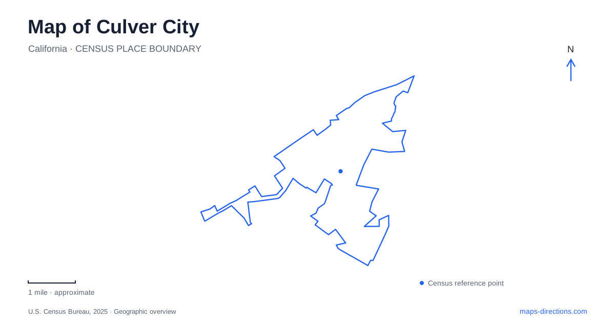
Street tiles load from OpenStreetMap when opened. The blue line shows the 2025 Census boundary.
- State
- California
- Population · July 2025
- 39,452
- Land area
- 5.1 sq mi
- Water area
- 0.0 sq mi
Culver City is closely associated with filmmaking, but its map also records an industrial town, a creek corridor, and a dramatic rise toward the Baldwin Hills. The compact downtown around Main Street is only one part of that geography. Studio properties occupy larger blocks, former manufacturing buildings have their own histories, and the creek creates a route toward the coast that does not follow the main commercial streets. Understanding those different scales makes the city easier to read.
Main Street and a six-story landmark
Harry Culver began promoting his planned community in 1913, choosing a location along transportation routes between Los Angeles and Venice. Incorporation followed in 1917. The original municipality covered a much smaller area than the later city and centered on Main Street; subsequent annexations expanded it considerably.
The Culver Hotel, erected in 1924 as the Hotel Hunt, remains a prominent reference point in this downtown setting. It originally accommodated Culver's offices and sales organization as well as hotel functions. Its height and distinctive presence make it a useful visual anchor among the surrounding streets. The building's role was therefore connected to the promotion and development of the town, not only to the film guests with whom it later became associated. Reading the hotel alongside Main Street helps put downtown Culver City into its early commercial context.
Two studio histories, two addresses
The Culver Studios and Sony Pictures Studios are separate properties. The former began in 1918 under Thomas Ince, with its Mansion among the original buildings. Its address is 9336 West Washington Boulevard. Later reconstruction and expansion retained historic structures while substantially changing the production campus around them.
Sony Pictures Studios is farther along Washington Boulevard at 10202. Its lot developed from Triangle Studios and became MGM's home in 1924. The current operator offers guided visits to a working studio, with reservations required. Those tours belong to this specific property; the presence of another famous studio nearby does not make their gates or visitor arrangements interchangeable.
For a map of Culver City, that distinction is particularly important because historical film-company names have changed repeatedly. A reference to MGM, Ince, or Sony in an older account may describe ownership or production history rather than the current name of a destination. The street address and the particular lot clarify which place is being discussed.
Helms belongs to the industrial story
The Helms Building adds a different kind of production history. Constructed in 1930 in the Zig-Zag Moderne style, it housed the family bakery until 1969. The company supplied the nearby Olympic Village during the 1932 Los Angeles Games, and its delivery coaches carried baked goods through Southern California.
The historical society notes that the building spans the boundary between Culver City and Los Angeles. That detail is a reminder that a recognizable district or commercial property can cross a municipal line even when everyday descriptions attach it to one place. Its architecture and bakery history remain distinct from the film studios, despite their shared industrial era. The building also illustrates why the city's economic history cannot be reduced to screen production alone: manufacturing and distribution occupied substantial space alongside the entertainment businesses.
Ballona Creek provides a coastal direction
Ballona Creek flows toward Santa Monica Bay through a channel created by the Army Corps of Engineers in the 1930s. The adjoining bicycle path connects toward Marina del Rey and the coastal route. Its line across the map offers a different organizing feature from Washington or Culver boulevards.
Public art makes parts of that engineered corridor more legible. Murals along the creek and at path entrances address local history, stormwater, and the connection to the ocean. A 2019 project involved artist Lindsay Carron and high-school students in creating ground murals at entrances. These works connect the path's recreational use to the drainage system beside it. The watercourse is both infrastructure and an environmental link to the bay; its concrete form does not remove that wider relationship.
The overlook changes the scale
Baldwin Hills Scenic Overlook rises above the surrounding urban landscape to a 420-foot peak. California State Parks interprets the site's transition from land affected by drilling to a place of habitat restoration and conservation. The main hiking route climbs steeply from Jefferson Boulevard, winding for about a mile toward the overlook.
From this elevated setting, the surrounding basin, ocean, and mountains become part of the same view. The climb therefore offers a different perspective on the street-level places below: downtown's compact blocks, large studio campuses, and the creek corridor belong to a broader terrain. A map of Culver City is most useful when it retains that contrast between the relatively flat urban routes and the physically demanding ascent into the hills.
Map and statistics: U.S. Census Bureau, 2025 Gazetteer, January 2025 generalized place boundaries and Vintage 2025 population estimates. Local references: City of Culver City; The Culver Hotel; The Culver Studios; Sony Pictures Entertainment; Sony Pictures; Culver City Historical Society; California State Parks. Article prepared by Maps & Directions.