Map of Crystal Lake
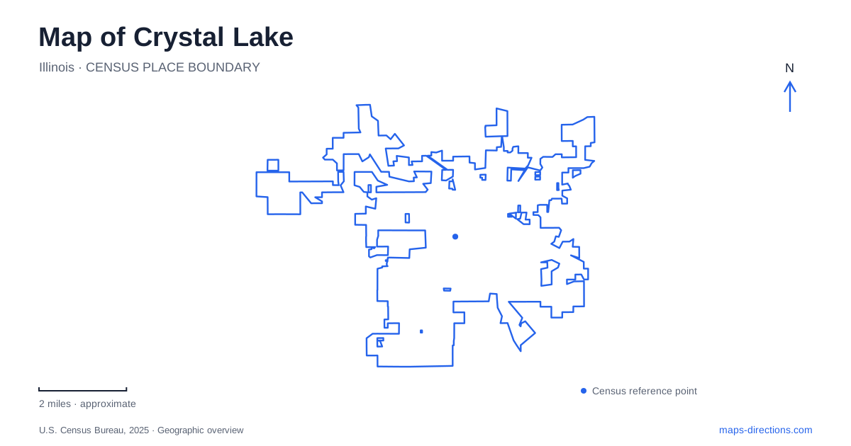
Street tiles load from OpenStreetMap when opened. The blue line shows the 2025 Census boundary.
- State
- Illinois
- Population · July 2025
- 42,288
- Land area
- 19.0 sq mi
- Water area
- 0.6 sq mi
Crystal Lake has several landscapes that can be mistaken for one another in a quick search: the city, its namesake lake, and the separate lakes at Three Oaks Recreation Area. Downtown adds another distinction because its development was closely tied to the railway, rather than simply to the lakefront. Understanding the city's origins in two communities explains this arrangement and gives useful context to the roads linking commercial streets, beaches and larger parks.
Two communities joined by rail and later government
The nineteenth-century settlement developed around two communities, one by the lake and the other associated with the railway at Nunda. Both incorporated as villages in 1874. Nunda changed its name in 1908, and the communities united under a city government in 1914. The resulting municipality inherited more than one historical focus rather than starting with a single center that expanded evenly outward.
The city's historical account identifies the original 1840 plat between Virginia Street, Lake Avenue, McHenry Avenue and Dole Avenue. A separate railroad-linked commercial settlement grew at Nunda during the 1850s. This distinction helps explain why the downtown street pattern and the older lake-oriented area have different organizing features. They belong to a shared city today, but the railway and shoreline each influenced where activity concentrated.
Dole Avenue has a particularly revealing predecessor: an 1856 rail spur between the railway settlement and the lake. It transported harvested ice to Chicago and carried visitors in the other direction. On a map of Crystal Lake, the avenue consequently represents a former economic connection between water, rail transport and regional tourism. The lake was a source of a traded commodity as well as a place for recreation.
Main Beach on the original lake
Lake Park, commonly called Main Beach, occupies 27 acres on the eastern shore at 300 Lakeshore Drive. The park district identifies it as the city's first park. Its bathhouse, fishing pier, boat launch, picnic grounds and band stage make the shoreline a substantial public destination rather than a narrow strip of sand.
The historic bathhouse once housed the park district's administrative offices, adding a civic role to a recreational building. The pavilion continues to support programs and events. These uses show how public access to the water became part of the community's everyday institutions. For a visit focused on the lake that gave Crystal Lake its name, Main Beach is the relevant east-shore location, with recreation extending onto land through its buildings, courts and gathering areas.
Quarry water at Three Oaks
Three Oaks Recreation Area has a different origin. The city opened it in 2010 on a former quarry site, creating a public landscape around two lakes. The watershed plan describes boating, fishing and scuba opportunities alongside native prairie and trails. It also records bioswales and rain gardens around buildings and parking areas, designed to filter runoff before it enters the water.
The address is 5517 Northwest Highway. The former extraction landscape matters as much as the modern recreation program: the water bodies and surrounding restoration reflect the reuse of industrial land. Comparing Three Oaks with Main Beach reveals two different histories of public recreation in Crystal Lake, one centered on an established lakefront and the other on a transformed quarry. The lakes should therefore remain separate destinations when planning a shoreline outing.
Prairie, woods and a regional trail
Veteran Acres Park is listed at 431 North Walkup Road, with entrances associated with Walkup and Route 176. Its 140 acres combine sports and play facilities with natural areas, a fishing pier and walking routes. The Nature Center, Rotary Building and Oakwoods Lodge give the park several distinct activity points.
Its broader significance comes from the surrounding protected landscape. Trails extend through Sterne's Woods and Wingate Prairie, while the McHenry County Conservation District's Prairie Trail passes through Veteran Acres. The park district manages both Sterne's Woods and Fen and Wingate Prairie as Illinois Nature Preserves. That designation distinguishes these areas from lawns or sports fields: they protect natural communities within a park system that also accommodates active recreation. A detailed trail map reveals those internal differences more clearly than a single park symbol.
Former farmland on Route 176
Lippold Park lies at 851 West Route 176, just west of Route 14. Named for the family that farmed the property, the 310-acre park now combines sports fields, a family golf facility, disc golf, a skate park and walking and bicycle trails. Its large footprint reflects a different kind of land conversion from either the railway downtown or the quarry recreation area.
Reading these places together gives Crystal Lake a coherent geography. The historic avenue follows an ice-shipping connection, Main Beach preserves the public lakefront role, Three Oaks reuses quarry ground, and the larger northern parks combine recreation with protected habitats. Their different origins explain why the city's most useful destinations are distributed across several centers rather than gathered around one waterfront district.
Map and statistics: U.S. Census Bureau, 2025 Gazetteer, January 2025 generalized place boundaries and Vintage 2025 population estimates. Local references: City of Crystal Lake; Crystal Lake Park District. Article prepared by Maps & Directions.