Map of Cranston
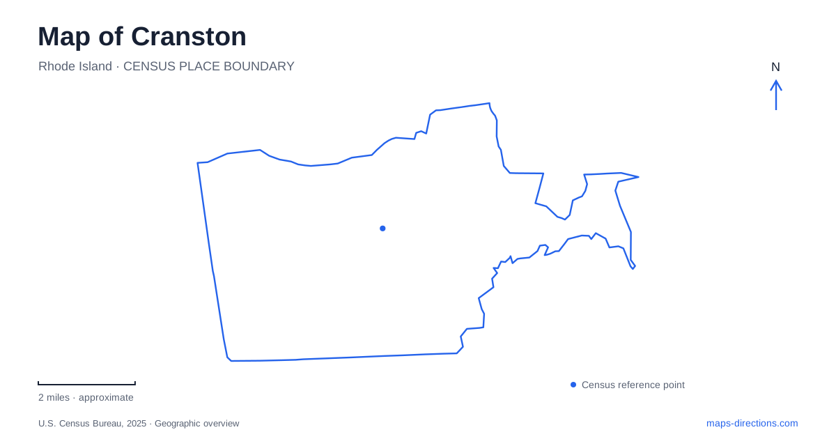
Street tiles load from OpenStreetMap when opened. The blue line shows the 2025 Census boundary.
- State
- Rhode Island
- Population · July 2025
- 84,647
- Land area
- 28.3 sq mi
- Water area
- 1.7 sq mi
Cranston is better understood as a collection of village and district settings than as one uniform suburban center. Its eastern edge reaches Narragansett Bay, while the western side retains lower-density residential and rural landscapes. Between them are civic streets, shopping areas and a former railway corridor now used for walking and cycling. The map becomes more informative when these places retain their local names and relationships, especially where a village crosses a city boundary or a trail changes its segment name.
Pawtuxet's river divides a shared village
The city's historical account locates Pawtuxet Village around the falls and cove where the Pawtuxet River meets upper Narragansett Bay. The river separates the portion to the north from the Warwick side to the south. A single village identity therefore spans two municipalities. An address with either city name can belong to the same broader village setting without representing a mapping error.
This gives eastern Cranston a distinctive boundary condition. Broad Street and Post Road relate to the village's commercial and transportation history, while the river and sheltered water explain its earlier settlement. When comparing addresses, use the river crossing and street location rather than relying only on the municipal label. The village's coherence is geographical and historical even though its administration is divided.
Oaklawn follows Wilbur Avenue
The historic district description places Oaklawn's buildings along Wilbur Avenue, between Natick Road and the railroad bridge separating the village from Oaklawn Avenue. The church and former schoolhouse, later used as the library, form recognizable central landmarks. This is a linear village pattern: the street and its sequence of buildings explain the district more clearly than a circle drawn around one central attraction.
Oaklawn's development also reflects railway access. The municipal history describes the nineteenth-century transition from a farming hamlet toward a residential suburb associated with the rail stop. That history helps connect the compact village streets with the larger corridor visible on present maps. The surviving building pattern records a different form of development from a modern shopping center, even when both places lie within the same city outline.
Garden City occupies a different commercial setting
The city's economic-development planning material places Garden City Center between Route 2 and Midway Road. This identifies a major retail destination through its surrounding road framework rather than through the older village street pattern. A visit there involves a different spatial problem from a stroll along Wilbur Avenue: individual buildings and internal circulation sit within a larger shopping property.
For a Cranston itinerary, keep this retail district separate from the civic destination at City Hall, which is listed at 869 Park Avenue. “City center” used casually for shopping is not an address for municipal business. Garden City, the Park Avenue civic location and Pawtuxet Village each offer a recognizable center of activity, but they are not alternative names for one downtown.
The Washington Secondary follows the railway inheritance
Rhode Island's transportation department identifies the Washington Secondary Bike Path as a former railway corridor extending toward western Coventry. Along its length, local names include the Coventry Greenway, West Warwick Greenway and other segments. The changing labels describe parts of a wider route rather than necessarily signaling the end of the path.
Within Cranston, the state's route description identifies crossings of Gansett, Dyer and Park avenues and a relationship with Oaklawn Avenue. These names help locate the trail within the ordinary street network. Its railway origin also explains the comparatively gentle alignment described by the transportation department. The route offers a different way of understanding the city from the road system: it connects places along an inherited corridor whose logic predates many surrounding automobile trips.
The western landscape changes the scale
The municipal comprehensive plan describes the west as containing low-density housing, agricultural land, forest and undeveloped open space. This contrasts with the more concentrated village and commercial patterns elsewhere. A map at one fixed zoom level can make the entire city seem equally compact, but the distribution of destinations tells a different story.
For western Cranston, identify the actual road and property before assuming that a nearby place label marks a walkable cluster. Conversely, the more concentrated streets of Oaklawn or Pawtuxet can be read through their local landmarks and intersections. The useful distinction is not a ranking of neighborhoods; it is the different scale at which each landscape works. Keeping villages, civic addresses, shopping properties and the rail trail separate produces a map that reflects the city's variety rather than reducing it to a single generic suburban label.
Map and statistics: U.S. Census Bureau, 2025 Gazetteer, January 2025 generalized place boundaries and Vintage 2025 population estimates. Local references: City of Cranston; Rhode Island DOT. Article prepared by Maps & Directions.