Map of Covina
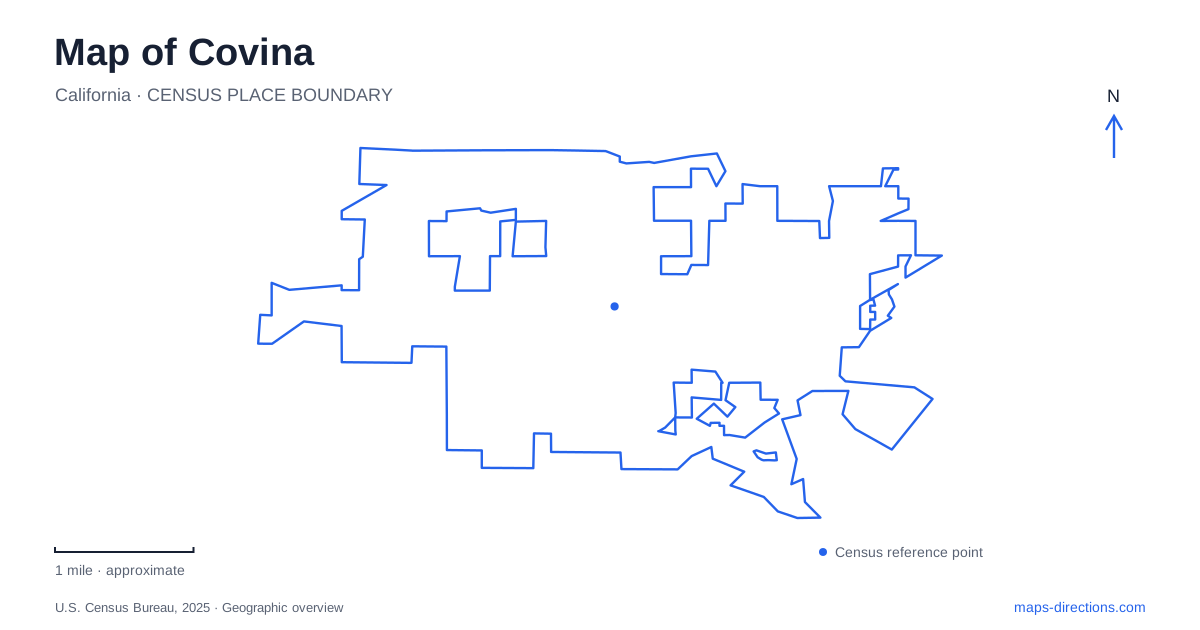
Street tiles load from OpenStreetMap when opened. The blue line shows the 2025 Census boundary.
- State
- California
- Population · July 2025
- 49,404
- Land area
- 7.0 sq mi
- Water area
- 0.0 sq mi
Covina's historic center is easiest to understand along Citrus Avenue, where commercial blocks, civic buildings, a plaza and the railway station create a sequence of destinations. The city lies between the I-10 and I-210 corridors in the eastern San Gabriel Valley, but neither freeway substitutes for a close view of this local street system. Citrus Avenue gives the central district a north–south reference, while Badillo Street, College Street and San Bernardino Road divide it into recognizable sections.
Reading the Citrus Avenue district
The municipality identifies the historic commercial core as the Citrus Avenue District. It is one part of a broader town center that also includes civic, medical and transportation functions. The historical society's downtown walking route focuses on the section between Badillo Street and San Bernardino Road, using the avenue and its alleys to interpret the older commercial landscape. That provides a useful area to examine at pedestrian scale.
Heritage Plaza, at 400 North Citrus Avenue, is another reference on this corridor. Its historical walk and small playground give it a different role from the storefront blocks. The public parking structure on East College Street faces City Hall, placing parking and civic services close to the commercial center. In a map of Covina, these addresses show how several downtown activities fit together without requiring that every stop be approached as a separate driving destination.
Rail platforms and two parking areas
Metrolink's San Bernardino Line serves the station at 600 North Citrus Avenue. The route connects the city with Los Angeles Union Station in one direction and communities toward San Bernardino in the other. It is a regional railway service, and its presence gives the northern part of downtown a transport role distinct from the shopping blocks farther along Citrus.
Parking is divided into Metro East, beside the station platform at number 600, and the Metro West structure across the street at 559 North Citrus Avenue. Their permit arrangements differ, and overnight parking is handled in the structure rather than the east lot. This is a concrete case where two nearby parking symbols should be read separately instead of treated as identical station access.
Pedestrian-bridge planning has considered a connection across the railway between the station, a recreation-village proposal and downtown via Front Street. Such drawings explain a possible relationship among destinations, but they are not a walking itinerary. When leaving the station, use established public crossings and the city's pedestrian guidance. This preserves the distinction between the railway as a physical barrier and a proposed route intended to make it easier to cross.
Civic history behind City Hall
The Firehouse/Jail Museum occupies the 1911 civic building behind City Hall at 125 East College Street, just east of Citrus Avenue. Its former functions show how municipal services once shared a small downtown footprint. The historical society established its museum there in 1979, and the collection includes documents, photographs and objects associated with earlier local life.
For visitors to Covina, the firehouse museum's operator is the appropriate source for arranging an interior visit. Municipal history pages can preserve an older opening pattern even after repair work or programming changes alter access. The building remains a historical reference on the map, but its exterior location and the availability of the collection are separate questions. Confirm the particular visit before building a Sunday outing around a past timetable.
City Hall also houses the Vintage Years photographic display, covering the period from 1846 to 1950. That collection offers another way to connect present streets with earlier scenes, within the building's public operating arrangements. The civic address consequently represents several layers of local history, not just a place for administrative business.
A moved house beside the park
Heritage House stands on the west side of Covina Park at 300 North Valencia. Built for pharmacist William Nash, the Craftsman-style residence originally stood on San Bernardino Road. The historical society moved it in 1989 to prevent demolition. Its present location is therefore a preservation destination rather than the property's original historical setting. The operator lists house visits by appointment.
The park's main address is 301 North Fourth Avenue. Its bandshell, aquatic center, skating rink and sports areas provide a larger recreation setting around the preserved house. A quarter-mile rubberized track and an inclusive playground add different kinds of activity. Looking at both Fourth Avenue and the western house location makes the site's arrangement clearer than assuming all facilities line the same frontage.
Other recreation clusters
Hollenbeck Park and the recreation office occupy 1250 North Hollenbeck Avenue. Cougar Park, at 150 West Puente Street, combines a community center and garden with a splash pad and play area. Sunkist Park, formerly Kelby Park, uses 815 North Barranca Avenue and contains the Senior and Community Center. The changed park name is useful when comparing older descriptions with current municipal information.
These addresses extend the picture of Covina beyond its historic shopping street. The central rail-and-civic corridor remains the strongest organizing reference, while the parks and community facilities show how public activities spread into surrounding neighborhoods. Together they form a practical map of distinct destinations with their own histories and uses.
Map and statistics: U.S. Census Bureau, 2025 Gazetteer, January 2025 generalized place boundaries and Vintage 2025 population estimates. Local references: City of Covina; Covina Valley Historical Society; Metrolink. Article prepared by Maps & Directions.