Map of Council Bluffs
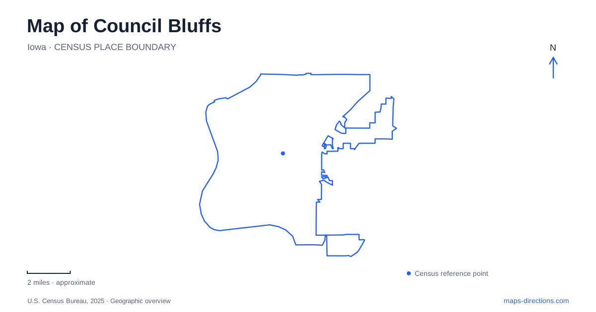
Street tiles load from OpenStreetMap when opened. The blue line shows the 2025 Census boundary.
- State
- Iowa
- Population · July 2025
- 62,680
- Land area
- 43.0 sq mi
- Water area
- 2.7 sq mi
Council Bluffs lies in a landscape where the Missouri River, urban streets, a large recreational lake and the Loess Hills all demand different kinds of map reading. A river crossing is not automatically a road crossing, and a hillside park is not interchangeable with a flat waterfront path. Pearl Street supplies a useful central reference, while River's Edge and Lake Manawa form separate recreation destinations. Keep these settings visible together at first, then move to the detailed entrance or trail view needed for the particular outing.
Pearl Street anchors a central visit
Bayliss Park is listed by the city at 100 Pearl Street. Union Pacific gives its museum address as 200 Pearl Street. These two destinations provide a straightforward pair of central reference points: one is a civic green space with monuments and a fountain, and the other is an indoor museum. Their shared street makes their relationship easier to understand without treating them as one facility.
For a Council Bluffs meeting, name the museum or a specific part of the park rather than simply choosing Pearl Street. A broad central pin does not tell companions whether to look for an entrance, a fountain or a surrounding sidewalk. If the visit includes both places, retain them as separate stops so that the map continues to describe the purpose of each part of the outing.
The pedestrian bridge requires a side of the river
The city identifies Tom Hanafan River's Edge Park as the Iowa landing of the Bob Kerrey Pedestrian Bridge. The bridge connects the riverfront with Omaha and is intended for pedestrian and bicycle travel. Its presence is especially important when comparing modes: a walking connection across the Missouri does not supply the corresponding route for a car.
Choose the intended bank before searching for parking or a pickup. A bridge result may describe the whole structure, while a road destination needs one landing or a nearby facility. In Council Bluffs, the River's Edge name helps identify the Iowa-side approach. Keep the bridge itself as the recreational connection and the arrival point as a separate location, particularly when members of a group approach from opposite states.
Lake Manawa is not the riverfront
Iowa's Department of Natural Resources lists Lake Manawa State Park at 1100 South Shore Drive. Its visitor information distinguishes paved nature trails, unpaved mountain-bike trails on the south side and boat ramps on multiple sides of the lake. Those features explain why a single lake pin is a poor substitute for a facility selection: several legitimate destinations occupy different parts of the shoreline.
For a Council Bluffs lake visit, decide whether the purpose is the beach, a trail, a boat launch or another named park facility. Then use the state park map to locate that specific approach. The lake and Missouri River belong to the same broader landscape but are not interchangeable water-access destinations. A trip planned around one should not silently end at the other simply because both appear nearby on a regional view.
Fairmount and Vincent Bluff introduce the hills
The municipal parks directory locates Fairmount Park at East Graham Avenue and Park Entrance, and identifies Gibraltar Trailhead at Ninth Avenue and High Street as another access to its hiking trails. Vincent Bluff is listed on Thallas Street and is described as a primitive place to explore the Loess Hills. These references provide alternatives to the river and lake settings without implying the same terrain or type of path.
Select a trailhead according to the walk you intend, rather than using the closest edge of a green polygon. An overlook and a trail system can occupy the same park while involving different approaches. A hillside outing also benefits from a terrain-aware view: street distance alone cannot describe the climb or the nature of an unpaved path. The named access points supply the beginning of the route, not a promise about its difficulty.
Preserve the difference between a network and a route
The wider trail system ties many recreation areas together, but an overview line does not establish that every segment is currently available or appropriate for the same activity. Read the current operator information for the particular trail and maintain the distinction between city parks and the state-managed lake park. Their maps describe different facilities and responsibilities.
A practical map of Council Bluffs can begin with just four clear settings: Pearl Street for the central museum and park, the Iowa bridge landing for the riverfront, a named Lake Manawa facility for waterside recreation, and a selected hillside trailhead. This is enough structure to compare an itinerary while leaving the final access details attached to the right destination. It also prevents the city's varied landscape from being reduced to one generic urban pin.
Map and statistics: U.S. Census Bureau, 2025 Gazetteer, January 2025 generalized place boundaries and Vintage 2025 population estimates. Local references: City of Council Bluffs; Union Pacific; Iowa Department of Natural Resources. Article prepared by Maps & Directions.