Map of Cottage Grove
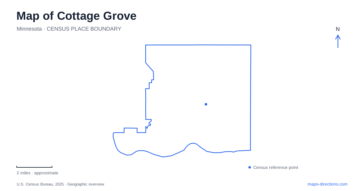
Street tiles load from OpenStreetMap when opened. The blue line shows the 2025 Census boundary.
- State
- Minnesota
- Population · July 2025
- 43,604
- Land area
- 33.6 sq mi
- Water area
- 3.9 sq mi
Cottage Grove contains landscapes that work at very different scales: a former agricultural village along Lamar Avenue, a deep wooded ravine system, and sandy terraces above the Mississippi River. Modern development surrounds these places, but it has not removed their differences. Reading the map through the old village, regional park, and river edge gives a clearer understanding of the city than assuming its green spaces all share the same terrain or purpose.
Lamar Avenue preserves a village pattern
The municipal East Ravine planning study describes the old village as a linear settlement centered on Lamar Avenue, roughly between Seventieth and Seventy-Seventh Streets. Its original 1871 plat did not provide a conventional town square or a separate business district. Commercial activity instead gathered along the village street and beyond the original platted area.
The railroad between Saint Paul and Hastings bypassed this older center in 1869–70. The village nevertheless developed as a service point for surrounding farms. That is an important distinction in a region where many towns organize their history around a depot: here, the old main street retained a role despite being outside the rail alignment.
On a map of Cottage Grove, Lamar Avenue consequently represents an earlier center of local life, not merely another residential road. Narrow setbacks and surviving historic properties help convey its village scale. Its relationship with the nearby ravine also matters, since the terrain constrained the direction in which the settlement could expand.
Farm buildings have taken on new functions
Furber Farm adds a concrete example of that agricultural past. The city identifies the Italianate house as a building constructed in 1871 by John P. Furber. A later dairy barn, built in 1947, supported a working herd before dairy use ended in the early 1970s. Restoration eventually adapted the barn for weddings and events.
This combination shows several periods of rural life on one property. The house belongs to the village's nineteenth-century development, while the barn reflects a later farming operation. Its current event use is another stage, rather than evidence that the entire farm was always a visitor attraction.
The city's historic inventory also identifies former homes, farm districts, a town hall, and a lime-kiln site elsewhere in the municipality. These scattered records reinforce the picture of several working landscapes that preceded the modern suburban city.
The regional park is defined by relief
The regional ravine park at 9653 Keats Avenue South gives Cottage Grove a landscape of steep slopes, wooded valleys, and old-field or prairie openings. Washington County describes how different slope exposures support varied vegetation and habitat. The pattern is therefore more complex than a uniform tract of woods.
Ravine Lake adds a water destination within that terrain, with nonmotorized boat access and fishing opportunities. Ravine Landing provides a building, gathering space, and connection to trails near the lake. The similar names refer to the waterbody, the facility, and the surrounding land at different scales.
For a gentler route, the county identifies an approximately two-mile paved out-and-back walk beginning at Ravine Landing, with benches at intervals. That designated option is useful because the surrounding park's dramatic terrain does not mean every path requires the same effort. It also distinguishes a published route from an assumption that a full circuit of the park will be equally gentle.
Mississippi terraces and wind-shaped sand
Grey Cloud Dunes introduces a contrasting environment along the river side of Cottage Grove. The Minnesota Department of Natural Resources describes two sandy terraces above the Mississippi, with dunes rising above lower swales. Wind has shaped crescents and blowouts, while the site includes dry prairie, oak savanna, woodland, and river-edge vegetation.
These features explain why the area looks and functions differently from the wooded ravines. Open sandy uplands and lower riverbank habitat occur within one protected landscape. A topographic view can be particularly useful here because the terraces occupy different elevations above the water, rather than forming a single flat riverside meadow.
The scientific and natural area designation also signals a conservation purpose. Its landscape is meant to be experienced with attention to the habitat itself; it should not be confused with a fully equipped sports or picnic park simply because both appear as public green space.
A neighboring park is still developing
Mississippi Dunes Park is a separate city property beside the state natural area. Cottage Grove purchased the 33-acre parcel in 2023, including more than 1,900 feet of river shoreline. The municipal page describes a future community-park plan combining recreation space with habitat preservation.
Existing access consists of a small parking area and paved and grass trails. Planned facilities should therefore remain distinct from what is already available. Reading these neighboring public lands together reveals a riverfront with different managers, conservation priorities, and stages of development. Alongside Lamar Avenue and the ravine park, they show how village history and varied terrain continue to structure the modern city.
Map and statistics: U.S. Census Bureau, 2025 Gazetteer, January 2025 generalized place boundaries and Vintage 2025 population estimates. Local references: City of Cottage Grove; Washington County; Minnesota Department of Natural Resources. Article prepared by Maps & Directions.