Map of Costa Mesa
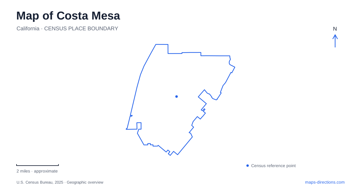
Street tiles load from OpenStreetMap when opened. The blue line shows the 2025 Census boundary.
- State
- California
- Population · July 2025
- 108,881
- Land area
- 15.8 sq mi
- Water area
- 0.0 sq mi
Costa Mesa's map brings together places built for very different purposes: a performing-arts campus, a large fairground, open habitat beside the Santa Ana River, and an adobe associated with early ranching. These destinations are distributed across the city rather than concentrated around one traditional downtown square. Bristol Street and Town Center Drive organize the arts area, Fair Drive identifies the fairgrounds, and Placentia and Adams avenues lead into another landscape of parks and historical sites. Understanding those clusters gives the street network a practical structure without reducing the city to its freeway exits.
The arts campus east of the shopping district
The Segerstrom Center for the Arts stands at 600 Town Center Drive, just east of South Coast Plaza. Its approach uses Bristol Street and Town Center Drive, while Sunflower Avenue, Avenue of the Arts, Park Center Drive, and Anton Boulevard help define the surrounding campus. This concentration is a distinctive northern anchor on a map of Costa Mesa, with several performance spaces occupying neighboring but separate buildings.
The center's visitor directions distinguish Segerstrom Hall and the Judy Morr Theater from the Renée and Henry Segerstrom Concert Hall and Samueli Theater. The former pair is associated with the Center Tower parking structure on Sunflower Avenue; the latter pair is associated with Plaza Tower parking behind the concert hall and South Coast Repertory. These relationships explain why the venue name on a ticket matters even within a compact arts district. The different halls have different positions within the same network of streets and plazas.
South Coast Repertory and the Orange County Museum of Art are also campus partners. On a neighborhood map, this creates a group of cultural destinations rather than a single theater with a large surrounding car park. The useful walking geography is the relationship between those buildings, the plaza spaces, and the nearby streets.
Fair Drive and the event grounds
The OC Fair & Event Center uses 88 Fair Drive, a separate destination cluster from the arts campus. Its official regional directions connect the site with the 55 freeway and approaches from Harbor Boulevard and Fairview Road. The property map places Arlington Drive, Fairview Road, and Fair Drive around the event grounds, with Orange Coast College shown nearby.
Within the property, names such as Pacific Amphitheatre, Centennial Farm, Heroes Hall, and The Hangar identify different facilities. They should be understood as parts of the same large event center rather than as unrelated citywide landmarks. The organizer designates Gate 1 off Fair Drive for ride-hailing pickup and drop-off, giving visitors a street-based reference for that particular arrival method. Other activities may use different gates, so the property's own map supplies a finer level of detail than the general street map.
This event landscape is a major part of Costa Mesa's civic identity, but it is physically and functionally different from the arts district. Keeping the two clusters separate makes a day with multiple activities easier to organize: one is a campus of performance institutions, while the other is a large flexible grounds with named buildings, outdoor venues, and internal circulation.
Open land toward the Santa Ana River
Fairview Park's municipal address is 2525 Placentia Avenue. The city's description identifies roughly 208 acres, most of it natural open space rather than maintained lawn. Multiple habitat types and a registered cultural-resource site make conservation central to the park's identity. Its trails provide access toward the Santa Ana River Trail and adjacent Talbert Regional Park.
For western Costa Mesa, this creates a substantial open-space geography that contrasts with the major commercial and event districts. Talbert's county map identifies Victoria Street, the river corridor, and separate trail areas. It also marks a fenced Victoria Pond area without legal public access. The landscape therefore cannot be read as one unrestricted field of paths: habitat management and designated routes shape how the connected parks are used. Fairview's Placentia Avenue address remains a useful starting anchor for the municipal park itself.
Adams Avenue and the adobe landscape
Estancia Park at 1900 Adams Avenue contains the Diego Sepulveda Adobe. The historical society explains that the original building sheltered herdsmen associated with Mission San Juan Capistrano, probably during the early 1820s, though an earlier date is possible. Later ownership and additions changed the structure; differences in adobe brick size preserve evidence of those building phases.
The society's museum and archives are elsewhere, at 1870 Anaheim Avenue; visiting the adobe requires checking its own access arrangements. Those two addresses separate the historical research collection from the historic building. Together with Fairview's habitat, the fairground facilities, and the arts campus, they show how Costa Mesa's map preserves several eras and uses within a relatively compact network of named streets.
Map and statistics: U.S. Census Bureau, 2025 Gazetteer, January 2025 generalized place boundaries and Vintage 2025 population estimates. Local references: Segerstrom Center for the Arts; OC Fair and Event Center; City of Costa Mesa; OC Parks; Costa Mesa Historical Society. Article prepared by Maps & Directions.