Map of Corpus Christi
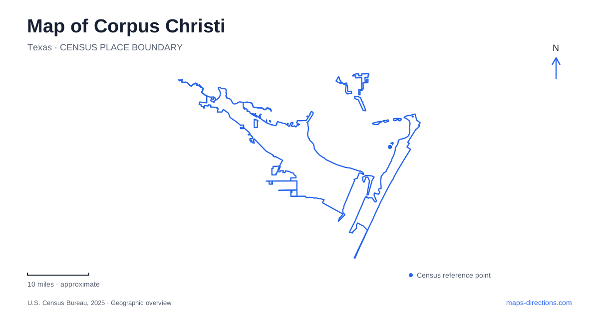
Street tiles load from OpenStreetMap when opened. The blue line shows the 2025 Census boundary.
- State
- Texas
- Population · July 2025
- 317,247
- Land area
- 167.8 sq mi
- Water area
- 325.1 sq mi
Corpus Christi's geography depends on the difference between a bayfront, a shipping channel, and a barrier-island shore. Downtown faces the bay, North Beach lies across the harbor crossing, and the island destinations require a separate approach over the causeway. The same regional map can therefore show urban promenades, port infrastructure, shallow lagoons, and open-coast beaches. Identifying which water body borders a destination is one of the most useful ways to understand how these places fit together.
Downtown follows the bay
The seawall and McGee Beach provide a public waterfront beside downtown. Wide paved paths support walking along the bay, while the gazebo-like miradores create recognizable stopping points. The waterfront is integrated with hotels, restaurants, arts venues, and the marina rather than separated from the city by an undeveloped coastal strip.
The Sea District groups sports, entertainment, and arts destinations, including the Art Museum of South Texas and Whataburger Field. The Marina Arts District adds galleries, dining, and cultural activity farther south. These district names describe overlapping visitor interests within a larger downtown area, but the waterfront provides a continuous geographical reference through them.
A map of Corpus Christi is easier to interpret when these urban bayfront places are distinguished from the island beaches. Both offer access to coastal scenery, yet the city-side setting includes a seawall, marina facilities, streets, and major public venues. An afternoon centered on downtown can therefore combine cultural buildings with a waterfront walk without becoming an island excursion.
North Beach and the harbor crossing
North Beach lies north of downtown across the Harbor Bridge. The USS Lexington Museum and Texas State Aquarium anchor the area, while a roughly one-and-a-half-mile Beachwalk follows the bay shore. Fishing jetties and waterfront businesses give the neighborhood recreational uses beyond its two best-known attractions.
The new cable-stayed Harbor Bridge began opening to traffic in 2025, replacing the older crossing over the ship channel. Its design provides greater clearance for ships, illustrating how the road network and the working port share the same constrained passage. The crossing is therefore a transport landmark for both motorists and maritime trade.
North Beach's location across that channel explains why it forms a separate destination cluster within Corpus Christi. The bridge connects it with downtown, but the neighborhood's attractions and shoreline can be read as their own group once across the water. Older photographs and maps may depict the previous bridge, so they remain useful for history while differing from the current skyline.
The causeway leads toward the islands
The route toward Padre Island follows TX-358, South Padre Island Drive, and the John F. Kennedy Memorial Causeway, continuing as Park Road 22. This is a different coastal crossing from the Harbor Bridge. It connects the mainland approach with the island road system and the route toward Padre Island National Seashore.
The National Park Service identifies Malaquite Visitor Center at 20420 Park Road 22 as the main visitor reference for the national seashore. It specifically warns that digital maps can place the street address several miles from the intended location. Selecting the named visitor center is useful here because the destination covers a long stretch of coastline rather than a compact urban parcel.
The national seashore is also distinct from the community of South Padre Island. There is no through-road allowing a visitor to continue down the park and emerge in that southern resort area. For trips beginning in Corpus Christi, this is a substantial geographical distinction, not a minor variation in the name of the same beach.
Two sides of a barrier island
Padre Island separates open coastal waters from Laguna Madre on its western side. The lagoon is shallow and unusually salty, supporting seagrass habitat and a range of birds and aquatic life. Bird Island Basin provides access to that lagoon and contains the national seashore's boat ramp.
The island's cross-section includes beach, dunes, grassland flats, wetlands, and lagoon-side habitat. A map viewed only as a narrow strip of sand misses those environmental differences. Gulf-facing beach recreation and lagoon activities use different shores, with different landscapes between them. The barrier island functions as an ecological transition as well as a destination.
Mustang Island's separate park landscape
Mustang Island State Park stands on State Highway 361 and protects more than five miles of coastline. Its paddling routes follow the island's western shoreline along the bay, while the beach occupies the open-coast side. The state acquired the park land in 1972, and the park opened in 1979.
This creates another useful island reference for a Corpus Christi map: the state park, the national seashore, and the urban North Beach area belong to different shoreline settings and approach routes. Understanding their relationship to the bay, lagoon, bridges, and island roads makes the region's coastal variety clear before choosing which part to explore.
Map and statistics: U.S. Census Bureau, 2025 Gazetteer, January 2025 generalized place boundaries and Vintage 2025 population estimates. Local references: Visit Corpus Christi; City of Corpus Christi; City of Corpus Christi / TxDOT; National Park Service; Texas Parks and Wildlife. Article prepared by Maps & Directions.